Starting point: Pečar (460 m)
| Latitude/Longitude: | 46,0401°N 14,6402°E |
| |
Walking time: 35 min
Difficulty: easy marked way
Elevation gain: 167 m
Elevation difference along the route: 170 m
Map: Ljubljana - okolica 1:50.000
Recommended equipment (summer):
Recommended equipment (winter):
Views: 12.500
 | 1 person like this post |
Access to starting point:
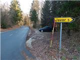
From the eastern Ljubljana bypass, we take the exit Ljubljana - Bizovik, and then continue driving towards Sostro and onward on the ascending road towards Besnica. On the saddle, where the road branches off to the right towards the village of Javor, we park on a smaller parking lot by the road.
Route description:
At the starting point, we notice signs for Žagarski vrh and Mali vrh, which direct us onto the asphalt road in the direction of the settlement Javor. The path first leads past a few more houses, then we ascend relatively steeply through the forest. A little further, a fruit road branches off to the right, but we continue on the asphalt road, which higher up at the sign flattens and leads us past a smaller hamlet, where we continue straight ahead. Behind the houses, a beautiful view opens up, then behind the hayrack the road returns to the forest. A little further ahead, the forest thins out again, and we bypass yet another house on the right side. We continue the ascent on the asphalt road all the way to the next hamlet, where in front of the houses we turn onto the upper left road towards the Hut of Amateur Radio Operators (Dom radioamaterjev).
We also continue from the intersection onward along the asphalt road, which is noticeably narrower. We follow the mentioned road all the way to Žagarski vrh, where the Hut of Amateur Radio Operators stands and from which a nice view opens up.
The description and pictures refer to the conditions in 2016 (December).

Photos:
 1
1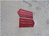 2
2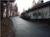 3
3 4
4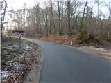 5
5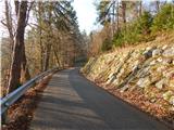 6
6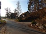 7
7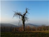 8
8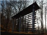 9
9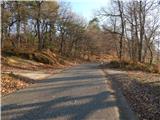 10
10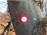 11
11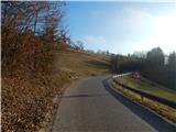 12
12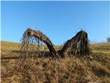 13
13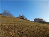 14
14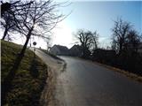 15
15 16
16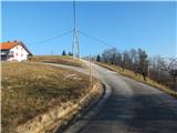 17
17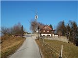 18
18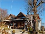 19
19 20
20
Discussion about the trip Pečar - Žagarski vrh
To post a comment you must log in:
If you do not yet have a username, you must first
register.