Pečana - Krekova koča na Ratitovcu
Starting point: Pečana (1400 m)
| Latitude/Longitude: | 46,2488°N 14,0739°E |
| |
Walking time: 45 min
Difficulty: easy marked way
Elevation gain: 242 m
Elevation difference along the route: 242 m
Map: Škofjeloško in Cerkljansko hribovje 1:50.000
Recommended equipment (summer):
Recommended equipment (winter):
Views: 41.326
 | 2 people like this post |
Access to starting point:
A) First, we drive to Bohinjska Bistrica, and then we continue driving towards Soriška planina. Higher up, we arrive at a crossroad, where we continue straight towards Železniki (sharp right Soriška planina), and we follow the main road for approximately 1 km more, and then we continue right towards Ribčeva planina. Higher, the asphalt ends, and the macadam road splits into two parts. We continue on the right road, which brings us to Ribčeva planina. At the crossroad above the mountain pasture, we continue right, then in the next two crossroads left. From the second crossroad, where we went left, we drive a few hundred meters to the next crossroad, there we turn right and then drive to the end of the road, where we park. From the crossroad on Bitenjska planina to the starting point is approximately 7.5 km.
B) From Železniki or Podbrdo, first we drive to Soriška planina, and then we continue driving towards Bohinjska Bistrica. From the parking lot on Soriška planina we drive approximately 1 km more, and then we turn right onto the forest road. At the first crossroad, to which we arrive after less than 2 km of driving from the spot where we left the main road, we continue left, then at the next one, which is located a few kilometers further, slightly right. From the second crossroad we drive a few hundred meters further, and then at the next crossroad we turn right and drive to the end of the road, where we park in a suitable place.
Route description:
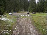
From the parking lot, we continue on a wide cart track which starts relatively steeply ascending through the forest. After approximately 10 minutes of walking the cart track flattens, then a little further it brings us to the cottages on the mountain pasture Pečana.
A few strides above the mentioned cottages we come out of the forest on grassy slopes, and we continue on the right side of the mountain pasture only a few meters, then at the crossing we continue right in the direction of Krekova koča (straight Kosmati vrh). The path ahead starts moderately ascending through increasingly sparse spruce forest. Higher, we finally step out of the forest onto the ample pastures of Ratitovec, where we leave the cart track and continue the ascent on a somewhat poorly visible but marked footpath, which after a few minutes of additional walking brings us onto the upper slope of Ratitovec, where from the right joins the path from Soriška planina. We continue left and follow the increasingly panoramic path, which leads us past the winter bivouac, all the way to Krekova koča na Ratitovcu, which we reach after less than 5 minutes of additional walking.

Photos:
 1
1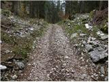 2
2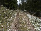 3
3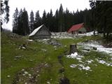 4
4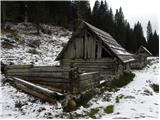 5
5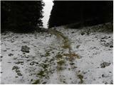 6
6 7
7 8
8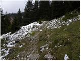 9
9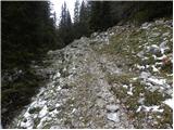 10
10 11
11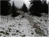 12
12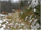 13
13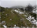 14
14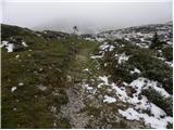 15
15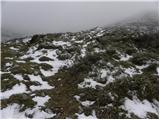 16
16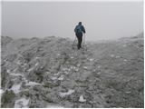 17
17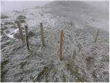 18
18 19
19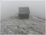 20
20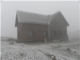 21
21
Discussion about the trip Pečana - Krekova koča na Ratitovcu
|
| Medved28. 07. 2007 |
Or maybe someone knows how long it takes to hike from Rovtarica (Jelovica) to Planina Pečana??? Thanks L.P. Thanks L.P.
|
|
|
|
| kajzar-j5. 08. 2007 |
From Rovtarica it is about a kilometre or two to the junction where the sign for Ratitovec stands. From there it is 11 km along the forest road to the turn-off for Pečana, which you reach in about 10 to 15 minutes. You can also drive these 11 km by car and rather spend your energy on the peaks of Ratitovca. Good luck!
|
|
|
|
| kajzar-j5. 08. 2007 |
Supplement: 10 to 15 minutes walking from the turn-off for Pečana to Pečana. Lp
|
|
|
|
| peter223. 11. 2008 |
We slept through the sunny sunrise today, during the day other errands, for the sunset on Ratitovec just enough time remained.
The road from Bohinj side towards Pečana is still passable, of course tomorrow it will be different. Thin layer of snow was today just nice decoration.
View of red illuminated slopes of Ratitovec from Altemaverja was magnificent, some snapshots for you again here.
|
|
|
To post a comment you must log in:
If you do not yet have a username, you must first
register.