Passo Tre Croci - Cristallino d'Ampezzo
Starting point: Passo Tre Croci (1805 m)
| Latitude/Longitude: | 46,5568°N 12,202°E |
| |
Walking time: 3 h 40 min
Difficulty: very difficult marked way
Elevation gain: 1203 m
Elevation difference along the route: 1230 m
Map: Tabacco 03 1:25.000
Recommended equipment (summer): helmet, self belay set
Recommended equipment (winter): helmet, self belay set, ice axe, crampons
Views: 18.056
 | 4 people like this post |
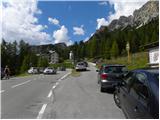
Access to starting point:
From Rateče or Predel we cross the border to Trbiž / Tarvisio and then on the highway in the direction of Vidma / Udine to exit Tolmezzo. From Tolmezzo we follow the road in the direction of village Ampezzo and mountain pass Passo della Mauria. The road then descends and brings us to a crossroad, where we continue right towards Auronzo. Further, we follow the signs for mountain pass Tre Croci.
Route description:
From the mountain pass Tre Croci we go right on a narrow, at first asphalt road (path number 203). At the beginning of the road there are also signposts, which direct us to the mentioned road. The asphalt quickly ends and we continue past a gate and start ascending on a macadam road which is closed for traffic. The road, which runs through the forest, then soon brings us to a crossing where the path towards the notch Forcella del Cristallo branches off to the right, and we still continue on the forest road. When we come out of the forest, the path from the parking lot at the ski slope Monte Cristallo joins us from the left. Further, we ascend on the road for some time, after that signposts direct us right onto a footpath.
The path starts ascending a little steeper and increasingly beautiful views start to open up on surrounding peaks. The path still in ascent crosses slopes towards the northwest and runs mostly by rare dwarf pines. Higher, the path brings us to the saddle Sonforcia where we again join the macadam road.
On the saddle, we continue right on the road, which we then follow all the way to the hut Son Forca.
From the hut, we continue towards the cable car. Signposts at the bottom station of the cable car then direct us onto the ski slope below the cableway. The path further all the time runs on the ski slope below the cable car and starts quite steeply ascending. In the last part, the path ascends on steep scree, which brings us to the upper cable car station.
At the upper station of the cableway, we continue left and first ascend metal stairs. Here begins the secured path Sentiero Ferrato Ivano Dibona on which we can see a lot of remains from the First World War. The path in the initial part ascends a steep ladder, then leads us through some tunnels from the First World War. Further, we ascend briefly along the steel cable, which brings us to the longest hanging bridge in the Dolomites. After crossing the bridge, an ascent on a ladder follows, then we walk for some time along the steel cable on the ridge. The path on the ridge brings us to a crossing where we continue left towards the summit Cristallino d'Ampezzo, and to the right ahead leads the path Ivano Dibona.
The path from the crossing first crosses slightly to the left, then ascends a little steeper up the ridge. In the last part, the path brings us into a smaller notch, where to the right branches off the path on which we join the path Ivano Dibona towards the summit Cresta Bianca and bivouac Buffa.
From the notch follows only a short steep ascent to a panoramic summit.

Photos:
 1
1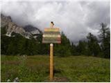 2
2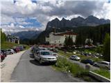 3
3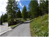 4
4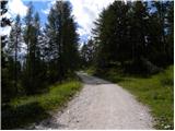 5
5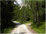 6
6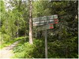 7
7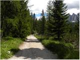 8
8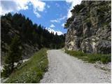 9
9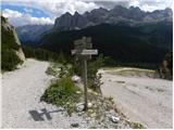 10
10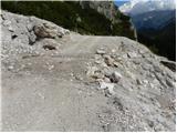 11
11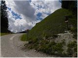 12
12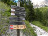 13
13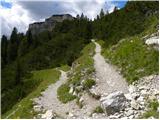 14
14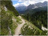 15
15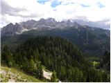 16
16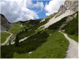 17
17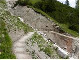 18
18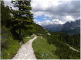 19
19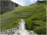 20
20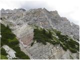 21
21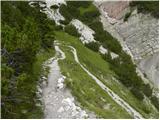 22
22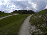 23
23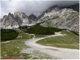 24
24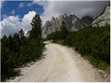 25
25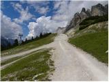 26
26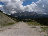 27
27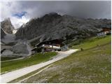 28
28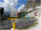 29
29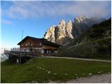 30
30 31
31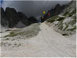 32
32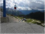 33
33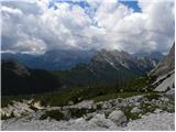 34
34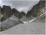 35
35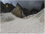 36
36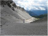 37
37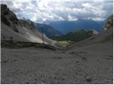 38
38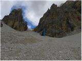 39
39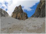 40
40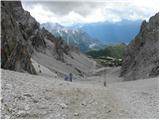 41
41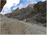 42
42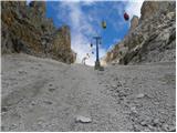 43
43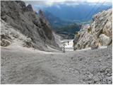 44
44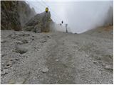 45
45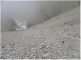 46
46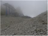 47
47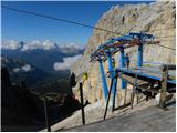 48
48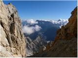 49
49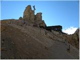 50
50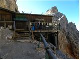 51
51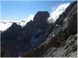 52
52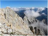 53
53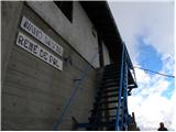 54
54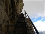 55
55 56
56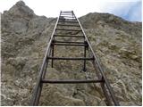 57
57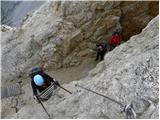 58
58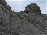 59
59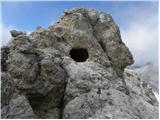 60
60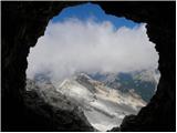 61
61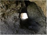 62
62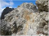 63
63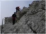 64
64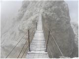 65
65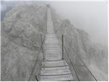 66
66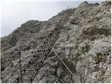 67
67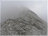 68
68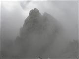 69
69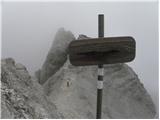 70
70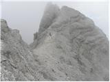 71
71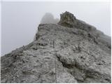 72
72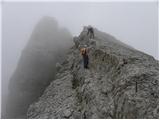 73
73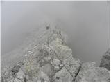 74
74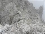 75
75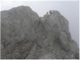 76
76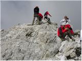 77
77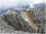 78
78
Discussion about the trip Passo Tre Croci - Cristallino d'Ampezzo
|
| petruša7. 01. 2013 |
Hello, since we are drawn to the Dolomites in summer, I'm interested if anyone has already hiked this trail and what they think of it. Is it harder than Triglav? We have already done quite a few harder mountains here and if anyone has wandered around the Dolomites for several days and camped somewhere in the Dolomites near Cortina d'Ampezzo, please write below. We will be very happy for any opinion. Regards
|
|
|
|
| jedriličar8. 01. 2013 |
See the trail description above. If you want to save a lot of energy, take the cable car to rif. Lorenzi. From there go via ferrata Ivano Dibona to the summit, but the beauty of this via ferrata is to continue after the via ferrata towards Ospedale di Cortina (about 5 hours walk) or after about 3 hours of via ferrata turn left into the valley and return to Passo Tre Croci. If you do the whole via ferrata, it's worth taking the cable car up as you save about 4 hours of ascent, if you only go to the summit it's not worth using the cable car. The trail itself is not so technically demanding, the ridge is a bit exposed, but it's physically demanding.
Regards and safe travels...
|
|
|
|
| JORDAN9. 01. 2013 |
The trail is definitely easier than the one to Triglav.
Cables, ladders and bridge are installed from the Staunies saddle, that is from koča Guido Lorenzi onwards. The mere fact that the hut is at 3000m and the summit at 3008m tells us that the trail is not physically demanding. From the hut to the summit you need about 40 min. Return ticket from Passo Tre Croci saddle to the top of Staunies saddle cost in 2011 about 22€. If you are already at Staunies saddle, treat yourself to Cima de Mezzo 3154m via ferrata Marino Bianchi besides this trail. Entry to the via ferrata is from the wooden platform behind koča Guido Lorenzi.
You have the trail description on Hribi.net and in the classic by Andrej Mašera - Dolomiti, sanjske gore.
North of Cortina there is autocamp Olympia where you can sleep. If you are in this camp, treat yourself to Col Rosà via ferrata Ettore Bovero. Description in Mašera's book.
Lots of enjoyment. Regards
|
|
|
|
| Matic253. 12. 2014 |
It looks really nice though  . .
|
|
|
|
| zvončica1. 12. 2020 |
With the chairlift you can only reach the Son Forca hut (2215m), to the Guido Lorenzi hut (3000 m) it hasn't been possible for some time already.
|
|
|
|
| mirank1. 12. 2020 |
And apparently there won't be anything with the planned cable car for some time either. The Lorenzi hut in the meantime is inexorably collapsing; by the way, I would rather advise against the foot ascent over those scree slopes.
|
|
|
|
| Janiel742. 12. 2020 |
I was on this path in summer 2017. Up and down the scree. And I don't know why someone would advise against the scree path up and down. Up went very quickly, down you fly. And we didn't have major problems either, actually it went great even uphill. Otherwise a beautiful access from the collapsing hut to the Cristallino summit.
|
|
|
|
| mirank2. 12. 2020 |
I myself don't belong to the hikers who particularly enjoy returning on their own tracks . When I described our ascent up there and descent via the Dibona via ferrata, I clearly wrote that I would advise everyone the opposite direction. Bagi came to the same conclusion later, who also did the M Bianchi via ferrata along the way. You can read what he thinks about the ascent up there. The other thing is if your goal is only to Forcella Staunies. . When I described our ascent up there and descent via the Dibona via ferrata, I clearly wrote that I would advise everyone the opposite direction. Bagi came to the same conclusion later, who also did the M Bianchi via ferrata along the way. You can read what he thinks about the ascent up there. The other thing is if your goal is only to Forcella Staunies.
|
|
|
To post a comment you must log in:
If you do not yet have a username, you must first
register.