Passo Pordoi - Porta Vescovo (Bindelweg)
Starting point: Passo Pordoi (2239 m)
| Latitude/Longitude: | 46,488°N 11,8113°E |
| |
Route name: Bindelweg
Walking time: 2 h 20 min
Difficulty: easy marked way
Elevation gain: 239 m
Elevation difference along the route: 330 m
Map: Tabacco 07 1:25.000
Recommended equipment (summer):
Recommended equipment (winter): ice axe, crampons
Views: 3.652
 | 2 people like this post |
Access to starting point:
Access from Gorenjska: Through the border crossing Rateče or Predel to Trbiž / Tarvisio and then on the highway in the direction of Videm / Udine to the exit Tolmezzo. From Tolmezzo we follow the road in the direction of the village Ampezzo and mountain pass Passo della Mauria. The road then descends and brings us to a crossroad, where we continue left (also right possible) in the direction of Cortina d'Ampezzo. In all following crossroads we follow the signs for Cortina d'Ampezzo.
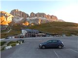
In Cortina d'Ampezzo we then follow the signs for the alpine pass Passo di Falzarego. We follow this ascending road to the mentioned pass. At the pass we come to a crossroad, where we continue on the left road in the direction of Marmolada and settlement Arabba (right Alta Badia). The road further descends for quite some time, then brings us to a crossroad, where we continue right in the direction of pass Passo Pordoi (left Marmolada). We follow the relatively wide and ascending road all the way to the mentioned pass, where we park on a large parking lot.
From the Primorska side: We drive on the highway towards Venice / Venezia. At the town Portogruaro we leave the highway towards Venice and continue right on the highway towards the town Pordenone. At the next highway junction near the town Conegliano we continue right towards the town Belluno. Near Belluno the highway ends, and we continue in the following junctions in the direction of Cortina d'Ampezzo. Further we follow the above description.
Route description:
From the parking lot on the pass we continue towards the southeast past the hut Savoia, behind which we will notice signposts. The signposts direct us to the footpath towards the hut Rifugio Fredarola. The wide path initially runs towards the southeast and brings us to the chapel. Here the path turns right and then slightly ascends below the eastern slopes of the peak Sas Bece. From the path we have otherwise a very nice view mainly on the nearby peaks in the mountain group Sella. The path then soon brings us to the saddle on the north side of the peak Sas Bece from where a view towards Marmolada also opens up.
At the saddle where there is a junction we continue straight ahead, left along the ski slope the path leads towards the hut Rifugio Sass Bece. The path from the saddle first crosses grassy slopes towards the south and then brings us to a macadam road.
At the junction we continue slightly left and then head to the footpath which crosses a short grassy slope. Left ahead along the road the path leads towards the hut Sass Bece, right downwards towards the hut Belvedere and further towards the peak Col di Rosc. After a short crossing the path brings us to a wider macadam path where we continue left.
The wide path then runs towards the east and slightly ascends along somewhat steeper grassy slopes with nice views towards Marmolada. Along such a path we then soon reach the hut Rifugio Fredarola.
At the hut where there is a junction we continue along the macadam road towards the east following the signs »Viel del Pan«. The road then quickly brings us to another marked junction.
We at the junction continue right towards the hut Rifugio Viel del Pan, left the ridge path (Sentiero Attrezzato delle Creste) leads towards the peak Sas Ciapel and further towards the saddle Porta Vescovo. From the junction we walk along the wide path which runs on the right side of the ridge and crosses slopes towards the east. The path then starts to descend slightly and continues to cross relatively steep grassy slopes below the peak Col da Cuch. From the path we have here a nice view on the mountain group Marmolada, soon a view also opens up towards the hut Viel del Pan. Later the path starts to ascend very slightly and brings us to the hut.
From the hut where the path becomes narrower we continue following the signs »Porta Vescovo« and in a slight descent we cross grassy slopes. Left a small path soon branches off, which leads towards the ridge path and further towards the peak Sas Ciapel. We continue along the path named Bindelweg, which after crossing below the slopes of the peak Sas Ciapel and Col de Pausa brings us near a smaller saddle from where a view opens up towards the mountain group Sella.
At the mentioned saddle where there is an unmarked junction we continue right and further cross the southern slopes. Left we can join the already mentioned ridge path. Further the path crosses slopes below the peak Le Forfesc and brings us to a marked junction. Right downwards the path branches off towards the pass Fedaia, we continue straight and cross further grassy slopes below the peak Belvedere. From the path a view soon opens up towards the peak Bech da Mesdi and from the right another path from the pass Fedaia joins us.
Here the path turns slightly left and starts to ascend somewhat more steeply. Such a path then soon brings us to the saddle Porta Vescovo.

The trip can be extended to the following destinations: Belvedere
Photos:
 1
1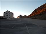 2
2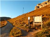 3
3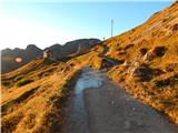 4
4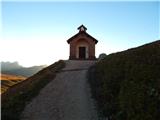 5
5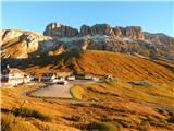 6
6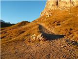 7
7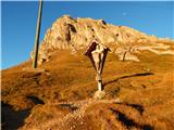 8
8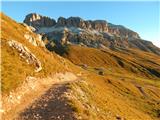 9
9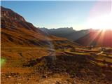 10
10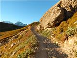 11
11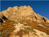 12
12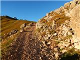 13
13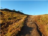 14
14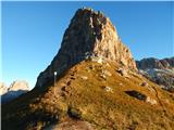 15
15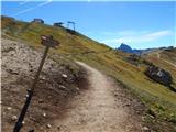 16
16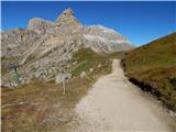 17
17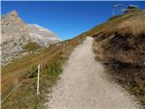 18
18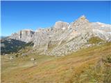 19
19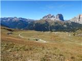 20
20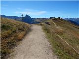 21
21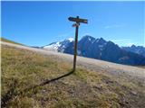 22
22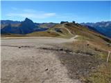 23
23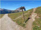 24
24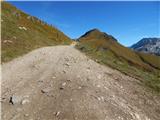 25
25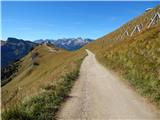 26
26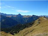 27
27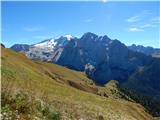 28
28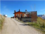 29
29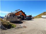 30
30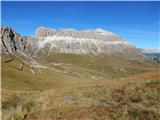 31
31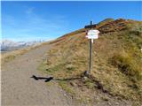 32
32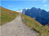 33
33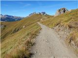 34
34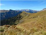 35
35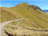 36
36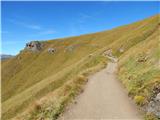 37
37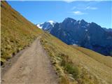 38
38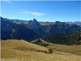 39
39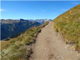 40
40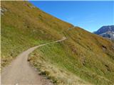 41
41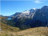 42
42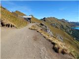 43
43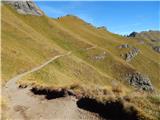 44
44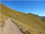 45
45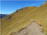 46
46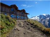 47
47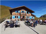 48
48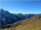 49
49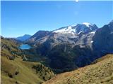 50
50 51
51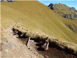 52
52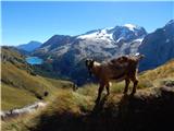 53
53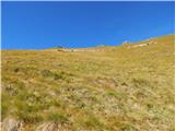 54
54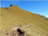 55
55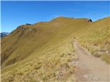 56
56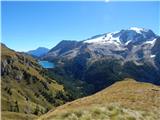 57
57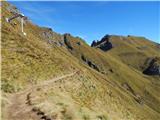 58
58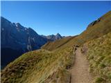 59
59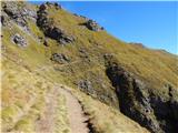 60
60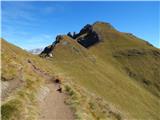 61
61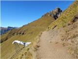 62
62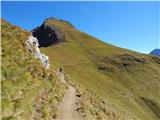 63
63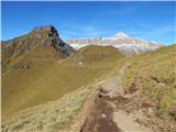 64
64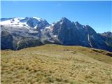 65
65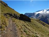 66
66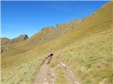 67
67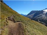 68
68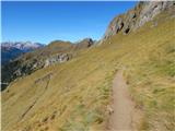 69
69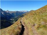 70
70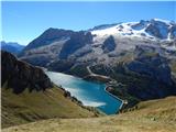 71
71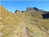 72
72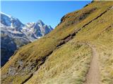 73
73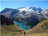 74
74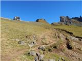 75
75 76
76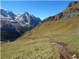 77
77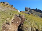 78
78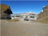 79
79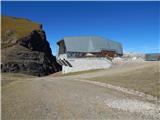 80
80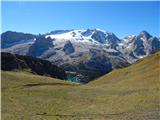 81
81
Discussion about the trip Passo Pordoi - Porta Vescovo (Bindelweg)
|
| pikec130. 10. 2013 |
Question: is it allowed to go by bike here?
Thanks, Grega
|
|
|
|
| GregorC31. 10. 2013 |
Yes. The famous MTB marathon Sellaronda Hero also takes place here.
|
|
|
|
| Savinja1130. 07. 2022 19:56:53 |
On 26.7.2020 we did the described route in both directions. The path is very scenic and long. It runs through high and vibrant green steep meadows at roughly the same altitude. Most attention is drawn by the highest mountain of the Dolomites, Marmolada, and searching for the part where the glacier broke off. We met a Slovenian couple who had ascended Punto Penio the previous day from the other side. From the saddle Porta Vescovo there is also a nice view of the Sella group. The path is suitable for all ages except younger children, as it is quite long. We walked 17km in six hours of hiking with a lot of enjoyment from the views. The path is massively visited, most people go to the huts, no orientation issues, everything is marked. On the path we meet many cyclists who are very fit and usually give way to hikers. We came across a case where a mountain biker was riding very slowly behind an older couple for quite some time until they were warned that there is a cyclist on the path. Despite the crowds, a relaxed atmosphere, civility and good mood prevail. Parking lots at Passo Pordoi are paid and very crowded, we parked lower by the road.
|
|
|
To post a comment you must log in:
If you do not yet have a username, you must first
register.