Passo Pordoi - Piz Boe (Via Ferrata Cesare Piazzetta)
Starting point: Passo Pordoi (2239 m)
| Latitude/Longitude: | 46,488°N 11,8113°E |
| |
Route name: Via Ferrata Cesare Piazzetta
Walking time: 3 h 30 min
Difficulty: extremely difficult marked way
Via ferrata: D
Elevation gain: 913 m
Elevation difference along the route: 950 m
Map: Tabacco 7
Recommended equipment (summer): helmet, self belay set
Recommended equipment (winter): helmet, self belay set, ice axe, crampons
Views: 32.458
 | 2 people like this post |
Access to starting point:
First, we drive to Cortina d'Ampezzo (to here you can go via the border crossings Rateče or Predel to Trbiž / Tarvisio and then on the highway in the direction of Udine to the exit Tolmezzo. From Tolmezzo we follow the road in the direction of the village Ampezzo and mountain pass Passo della Mauria. The road then descends and brings us to an intersection, where we continue left (possible also right) in the direction of Cortina d'Ampezzo. At all next intersections, we follow the signs for Cortina d'Ampezzo.
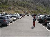
In Cortina d'Ampezzo then we follow the signs for the alpine pass Passo di Falzarego. At the mentioned pass we come to an intersection, where we continue on the left road in the direction of Marmolada and settlement Arabba (right Alta Badia). The road ahead descends for quite some time, then brings us to an intersection, where we continue right in the direction of the pass Passo Pordoi (left Marmolada). We follow the relatively wide and ascending road all the way to the mentioned pass, where we park on a large parking lot.
Access from Primorska: We drive on the highway in the direction of Padova, but only to a highway junction, where we continue in the direction of Veneto and Belluno. Near Belluno the highway ends, and we follow the road ahead in the direction of Belluno, where at the larger intersection we continue right in the direction of the town Agordo. From the mentioned town onwards we follow the signs for settlement Arabba and alpine pass Passo Pordoi, which is also the starting point for our tour.
Route description:
From the parking lot first we carefully cross the road, then we head to path no. 627 (direction Piz Boe). The path first rises somewhat more steeply across a panoramic grassy slope, then it flattens and brings us into more rocky terrain. The path ahead turns slightly to the left and starts to ascend more steeply again. After a few minutes of further walking we finally leave the grassy slopes, and the path transitions into scree terrain, across which we ascend on a quite wide path. Higher up the path flattens once again and brings us to a marked junction.
We continue right on path 626 following the signs “Via Ferrata C. Piazzetta”, straight ahead the path leads to hut Rifugio Forcella Pordoi. The path from the junction then for quite some time in gentle ascents and descents crosses the slopes below steep walls to the east. Later from the right side the path joins which leads past the monument of the First and Second World Wars. From the junction then only a short crossing follows to the entrance to the climbing section of the path.
At the entrance to the climbing section of the path we must equip ourselves with a helmet and via ferrata set, also highly recommended is the use of climbing gloves. The path already in the very beginning becomes extremely demanding and ascends with the aid of just the steel cable into a vertical wall. At some points the wall is even slightly overhanging, there are very few footholds and even those are due to numerous climbers already quite worn smooth.
Further we climb for quite some time upwards in the vertical wall, occasionally also crossing the wall to the left and right side. On a short overhang iron footrests also help us, later in the vertical wall there is also a very short ladder. The path then crosses again to the left and then ascends vertically to a somewhat wider ledge, where we can rest a bit.
From the ledge follows a vertical ascent through a somewhat awkward narrow passage, then the path becomes somewhat less demanding. Further the path crosses a hanging bridge from which there is a nice view of the initial most demanding section of the path. From the bridge onwards we then start ascending a somewhat less steep slope along the steel cable. Such a path then brings us to the last demanding vertical ascent. Before the last wall there is also a small emergency shelter (a small hole carved into the rock), where we can seek shelter in case of a thunderstorm. The last vertical wall can otherwise also be bypassed on the left side, but that path is quite crumbly.
Further the path becomes less steep, but at some points it is not secured, so considerable caution is still needed.
Later we join path 638 and only an ascent follows on an undemanding slope to the summit of Piz Boe.
The Via Ferrata Cesare Piazzetta path to Piz Boe is extremely demanding and suitable only for the most experienced climbers with sufficient arm strength and mandatory self-belaying. Many mark the described path as the most demanding secured path in the entire Dolomites.
We descend on the easy path past hut Rifugio Forcella Pordoi.

Photos:
 1
1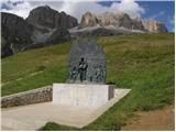 2
2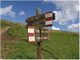 3
3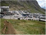 4
4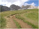 5
5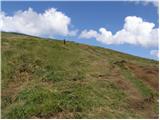 6
6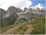 7
7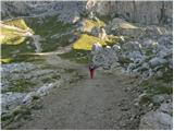 8
8 9
9 10
10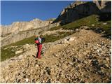 11
11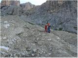 12
12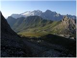 13
13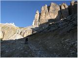 14
14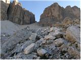 15
15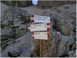 16
16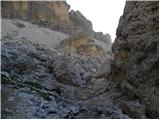 17
17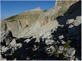 18
18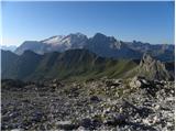 19
19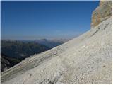 20
20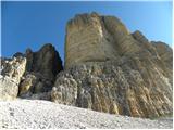 21
21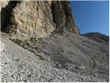 22
22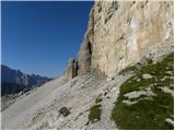 23
23 24
24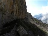 25
25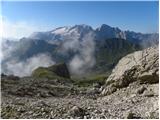 26
26 27
27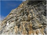 28
28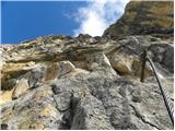 29
29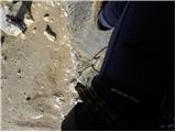 30
30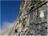 31
31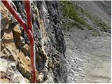 32
32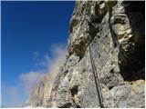 33
33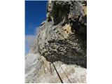 34
34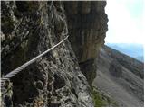 35
35 36
36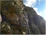 37
37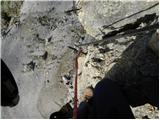 38
38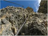 39
39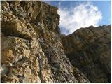 40
40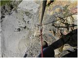 41
41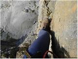 42
42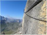 43
43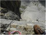 44
44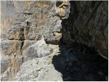 45
45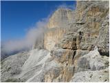 46
46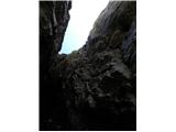 47
47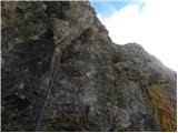 48
48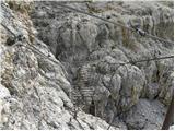 49
49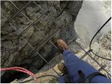 50
50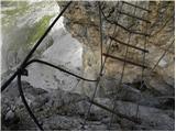 51
51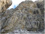 52
52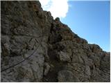 53
53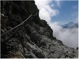 54
54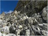 55
55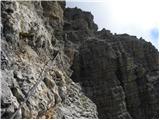 56
56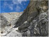 57
57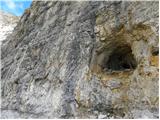 58
58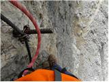 59
59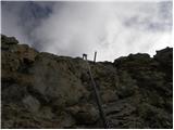 60
60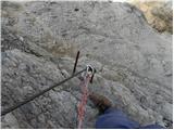 61
61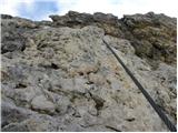 62
62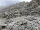 63
63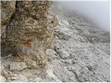 64
64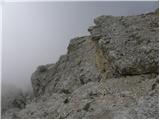 65
65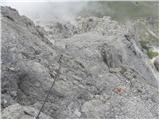 66
66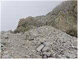 67
67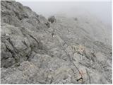 68
68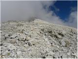 69
69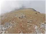 70
70 71
71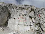 72
72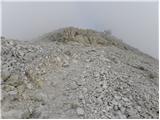 73
73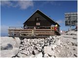 74
74
Discussion about the trip Passo Pordoi - Piz Boe (Via Ferrata Cesare Piazzetta)
|
| jedriličar3. 08. 2010 |
Yesterday did the described ferrata (thanks to author for pictures and description, excellent preparation for ascent). Ice axe and crampons unnecessary, though we carried them. Approach to ferrata a bit long, about 1:30 h, since we parked the car at the monument-cemetery, so saved about half an hour walk. Ferrata: what to say, one of the harder ones I've climbed, initial part to first ledge very demanding, vertical with several overhangs, rock mostly worn and polished, so despite all my climbing experience quite strenuous (say the initial part is a good alpine 5 in difficulty), requires a lot of arm strength. Further on ferrata ok, much easier, has a few details like a small chimney where you have to drag the backpack under you, or a wobbly little bridge, but nothing special. Ferrata time about 2 hours and another half hour to summit. Descent normale via to Forcela di Pordoi hut then ascent to Sas Pordoi and descent with gondola cable car (price 6.70 Eur), ca. 1 hour. From gondola to car another ca. half hour walk. Overall, phenomenal tour, not for everyone. We were first on ferrata in the morning, after us about twenty people came to ferrata, but only a few reached the summit, meaning many gave up at the very entrance which is the most demanding. Recommend to everyone who feels capable and has no height problems (ferrata quite exposed ...).
|
|
|
|
| Kili0231. 07. 2016 |
Nothing to add to the description, all holds true, the lower part, slightly overhanging in places, requires arm strength from the start, the few footholds there are mostly small and quite smooth, but in key sections exactly enough protections are placed, grade D, which in some parts borders on E.
|
|
|
|
| A26. 08. 2020 |
Completed the ascent over the weekend. Based on the description and read blogs, I set off with great respect. The description is spot on, the initial 100m+ is the hardest, steps worn, requires a lot of arm strength. After the wider ledge, demanding vertical climb then easier onwards. On the last difficult section, a peg is pulled out.
|
|
|
|
| don kihott27. 08. 2020 |
No comparisons with E rating anywhere, the ferrata is comparable in difficulty to Cjajnik... Some descriptions exaggerate a bit..
|
|
|
To post a comment you must log in:
If you do not yet have a username, you must first
register.