Passo di Fedaia - Punta Serauta (Via ferrata Eterna)
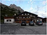
Starting point: Passo di Fedaia (2057 m)
| Latitude/Longitude: | 46,4534°N 11,8889°E |
| |
Route name: Via ferrata Eterna
Walking time: 6 h 30 min
Difficulty: extremely difficult marked way
Via ferrata: C/D
Elevation gain: 905 m
Elevation difference along the route: 1100 m
Map: Tabacco 07 1:25.000
Recommended equipment (summer): helmet, self belay set
Recommended equipment (winter): helmet, self belay set, ice axe, crampons
Views: 5.731
 | 1 person like this post |
Access to starting point:
First, we drive to Cortina d'Ampezzo (possible via the border crossing Rateče or Predel to Trbiž / Tarvisio and then on the highway in the direction of Udine to the exit Tolmezzo. From Tolmezzo, we follow the road in the direction of the village Ampezzo and mountain pass Passo della Mauria. The road then descends and brings us to an intersection, where we continue left (possible also right) in the direction of Cortina d'Ampezzo. At all following intersections, we follow the signs for Cortina d'Ampezzo and then follow the signs for the alpine pass Passo di Falzarego. Already in the first part of the ascent towards the pass Falzarego, we will come to an intersection, where the signs for pass Passo di Giau (2233 m) and Marmolada direct us to the left. The road after the pass Giau starts to descend, and we follow it through the settlements in the lower part in the direction of Marmolada or pass Passo di Fedaia. The road, which then starts ascending again, brings us higher to the pass Fedaia, where we park at the parking lot by the hut Rifugio Fedaia.
Access from Primorska: We drive on the highway in the direction of Padova, but only to the highway junction, where we continue in the direction of Veneto and Belluno. Near Belluno, the highway ends, and we follow the road ahead in the direction of Belluno, where at a larger intersection we continue right in the direction of the town Agordo. From the mentioned town onwards, we follow the frequent signs for Marmolada or pass Passo di Fedaia. When we arrive at the mentioned pass, we park at the parking lot by the hut Rifugio Fedaia.
Route description:
The initial part of the described path is CLOSED! The entrance to the secured part of the path is changed and is now located below the western slopes of the ridge. Access runs along the ski slope.
Old description: From the parking lot on the pass, we continue left and first descend a little on the grassy slope. Soon we will notice a path on the right below the wall, which leads through the dwarf pines. We head to this path and begin to ascend diagonally in the direction towards the southeast. The path then turns right and follows the ascent on the grassy slope towards the wall. A little before the wall, the path brings us to a junction where the path towards the summit Sass del Mul branches off to the right. We continue left towards the wall on which we can see a large red letter F. Here is the beginning of the climbing part of the path.
At the beginning of the path there is also a wooden sign on which there was a warning that the path is closed. The warning on the sign unfortunately is no longer there, but the path is still CLOSED! (August 2011) If you decide to go on this path anyway, additional belaying with a rope is highly recommended, as especially in the first part of the path the fixed safety gear is in very bad condition, and at some spots there is no fixed safety gear at all.
The climbing path named Via ferrata Eterna otherwise steeply ascends on the rocky slope in the initial part and all the time runs in the direction towards the southwest. From the path there is a very nice view back towards the pass Fedaia and on the peaks north and east of the pass Fedaia. On the climbing path we climb on solid rock, and the fixed safety gear is mostly placed so that we use it only for belaying and "pulling on the steel cable" is not possible. It should also be noted that the distances between the bolts to which the steel cable is attached are quite large. The climbing path then brings us to the main ridge where it turns slightly to the right.
Further on, the path runs on and along the precipitous ridge and several times steeply ascends and descends. The path is extremely exposed at some spots, secured only with the steel cable all the time, and only occasionally will we notice a bolt that is still there from the period of the First World War. The closer we get to the summit Punta Serauta, the more remains from the First World War we will notice along the path. At the end follows an ascent on stirrups, which brings us into an artificial cave where the path Via ferrata Eterna ends.
Further, we walk on a somewhat wider path along the steel cable, which leads us past numerous military caverns. When we come to a junction, we continue right upwards and a short ascent along the steel cable to the summit follows.
The descent is easiest to the hut Rifugio Serauta from which a gondola cable car runs down to the valley. The second option is descent via the glacier, in which case we need an ice axe and crampons. The third option is descent via the climbing path Via ferrata Pontura.
The described path is extremely demanding and is the longest secured climbing path in the Dolomites. It is suitable only for experienced mountaineers with sufficient fitness and mandatory self-belaying.
Currently the path is officially closed (August 2011).

Photos:
 1
1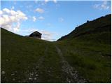 2
2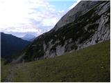 3
3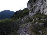 4
4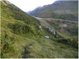 5
5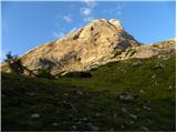 6
6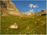 7
7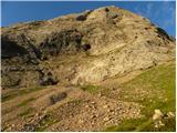 8
8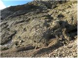 9
9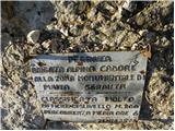 10
10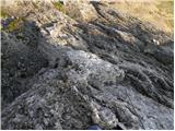 11
11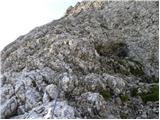 12
12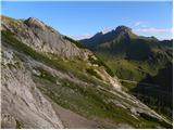 13
13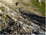 14
14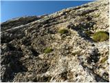 15
15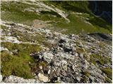 16
16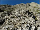 17
17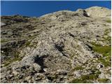 18
18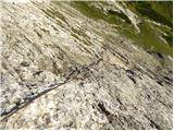 19
19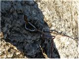 20
20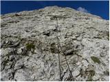 21
21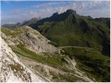 22
22 23
23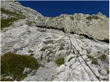 24
24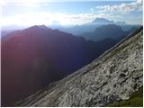 25
25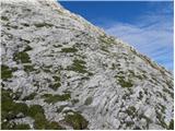 26
26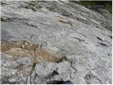 27
27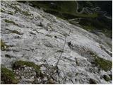 28
28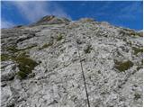 29
29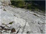 30
30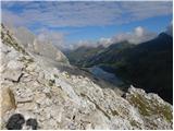 31
31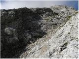 32
32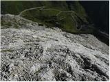 33
33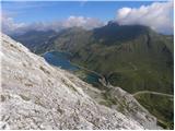 34
34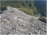 35
35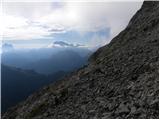 36
36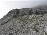 37
37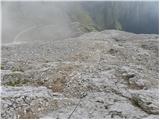 38
38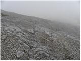 39
39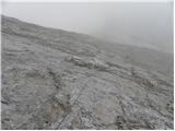 40
40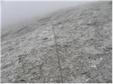 41
41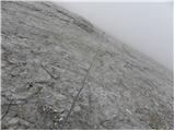 42
42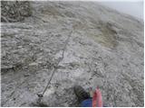 43
43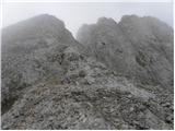 44
44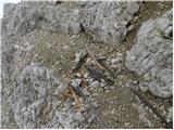 45
45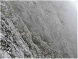 46
46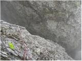 47
47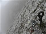 48
48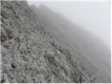 49
49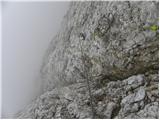 50
50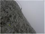 51
51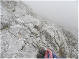 52
52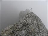 53
53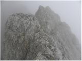 54
54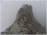 55
55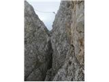 56
56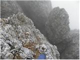 57
57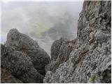 58
58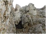 59
59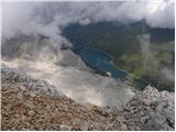 60
60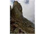 61
61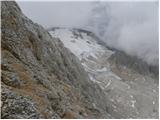 62
62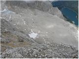 63
63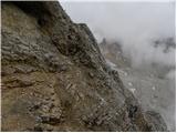 64
64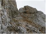 65
65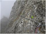 66
66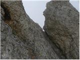 67
67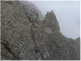 68
68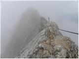 69
69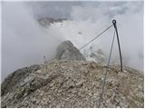 70
70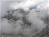 71
71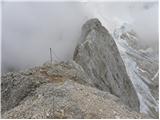 72
72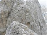 73
73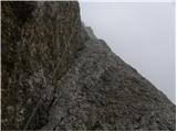 74
74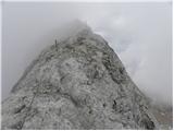 75
75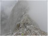 76
76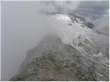 77
77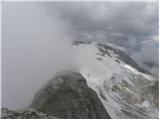 78
78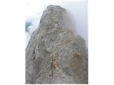 79
79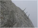 80
80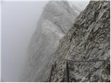 81
81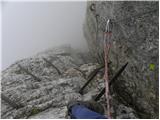 82
82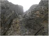 83
83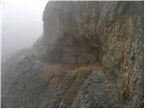 84
84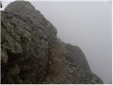 85
85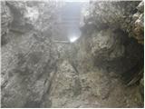 86
86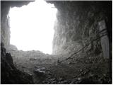 87
87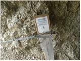 88
88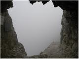 89
89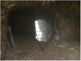 90
90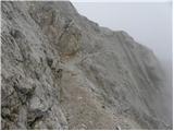 91
91 92
92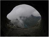 93
93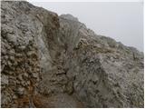 94
94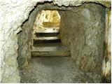 95
95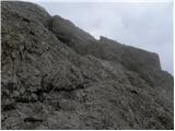 96
96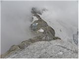 97
97
Discussion about the trip Passo di Fedaia - Punta Serauta (Via ferrata Eterna)
|
| ivanjr7. 08. 2014 |
I want to inform mountain lovers that the Eterna ferrata has been impeccably maintained and safely passable for two years (since 2012) (of course with appropriate equipment and knowledge). The course of the lower part of the ferrata has changed, the old entrance described in the description has been abandoned, you will search for the cables in vain. The new entrance is about 250 m higher on the western side of the ridge, marked with a large red dot visible from afar, and it runs obliquely to the left upwards along the distinct slope that merges into the roof. The further course is unchanged. My friend and I visited it on 6.8.2014 and we were enthusiastic also thanks to the wonderful weather. The day started suspiciously when, unaware of the actual situation, we stood under the old entrance and nothing was clear to us, we had already said goodbye to the nice tour in our minds, but then the day turned out ideally. As said, the safety features are impeccable, the entrance part is the most demanding part of the tour, but mountaineers accustomed to such paths should not have major difficulties. Otherwise, the lower part is just an entry ticket to truly enjoyable strolling along the panoramic ridge that takes you straight to the well-deserved beer. Good luck.
|
|
|
|
| jedriličar7. 08. 2014 |
If you have pictures, it would be good to send them together with the description to the webmaster so that he changes the ferrata description and adds pictures of the new part (entrance and up to the junction with the old ferrata route), so that those who go according to the description from hribi.net are not misled like you...
|
|
|
|
| andrejp1. 09. 2015 |
We were on it on Friday and you don't need pictures for the access, because everything is well marked. From the pass, instead of descending, go straight up the ski slope. It's well marked on the map. We returned across the glacier.
Nice day
|
|
|
|
| janezs731. 09. 2015 |
I posted the description of the new variant under conditions "ferrata eterna - punta serauta" and added pictures (unfortunately can't add pictures here)
|
|
|
To post a comment you must log in:
If you do not yet have a username, you must first
register.