Passo della Forcella - Col Gentile (on ridge)
Starting point: Passo della Forcella (1824 m)
| Latitude/Longitude: | 46,48747°N 12,81054°E |
| |
Route name: on ridge
Walking time: 2 h 30 min
Difficulty: partly demanding marked way
Elevation gain: 251 m
Elevation difference along the route: 251 m
Map: Tabacco 1:25.000 list 13, aplikacije Tabacco EO7G, EO7H
Recommended equipment (summer):
Recommended equipment (winter): ice axe, crampons
Views: 2.742
 | 4 people like this post |
Access to starting point:
From the Friulian highway in the place Carnia we continue past Tolmezzo in the direction of Villa Santina on the state road SS52, and from there on the road SS355 in the direction of Sappada. In the place Ovaro a signpost for Mione directs us to the right and below the road and over the stream Degano.
Through Liunt and Mione we follow the ever narrower, steep, newly (2014) asphalted road with numerous turns through the beech forest to the pass Passo della Forcella, where there is some space for parking on both sides of the road.
Route description:
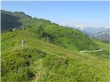
At the pass we take the comfortable, marked footpath towards the south and follow it to the summit ridge (to here around an hour and a half), where the footpath turns to the left and on a somewhat steeper and in places exposed summit ridge in less than an hour we reach the panoramic peak.
A little lower on the west side of the saddle comes from the valley a marked path, which after a few hundred meters joins the path described here on the ridge.
On the summit there is a cross with a bell and a summit logbook.
Photos:
 1
1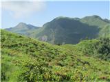 2
2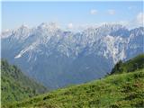 3
3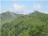 4
4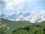 5
5 6
6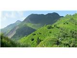 7
7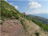 8
8 9
9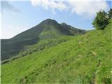 10
10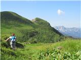 11
11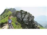 12
12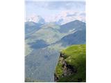 13
13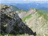 14
14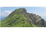 15
15 16
16 17
17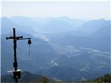 18
18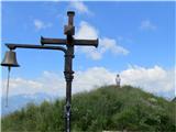 19
19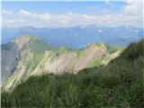 20
20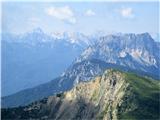 21
21 22
22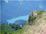 23
23 24
24 25
25 26
26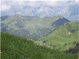 27
27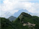 28
28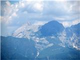 29
29 30
30
Discussion about the trip Passo della Forcella - Col Gentile (on ridge)
|
| tulipan24. 07. 2016 |
In picture 23 is Lake Sauris.
|
|
|
To post a comment you must log in:
If you do not yet have a username, you must first
register.