Passo Campolongo - Ütia Franz Kostner
Starting point: Passo Campolongo (1860 m)
| Latitude/Longitude: | 46,5193°N 11,87393°E |
| |
Walking time: 2 h 10 min
Difficulty: easy marked way
Elevation gain: 640 m
Elevation difference along the route: 660 m
Map:
Recommended equipment (summer):
Recommended equipment (winter):
Views: 1.510
 | 2 people like this post |
Access to starting point:
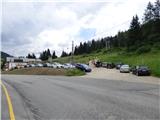
Through the Karawanks Tunnel, we drive to Austria, then we continue driving towards Spittal and further towards Lienz (a little after Spittal the highway ends). Further, we drive on a relatively nice and wide road through the Drava Valley, which brings us to Italy. The road further leads past the towns Dobbiaco / Toblach and Brunico / Bruneck. Only a little after the last-mentioned town, past which a bypass leads, we turn left into the valley Val Badia. Further, we drive through the mentioned valley past the towns La Vila and Corvara. Next follows an ascent towards the pass Passo Campolongo. A few hundred meters before the pass, we will notice on the left side a macadam parking lot on which we park. The parking lot is located behind the hotel Laguscei opposite the bus station. By the road is also the lower station of the chairlift. A smaller parking lot is also on the right side of the road before the bus station.
Route description:
From the parking lot, we continue along the main road (towards the south) to the Hotel Boe, which is located on the right western side of the road. At the hotel where there are also signposts, we turn right onto the macadam road following the signs «Rifugio Lago Boe». Behind the hotel, the road turns right and slightly descends, then starts to ascend and crosses the ski slope. Further, the road ascends for a short time through the forest and then brings us to the mountain pasture Malga Plan Fisti.
We continue along the road across the mountain pasture and a little after the mountain pasture we come to a marked junction where the footpath to the hut Kaiser Hütte branches off to the left. We continue right and continue ascending along the road. After a short ascent, the path 638A to the summit Crep de Munt also branches off to the right. We continue left along the road from which beautiful views open towards Marmolada and the mountains above the Val Badia valley. Here the road ascends somewhat more steeply and brings us again to the ski slope. A little higher, the road turns right and continues ascending along mostly grassy slopes. The road then becomes flatter and soon brings us to the hut Rifugio Lago Boe. A circular cabin cable car from the town Corvara in Val Badia also runs to the hut. Near the hut there is also the lower station of the chairlift that leads to the summit Vallon (2530m). Both cable cars also operate in the summer months.
Near the hut where there is a junction, we continue left along the ski slope where signs direct us to the lake Lech de Boe and the hut Ütia Franz Kostner. The path runs along the right edge of the ski slope and after a short ascent brings us to the mentioned lake, which is located to the right of the ski slope below the rocky ridge.
From the lake, we continue along path 638, which turns left and crosses the ski slope. Further on, the path runs a little left of the ski slope across partly grassy terrain. The path soon brings us to a marked junction where path 636 to the hut Kaiser Hütte (Rifugio Bec de Roces) branches off to the left. We continue along the path, which ascends the slope parallel to the ski slope, and soon path 646A to the summit Boeseekofel (Piz da Lech) branches off to the right. We continue along the path that runs left of the ski slope and gradually beautiful views open towards the hut Ütia Franz Kostner and the sheer walls of the nearby summits in the Sella mountain group. Further on, the slope becomes somewhat flatter and the path brings us to a marked junction.
To the right, the path to the upper station of the Vallon cable car and further to the summit Boeseekofel (Piz da Lech) branches off, while we continue left along path 638 to the hut Ütia Franz Kostner. The wide and panoramic path runs westwards and quickly brings us to another junction. To the right, the path to the summit Piz Boe and the pass Passo Pordoi branches off this time, while we continue left along the wide path, which soon brings us to the hut Ütia Franz Kostner.

Photos:
 1
1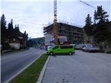 2
2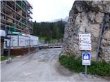 3
3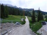 4
4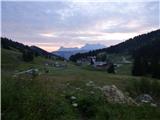 5
5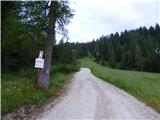 6
6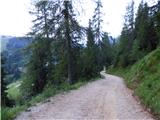 7
7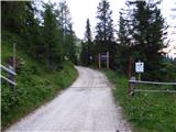 8
8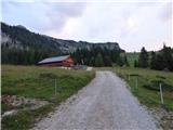 9
9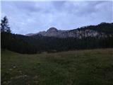 10
10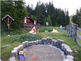 11
11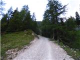 12
12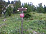 13
13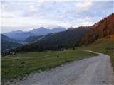 14
14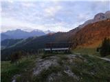 15
15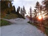 16
16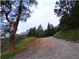 17
17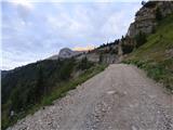 18
18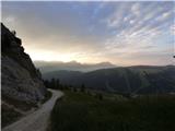 19
19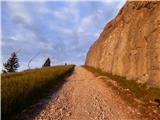 20
20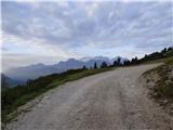 21
21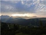 22
22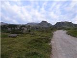 23
23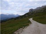 24
24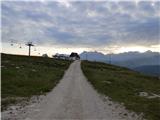 25
25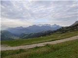 26
26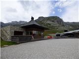 27
27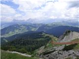 28
28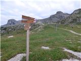 29
29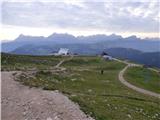 30
30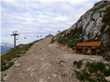 31
31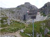 32
32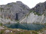 33
33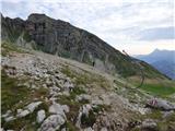 34
34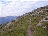 35
35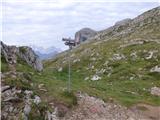 36
36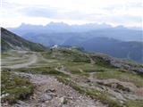 37
37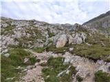 38
38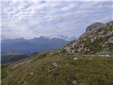 39
39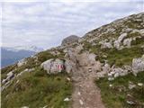 40
40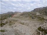 41
41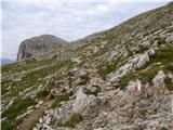 42
42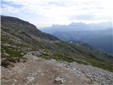 43
43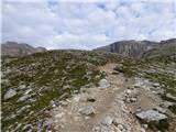 44
44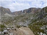 45
45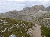 46
46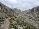 47
47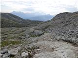 48
48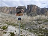 49
49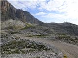 50
50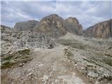 51
51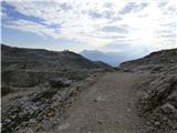 52
52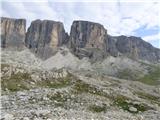 53
53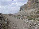 54
54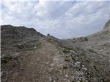 55
55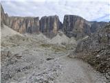 56
56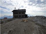 57
57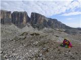 58
58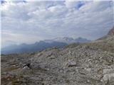 59
59 60
60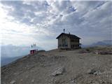 61
61
Discussion about the trip Passo Campolongo - Ütia Franz Kostner
|
| Savinja1127. 07. 2023 12:19:18 |
On 23.7.2023 we were on this path. Opposite the Monte Cherz hotel at Passo Campolongo (1875 m), which connects Corvara and Arabba, there is a marked uphill path (gravel road) towards the Bec de Roces hut. From there we continued on the similarly marked and well-trodden path to the family-run Franz Kostner hut (2500 m). The hut offers great views, home-cooked food and cable car access even for the very old and very young. We returned via the path described here past Lago Boe. The path is easy, marked, orientation clear and simple, the hike doesn't tire us too much and we can enjoy the beautiful mountain environment. Suitable for all age groups. From the hut to the top of Piz Boe is two hours. The vertical walls of the three-thousanders around the hut offer climbing for the more demanding participants in the mountains. For children there are plenty of playgrounds at the huts (except at Kostner of course), panoramic platforms with pictures and marked mountains we see around, explanations of the formation of the Dolomites, maps and other information that complement a beautiful and health-beneficial day spent.
|
|
|
To post a comment you must log in:
If you do not yet have a username, you must first
register.