Parkirišče Erichhütte - Erichhütte
Starting point: Parkirišče Erichhütte (1339 m)
| Latitude/Longitude: | 47,39164°N 13,04879°E |
| |
Walking time: 30 min
Difficulty: easy marked way
Elevation gain: 206 m
Elevation difference along the route: 206 m
Map:
Recommended equipment (summer):
Recommended equipment (winter):
Views: 2.825
 | 2 people like this post |
Access to starting point:
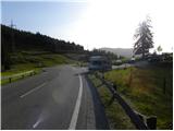
Through the Karawanks Tunnel, we drive to Austria, and then we continue driving on the Tauern highway. Further, we drive through the Katschberg Tunnel and later also the Tauern Tunnel / Tauerntunnel. We follow the highway towards Salzburg (also Solnograd) only to the exit for Bischofshofen, from where we continue driving on a four-lane road towards the already mentioned town. From Bischofshofen we follow the signs for Höchkonig and Dienten am Höchkonig. The road starts ascending and brings us to the Dientner Sattel saddle. From the saddle, we continue a good 100 meters on the road which starts descending, and then we will notice a parking lot on the right side of the road on which we park.
Route description:
From the parking lot, we continue by following the signs »Erichhütte 30 min« on the mountain road which is closed for traffic. Macadam road on which we are ascending leads us by pastures with a nice view towards High Tauern and on the nearby peaks above the mountain pasture Schönbergalm. The path then leads us through a short stretch of forest where we also cross a smaller stream. Further, the path again runs by pastures all the way to the mountain hut Erichhütte on the mountain pasture Schönbergalm.
Photos:
 1
1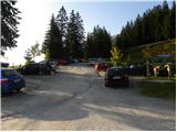 2
2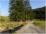 3
3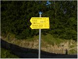 4
4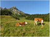 5
5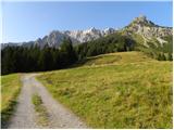 6
6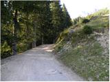 7
7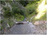 8
8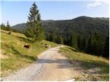 9
9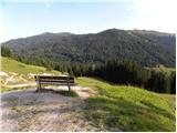 10
10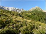 11
11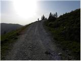 12
12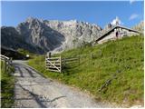 13
13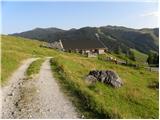 14
14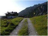 15
15 16
16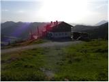 17
17
Discussion about the trip Parkirišče Erichhütte - Erichhütte
To post a comment you must log in:
If you do not yet have a username, you must first
register.