Parkirišče pod Mokrinami / Nasfeld - Malvuerich Alto
Starting point: Parkirišče pod Mokrinami / Nasfeld (1460 m)
| Latitude/Longitude: | 46,5524°N 13,2735°E |
| |
Walking time: 1 h 45 min
Difficulty: difficult marked way
Elevation gain: 439 m
Elevation difference along the route: 500 m
Map: Tabacco 18
Recommended equipment (summer): helmet
Recommended equipment (winter): helmet, ice axe, crampons
Views: 5.364
 | 4 people like this post |
Access to starting point:
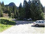
Across the border crossing in Rateče we drive through Trbiž / Tarvisio, Ukve / Ugovizza to the place Tablja / Pontebba, where we turn right following the signs »Passo di Pramollo / Nassfeld« (Slovenian Mokrine). A little before the pass, in the right bend, a macadam road branches off to the left. At the intersection, there are signposts and a small parking lot on which we park.
Route description:
At the parking lot, we head onto the macadam road that is closed to traffic and after a few meters we come to a junction where a path branches off to the right leading towards the pass Mokrine / Nassfeld. We continue left along the road, which in about half an hour with gentle ascents and descents brings us to the alpine pasture by the hut Baita Winkel (1470 m). At the alpine pasture, we turn left following the signs Rosskofel Ostgrat. The path crosses the stream and begins to ascend in zigzags through the forest. A little before the ridge we come to a junction where we turn left following the signs Malvueric, the right path leads to Rosskofel (2240 m). The path becomes somewhat gentler and brings us to the ridge from which a nice view opens onto the south side. Soon the path begins to ascend quite steeply and turns slightly right onto the south slopes, which are slightly exposed in a few places. The path then turns left and brings us back onto the north side of the ridge. Here the path becomes quite exposed. There is quite a lot of loose rock on the path, and when wet it is also quite muddy, so it is fairly dangerous for slipping. When the path brings us back onto the south slopes the difficulties end and to the summit follows only a short ascent on the grassy slope.

Photos:
 1
1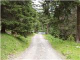 2
2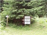 3
3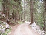 4
4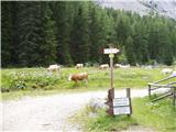 5
5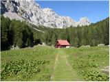 6
6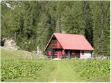 7
7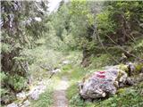 8
8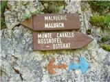 9
9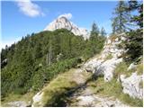 10
10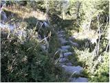 11
11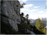 12
12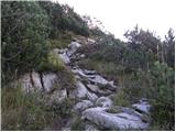 13
13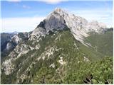 14
14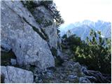 15
15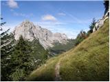 16
16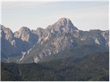 17
17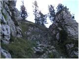 18
18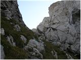 19
19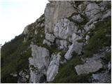 20
20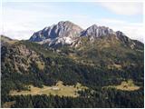 21
21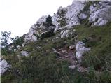 22
22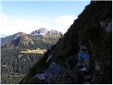 23
23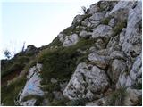 24
24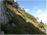 25
25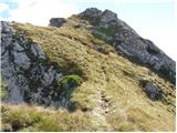 26
26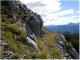 27
27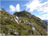 28
28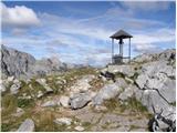 29
29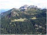 30
30
Discussion about the trip Parkirišče pod Mokrinami / Nasfeld - Malvuerich Alto
|
| VanSims2. 10. 2011 |
Not sure if there are two paths from Baita Winkel to Malvuerich Alto or if they renovated and widened the path thoroughly. I went through two small tunnels and a little bridge not on these pictures. The path I took could easily be 'easy marked trail'
|
|
|
To post a comment you must log in:
If you do not yet have a username, you must first
register.