Parkirišče pod Malga Giau - Corvo Alto
Starting point: Parkirišče pod Malga Giau (1963 m)
| Latitude/Longitude: | 46,489°N 12,06721°E |
| |
Walking time: 1 h 50 min
Difficulty: easy unmarked way
Elevation gain: 492 m
Elevation difference along the route: 590 m
Map: Tabacco 03 1:25.000
Recommended equipment (summer):
Recommended equipment (winter): ice axe, crampons
Views: 375
 | 2 people like this post |
Access to starting point:
First, we drive to Cortina d'Ampezzo (to get here, you can go over the border crossing at Rateče or Predel to Trbiž / Tarvisio and then on the highway in the direction of Udine / Videm to the exit Tolmezzo. From Tolmezzo, we follow the road in the direction of the village Ampezzo and the mountain pass Passo della Mauria. The road then descends and brings us to a junction, where we continue left (also possible right) in the direction of Cortina d'Ampezzo. At all subsequent junctions, we follow the signs for Cortina d'Ampezzo. Or from the Primorska side, where we drive on the highway in the direction of Trst / Trieste. Further, we drive on the Italian highway in the direction of Padova, but only to the highway junction, where we continue in the direction of Veneto and Belluno. Near Belluno, the highway ends, and at the next junctions we continue in the direction of Cortina d'Ampezzo and then follow the signs for the alpine pass Passo di Falzarego. We then follow this ascending road to a junction at an altitude of approximately 1400 m. At the junction, we continue left in the direction of the alpine pass Passo di Giau and Marmolada. We follow this road all the way to the parking lot below the mountain pasture Malga Giau. The parking lot is located on the right side before the sharp right turn at an altitude of approximately 1960 m.
Route description:
From the parking lot, we continue on the main road; at the right turn, we can go straight on a shortcut through the pasture or continue along the main road. If we continue along the road, first at the left turn a road branches off right upwards toward the mountain pasture Malga Giau, and we continue another good 200 meters along the road, where we will then notice signposts and the beginning of the footpath on the left side. A little before the beginning of the mentioned footpath, there is another smaller parking lot on the right side of the road.
We head onto the mentioned footpath in the direction toward the notch Forcella Giau. The path first crosses pastures toward the south and also slightly descends. Next follows the crossing of somewhat swampy terrain, where the mentioned shortcut joins us from the left. We continue straight ahead and begin to ascend again. Further on, grassy slopes and belts of sparse larch forest alternate, and the path continues toward the south. Somewhat higher, when we approach the slopes of the peak Monte Formin, we come to a junction where the path from the pass Passo Giau joins us from the right.
At the junction, we continue straight toward the notch Forcella Giau, and from the path increasingly beautiful views begin to open up on the mountain groups Tofana and Sella. Such a path then brings us to the already mentioned notch, where a view opens up toward the south, where Monte Pelmo stands out.
At the notch, where there is a junction, a well-beaten path 436 branches off to the left toward the notch Forcella Ambrizola, and we head right onto the poorly visible path 465. The poorly visible path here begins to descend on grassy slopes and brings us to a junction.
The marked path here turns right toward the valley Val Cernera, and we head slightly left onto the unmarked archaeological path, which leads past large boulders toward the small lake Lago delle Basti, which we can already see from the path for some time. The path continues to descend all the way to the mentioned lake.
On the other side of the lake, where the path toward the mountain pasture Malga Mondeval di sopra and Mesolithic archaeological finds turns left, we head right onto an even less visible path along the ridge. Further on, we ascend along the ridge toward the summit Corvo Alto. The path runs along the left eastern side of the ridge, where the slopes are grassy and relatively gentle; the right western side of the ridge is precipitous. We continue further along the increasingly scenic path along the ridge all the way to the summit.

Along the route: Forcella Giau (2360m), Lago delle Baste (2281m)
Photos:
 1
1 2
2 3
3 4
4 5
5 6
6 7
7 8
8 9
9 10
10 11
11 12
12 13
13 14
14 15
15 16
16 17
17 18
18 19
19 20
20 21
21 22
22 23
23 24
24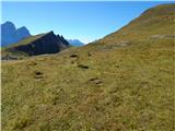 25
25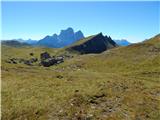 26
26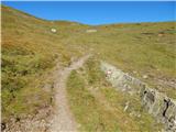 27
27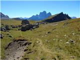 28
28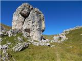 29
29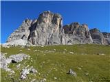 30
30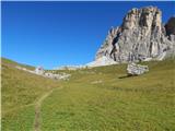 31
31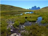 32
32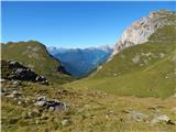 33
33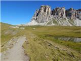 34
34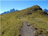 35
35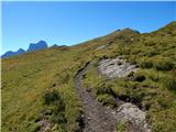 36
36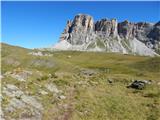 37
37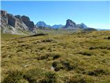 38
38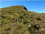 39
39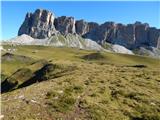 40
40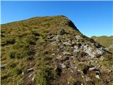 41
41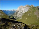 42
42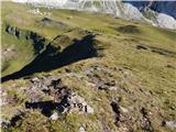 43
43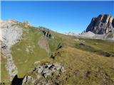 44
44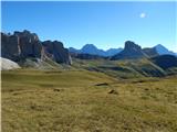 45
45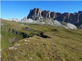 46
46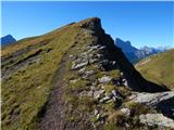 47
47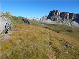 48
48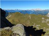 49
49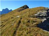 50
50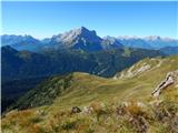 51
51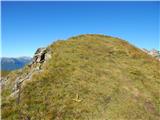 52
52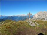 53
53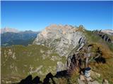 54
54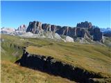 55
55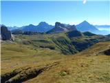 56
56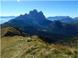 57
57
Discussion about the trip Parkirišče pod Malga Giau - Corvo Alto
To post a comment you must log in:
If you do not yet have a username, you must first
register.