Palafavera - Monte Civetta (Via Ferrata Alleghesi)
Starting point: Palafavera (1507 m)
| Latitude/Longitude: | 46,40196°N 12,10119°E |
| |
Route name: Via Ferrata Alleghesi
Walking time: 6 h 30 min
Difficulty: extremely difficult marked way
Via ferrata: C
Elevation gain: 1713 m
Elevation difference along the route: 1720 m
Map: Tabacco 15 1:25.000
Recommended equipment (summer): helmet, self belay set
Recommended equipment (winter): helmet, self belay set, ice axe, crampons
Views: 16.720
 | 4 people like this post |
Access to starting point:
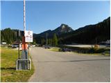
Via the border crossing Rateče we drive to Trbiž / Tarvisio, where we turn onto the motorway in the direction of Udine. We leave the motorway at the Tolmezzo exit and follow the road to the mentioned place. From Tolmezzo we continue in the direction of the settlement Ampezzo and the mountain pass Passo della Mauria. The road then starts descending and brings us to the Cadore valley, where we continue left towards Cortina d'Ampezzo. We then follow the signs for Cortina d'Ampezzo to the settlement Venas di Cadore. A little before the end of the mentioned settlement we turn left towards the settlement Forno di Zoldo. The road then through the Cibiana pass brings us to the Val di Zoldo valley, where we continue right towards the Staulanza pass. We follow the ascending road to the settlement Palafavera, where we park on a large parking lot by the Rifugio Palafavera hut. The parking lot is located on the left side of the road by the ski slope.
Route description:
From the parking lot at the Rifugio Palafavera hut we continue south and then turn right onto the gravel road following the signs "Rifugio Coldai, Forcella D'Alleghe". After a few meters the road brings us to a junction where we continue right on the gravel road closed to traffic. The road then ascends along and beside the ski slope, and during the ascent beautiful views open up mainly towards the summits of Monte Pelmo and Civetta. Later the road brings us to the western side of the peak Col Marino della Travesera. Here a quite flat road runs across the ski slope and brings us to the pasture Malga Pioda at the Forcella D'Alleghe saddle.
On the pasture where there is a junction we continue left on the footpath following the signs "Rif. A. Sonnino al Coldai". Initially still very wide, the path starts to ascend slowly in long zigzags towards the slopes of the peak Cima di Coldai. The path then turns left and crosses the slopes ascending southwards, bringing us below the cargo cableway. Here the path turns right and then ascends more steeply on the slope below the cableway. When we reach the upper station of the cargo cableway, the path flattens and quickly brings us to the hut.
A little beyond the hut where there is a junction we continue left following the signs "Sent. Tivan, Ferr. Alleghesi", straight ahead the path leads to Lago Coldai lake. The path then for quite some time crosses relatively steep slopes southwards and on a shorter section steel cables assist us. Such a path then brings us to the saddle below the Schinal del Bech summit. At the saddle where there is a junction we continue right where a large sign on the rock "Ferrata Alleghesi" directs us. The path then turns slightly left and soon we are at the entrance to the climbing section of the path.
The protected path named Via Ferrata Alleghesi first ascends moderately along the steel cable, then soon follows a vertical ascent on pegs and ladder. Further on the path mostly runs through a well-protected steep gully and occasionally includes shorter crossings left and right. Higher up the path brings us to a more demanding section, where with the aid of numerous pegs we climb over a slightly overhanging chimney. Further we continue ascending along the steel cable and increasingly beautiful views towards the north begin to open up.
The path then turns left and crosses the slopes below Punta Civetta summit. Later the path starts ascending somewhat more steeply again and continues southwards. In the final section there follows an ascent along the ridge to the panoramic summit.
We descend via the normale path, which leads down the eastern slopes of the mountain past the Torrani hut and then back towards the Coldai hut. The slopes down which we descend are slightly less steep, but due to the slippery sand considerable caution is required on this path too.

Photos:
 1
1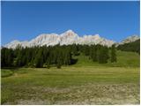 2
2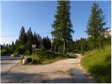 3
3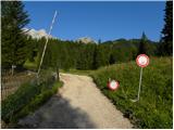 4
4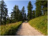 5
5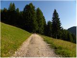 6
6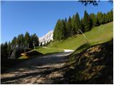 7
7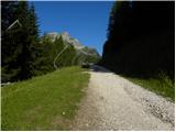 8
8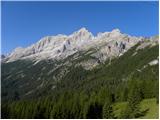 9
9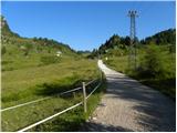 10
10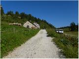 11
11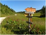 12
12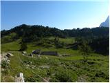 13
13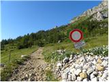 14
14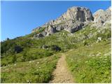 15
15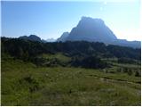 16
16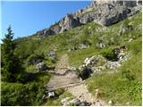 17
17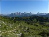 18
18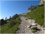 19
19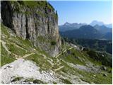 20
20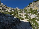 21
21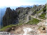 22
22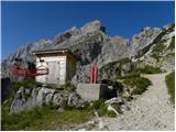 23
23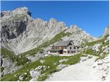 24
24 25
25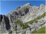 26
26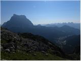 27
27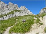 28
28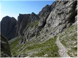 29
29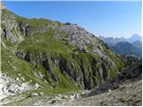 30
30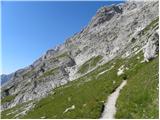 31
31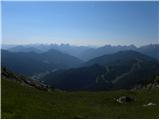 32
32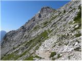 33
33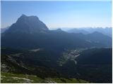 34
34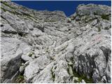 35
35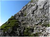 36
36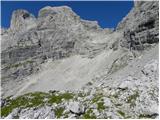 37
37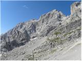 38
38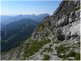 39
39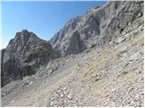 40
40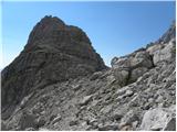 41
41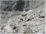 42
42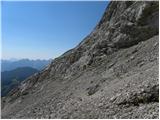 43
43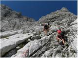 44
44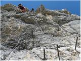 45
45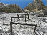 46
46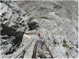 47
47 48
48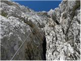 49
49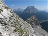 50
50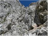 51
51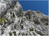 52
52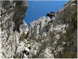 53
53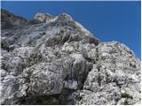 54
54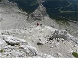 55
55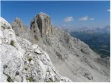 56
56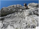 57
57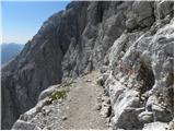 58
58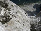 59
59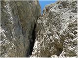 60
60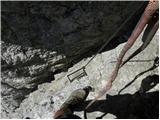 61
61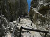 62
62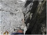 63
63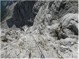 64
64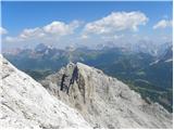 65
65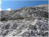 66
66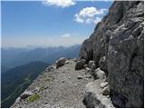 67
67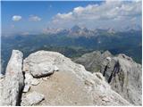 68
68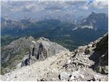 69
69 70
70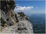 71
71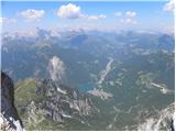 72
72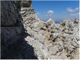 73
73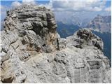 74
74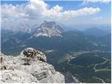 75
75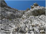 76
76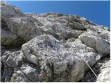 77
77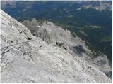 78
78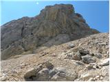 79
79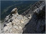 80
80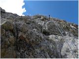 81
81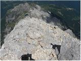 82
82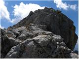 83
83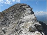 84
84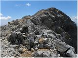 85
85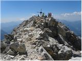 86
86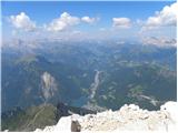 87
87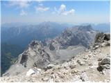 88
88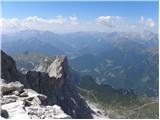 89
89
Discussion about the trip Palafavera - Monte Civetta (Via Ferrata Alleghesi)
|
| malimiha16. 01. 2018 |
Hi, interested in the difficulty of the path. Can it be compared to any path in Slovenia? Thanks and regards
|
|
|
|
| jax16. 01. 2018 |
The difficulty is very moderate, nothing significantly harder than some Vrbanove špice. It's long and strenuous, but you really don't need to be afraid of it, just because it's in the Dolomites and you reach 3200m.
|
|
|
|
| jax16. 01. 2018 |
Oh, and also this: actually the more natural starting point is on the Grava pasture on the south side. Otherwise no hut at the start, but you get closer to the mountain, less approach, descent much more direct. And you can combine with Tissi via ferrata if this one alone isn't enough...
|
|
|
|
| mirank16. 01. 2018 |
There are no protected paths of such length and associated difficulty here - but we don't have such high mountains either. I also think that casera Grava is definitely the most suitable starting point. The descent via ferrata Tissi still attracts me, but the continuation from below the aforementioned ferrata - from Forcella delle Sasse to the starting point - puts me off. For well-seasoned hikers, it's a full program in one day!
|
|
|
|
| malimiha17. 01. 2018 |
OK, thanks to both of you for all the information
|
|
|
|
| VanSims18. 01. 2018 |
I wouldn't quite agree that it's not significantly harder than Vrbanove špice. There is a difference after all. They are also not comparable in character.
For an experienced ferratist, of course it's no problem. Ordinary medium difficulty. Somewhat harder than say the one to Stol from the Austrian side. Also comparable in character but at least half longer.
Was there this summer.
|
|
|
|
| ANDREJA1236. 03. 2024 21:58:53 |
How does it compare to Cjajnik from the AUT side? Is there also any descent via ferrata if you go Via normale? Cjajnik is also extremely difficult, but has sections D. From Cjajnik in the ridge direction you also descend a shorter section down.
|
|
|
|
| VanSims7. 03. 2024 10:42:16 |
The Cjajnik ferrata is much harder than Alleghesi, even if you choose the easier variant before the summit (and avoid the D). But it's shorter.
There are some secured sections on Via normale, of course nowhere such a brutal descent as into the Cjajnik notch (in the ridge direction).
|
|
|
|
| mirank7. 03. 2024 14:23:53 |
And as many times before, I recommend the starting point from planina Grava. From there the tour is easily doable in one day with normal fitness of course . We started it with a group of 14 hikers in the dark but finished at 14:00 and we weren't very fast. . We started it with a group of 14 hikers in the dark but finished at 14:00 and we weren't very fast.
|
|
|
To post a comment you must log in:
If you do not yet have a username, you must first
register.