Starting point: Otlica (815 m)
| Latitude/Longitude: | 45,927°N 13,9098°E |
| |
Walking time: 1 h 20 min
Difficulty: easy marked way
Elevation gain: 187 m
Elevation difference along the route: 230 m
Map: Goriška - izletniška karta 1:50.000
Recommended equipment (summer):
Recommended equipment (winter):
Views: 39.203
 | 1 person like this post |
Access to starting point:
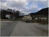
A) From central Slovenia, we first drive to Logatec, then continue driving in the direction of Idrija. At Kalcah near Logatec, we turn left in the direction of Col, then continue driving on a winding road towards Col. At Col, we turn right and then after 100 m left in the direction of Predmeja. Further, we drive on an occasionally somewhat narrower and also partly still winding road, which we follow to the settlement Otlica, where at the church of the Guardian Angels we turn left in the direction of Otliško okno. We park about 50 meters ahead on the parking lot by the cemetery.
B) We drive to Idrija, from there we continue driving towards Logatec. In the settlement Godovič, we leave the main road towards Logatec and continue driving right in the direction of Črni Vrh, Col and Ajdovščina. We follow the mentioned road to Col, where signs for Predmeja direct us to the right. Further, we drive on an occasionally somewhat narrower and also partly still winding road, which we follow to the settlement Otlica, where at the church of the Guardian Angels we turn left in the direction of Otliško okno. We park about 50 meters ahead on the parking lot by the cemetery.
C) From the expressway Razdrto - Nova Gorica, we take the exit Ajdovščina and follow the road ahead towards the village Lokavec (to Lokavec we come from the center of Ajdovščina, or from the old road Ajdovščina - Nova Gorica, where at the settlement Cesta we turn right). From Lokavec, we continue driving on an ascending winding road in the direction of Predmeja. When the road flattens a little, we come to the crossroads, where we continue right towards Predmeja and Col. On the road towards Col we drive to Otlica, where at the church of the Guardian Angels we turn right towards the nearby cemetery. We park on the parking lot by the cemetery.
Route description:
From the parking lot, we continue on the right side of the cemetery on a narrower asphalt road in the direction of Otliško okno. We walk on the road only for a short time as signs for Otliško okno direct us left onto a grassy cart track, which a little further crosses a strip of bushes, then along the pasture fence we quickly arrive near the nearby house. Here we continue right on a wider cart track, along which in a few steps we arrive at a marked junction.
From the junction, we continue left (right Predmeja and Čaven) and continue the path a few tens of meters left of the edge of the Gora plateau. After a short gentle descent, we reach the edge of the plateau, where from the right the path from the Hubelj spring joins.
Here we continue slightly left and ascend to the place where a short path branches off to the left to the stone snail (the snail is the idea and work of architect Damjan Popelar, who in his artistic work tries to connect nature and culture).
We continue straight (left stone snail 2 minutes) and after a few tens of steps of further walking we arrive at the information boards above Otliško okno.
From the boards, we continue right and descend to the nearby window, through which a nice view opens up.
From the window, we continue on the path in the direction of Sinji vrh. The path ahead quickly emerges from the forest and brings us to panoramic slopes, along which we ascend by the edge of the cliffs in the southeast direction. After approximately 10 minutes of walking from the window, the path splits into two parts. At the spot where the pasture fence makes a sharp left turn, we leave the wide path and head right onto a worse but marked path, which after five minutes of ascent brings us to Navrše.
From the top, the path descends to a small saddle, where we rejoin the path that bypasses Navrše. The path ahead crosses a strip of forest and a little further brings us to a pleasant viewpoint, where the path over Stara baba joins. Here at the electricity poles, the marks for Sinji vrh direct us left onto a cart track, which first gently ascends then gradually descends. When the path ascends again, we step onto the road, where we continue left uphill (right the road ends at the last house in the village). After a few minutes' walk on the road, we come to a crossroads, where we continue right and then after a few meters right again. The road, which further ascends somewhat more steeply, brings us higher to another crossroads, where we again continue right. There follows another 700 m of walking on the road to the Sinji vrh guesthouse. Here the road ends and we continue on an unmarked path towards Sinji vrh, which we reach after three minutes. Orientation in the last part is not difficult.

Photos:
 1
1 2
2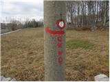 3
3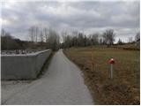 4
4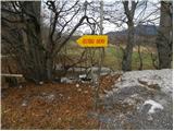 5
5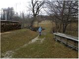 6
6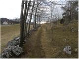 7
7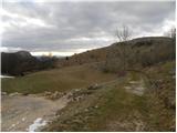 8
8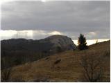 9
9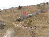 10
10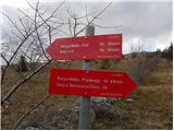 11
11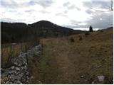 12
12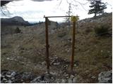 13
13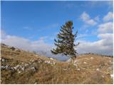 14
14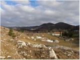 15
15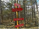 16
16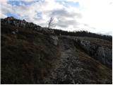 17
17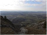 18
18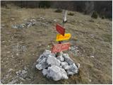 19
19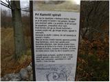 20
20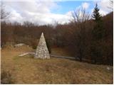 21
21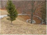 22
22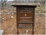 23
23 24
24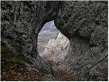 25
25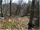 26
26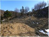 27
27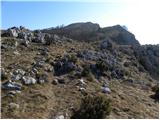 28
28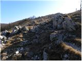 29
29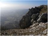 30
30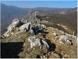 31
31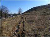 32
32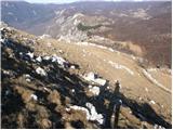 33
33 34
34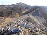 35
35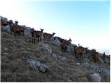 36
36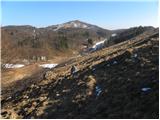 37
37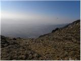 38
38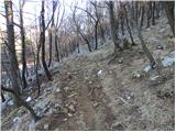 39
39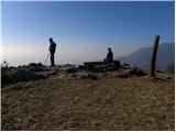 40
40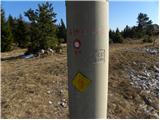 41
41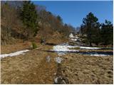 42
42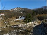 43
43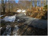 44
44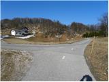 45
45 46
46 47
47 48
48 49
49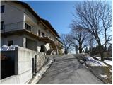 50
50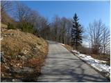 51
51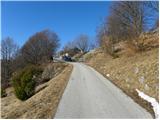 52
52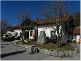 53
53 54
54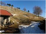 55
55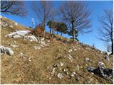 56
56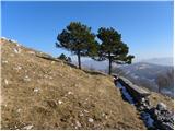 57
57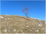 58
58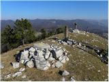 59
59 60
60
Discussion about the trip Otlica - Sinji vrh
|
| mako4419. 01. 2013 |
Nice tour, gorgeous photos... good luck further on the paths and in general!
|
|
|
|
| Parkeljc27. 04. 2013 |
I walked the trail on 25.4.2013 and I have to say that the stated time is seriously overestimated  . Again I relied on reaching the top half earlier than stated, but unfortunately I miscalculated. I can't even state the exact time because I don't know exactly when I started, but to the top I took around 1 hour and 30 minutes. Since the trail seemed longer than stated, on the way back I timed it and walked 1 hour and 15 minutes. The fact is, I don't walk slowly, nor do I run, except downhill, but only when I got back to Otlica did I look where Sinji vrh is and if I had known from the start where I was heading and for how long, it's questionable if I would have gone at all. That day I already had one tour behind me and I must emphasize that Sinji vrh from Otlica is veeeeeery far. . Again I relied on reaching the top half earlier than stated, but unfortunately I miscalculated. I can't even state the exact time because I don't know exactly when I started, but to the top I took around 1 hour and 30 minutes. Since the trail seemed longer than stated, on the way back I timed it and walked 1 hour and 15 minutes. The fact is, I don't walk slowly, nor do I run, except downhill, but only when I got back to Otlica did I look where Sinji vrh is and if I had known from the start where I was heading and for how long, it's questionable if I would have gone at all. That day I already had one tour behind me and I must emphasize that Sinji vrh from Otlica is veeeeeery far.
I know that walking time is very relative, but this one is quite exaggerated  . .
Otherwise a very interesting trail, especially the one "Po robu" from Predmeja and then towards "Angelski poti", which is full of attractions and beautiful views of Vipava valley and further to the sea. But that can be a full-day tour.
The homestead at Sinji vrh and surroundings very nicely arranged, clean, friendly caretaker.. The landscape is really beautiful, as an interesting fact I mention that here and there a new building appears that would fit better in the surroundings of Ljubljana, not here ... Money is the world ruler  .. That's just my opinion .. That's just my opinion 
|
|
|
|
| Parkeljc29. 04. 2013 |
Well, I'm glad you've reset the "timing"
|
|
|
|
| mvidmar3@amis.net2. 03. 2015 |
Milan, as a child I ran around here, I had to go with my stomach for bread, first studies then job, long years from the home area I returned but too little, in me it always yearned to return back to the home place and now that moment has also come, really beautiful my home places, the most beautiful place in the world
|
|
|
|
| owlic28. 03. 2015 |
I just have one complaint to make. And that's when you arrive all happy at Sinji vrh, to stamp your hiking logbook and find out that it's unrecognizable (destroyed) and you can't read what's on that stamp...
|
|
|
|
| rades23. 04. 2016 |
It's true that the stamp before the hut (pension) is poorer, but it's readable. You can also get a classic SPP stamp (not fixed) at the pension.
|
|
|
|
| marinka6715. 08. 2016 |
The stamp in front of the hut is still poor and barely visible, and you really don't go inside searching because you assume the one outside is the only one. We also took 1:40 hours, beautiful path, only the last 20 min trudging on asphalt is tedious. However, at the top we were rewarded with wonderful views.
|
|
|
|
| modrook121. 10. 2016 |
Today we walked this path. The path is excellently marked, suitable for small children. Shame that the stamp is so poor, unrecognizable. Nice hiking greeting from Posavje.
|
|
|
|
| domek23. 07. 2019 |
A couple of days ago we also hiked this path. It took us more time to reach the goal than stated in the description. Wonderful places with beautiful views. There is a new stamp in front of the pension.
|
|
|
|
| Tajka6710. 06. 2023 18:50:16 |
Today also to Sinji vrh via this path. Three locals I met at Golaki directed me. The view through Otliško okno is really wonderful. The path itself is marked, but in the last part there's quite a lot of walking on asphalt. Almost no hikers, probably due to the weather that kept threatening with a thunderstorm all the time.
|
|
|
To post a comment you must log in:
If you do not yet have a username, you must first
register.