Orešnik - Koča pod Kremžarjevim vrhom
Starting point: Orešnik (660 m)
Walking time: 1 h 25 min
Difficulty: easy marked way
Elevation gain: 442 m
Elevation difference along the route: 442 m
Map: Pohorje 1:50.000
Recommended equipment (summer):
Recommended equipment (winter): ice axe, crampons
Views: 19.091
 | 2 people like this post |
Access to starting point:
From Velenje or Dravograd we drive to Slovenj Gradec, here at the roundabout, which is located on the main road Dravograd - Velenje, we take the exit Kope and Legan. The road then soon brings us to the next crossroad, where we continue straight in the direction of Gradišče. The road then brings us to a crossroad, where "farms" are marked. Here we continue right and follow the road to the next crossroad, where we continue right again upwards. Further, we drive only for a short time to the next crossroad, where we continue sharply right upwards. After a few tens of meters of driving the road reaches the "farm" Hriberšek behind which the road turns sharply left. Further, we drive only a short time, and then behind the torrent, which we have just crossed, the described path begins. At the starting point there are no arranged parking spots, but they have arranged a parking lot a little away at the picnic area Vinišnik.
Route description:
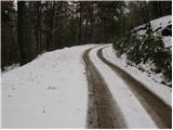
From the starting point we continue on the road, after a few minutes of walking the road crosses the marked path. Here we leave the road and go left upwards on a cart track which first ascends steeply and then moderately through the forest. We follow this path for a good half hour to the place where it brings us to the road. Here is an intersection of four roads and our footpath, which merely crosses the intersection. The path then still runs through the forest and ascends on a cart track surrounded by spruce forest. A little higher we come to the "farm" Lampret, behind it we again cross the road. The path ahead runs almost horizontally to the place where the signs for Kremžarjev direct us right steeply upwards. The steepness quickly eases and the path brings us to an indistinct ridge, where there is a junction and next to it an interesting half-open, half-glass chapel. Here we continue left in the direction of the hut which we reach after three minutes of easy walking (right peak 7min).

Photos:
 1
1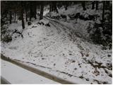 2
2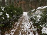 3
3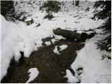 4
4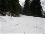 5
5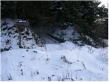 6
6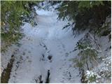 7
7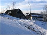 8
8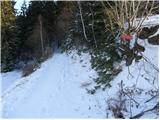 9
9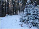 10
10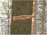 11
11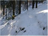 12
12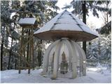 13
13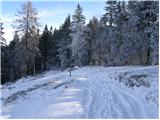 14
14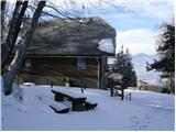 15
15
Discussion about the trip Orešnik - Koča pod Kremžarjevim vrhom
|
| Gost30. 12. 2007 |
No information about the hut's opening hours!
|
|
|
|
| Gost30. 12. 2007 |
In winter, it is open on Saturdays, Sundays, and holidays.
|
|
|
|
| Sini18. 10. 2015 |
Nice hike! All praise to the hut keeper - very friendly gentleman and very friendly prices!
|
|
|
To post a comment you must log in:
If you do not yet have a username, you must first
register.