Ocinje - Sveta Ana pri Igu / Sankt Anna am Aigen
Starting point: Ocinje (292 m)
| Latitude/Longitude: | 46,82254°N 16,00183°E |
| |
Walking time: 40 min
Difficulty: easy unmarked way
Elevation gain: 111 m
Elevation difference along the route: 150 m
Map: Pomurje 1:40.000
Recommended equipment (summer):
Recommended equipment (winter):
Views: 14
 | 0 people like this post |
Access to starting point:
We drive to Gederovce (up to here from Murska Sobota or Radenci), then we continue driving towards Kuzmi. After Rogašovci we arrive in Nuskovo, a little further on we arrive in Serdico, where signs for Ocinje direct us left. In the continuation we climb to a smaller pass, from which we descend into Ocinje. This is followed by a more pronounced left turn, then we go right, where we park at the parking lot under the cemetery.
Route description:
From the parking lot we continue along the macadam road, which continues towards the northwest. Initially we ascend along the pine forest, then after the apiary we arrive among the fields, from where a beautiful view of Goričko opens up to us. Higher up the road levels out, at the junction we choose the road that leads straight (right Apenini breg).
The path ahead gradually begins to descend and takes us into the forest, where we continue to descend along a somewhat worse forest road. In a few minutes of descent we arrive at the memorial at Črni kamen, which we notice on the right side of the path.
We bypass Črni kamen on the left side and cross the border stream Kučnica, crossing to the Austrian side. When the road turns slightly left, we go slightly right on the cart track, which in the continuation moderately ascends through the forest. A few minutes higher we arrive at the water reservoir on the stream Türkengraben, which we bypass on the right side, then next to the football field in the place Sveta Ana pri Igu / St. Anna am Aigen we reach the asphalt road, which we follow to the right. After the field we go left and ascend past the cemetery to the main road, where we go right, from it then quickly left on the asphalt footpath, which ascends to the church of St. Anne, from the church we continue another minute or so forward to the viewpoint, from which a beautiful view opens up to us.
Ocinje - Črni Kame 0:20, Črni kamen - Sv. Ana pri Igu 0:20.
The description refers to the state in February 2026, the pictures are from different periods.

Photos:
 1
1 2
2 3
3 4
4 5
5 6
6 7
7 8
8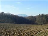 9
9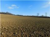 10
10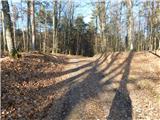 11
11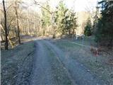 12
12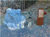 13
13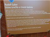 14
14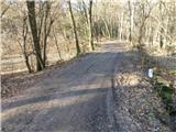 15
15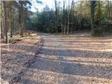 16
16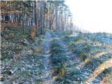 17
17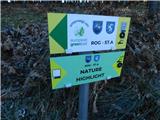 18
18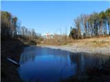 19
19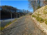 20
20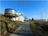 21
21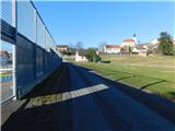 22
22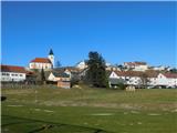 23
23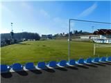 24
24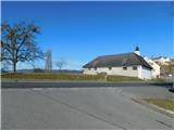 25
25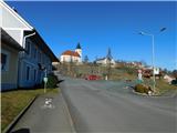 26
26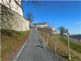 27
27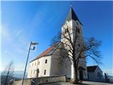 28
28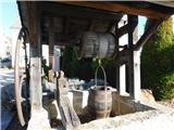 29
29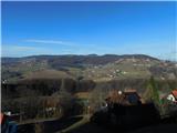 30
30 31
31
Discussion about the trip Ocinje - Sveta Ana pri Igu / Sankt Anna am Aigen
To post a comment you must log in:
If you do not yet have a username, you must first
register.