Ocinje - Apneni breg (via Slatinski vrelec Ocinje)
Starting point: Ocinje (292 m)
| Latitude/Longitude: | 46,82254°N 16,00183°E |
| |
Route name: via Slatinski vrelec Ocinje
Walking time: 30 min
Difficulty: easy unmarked way
Elevation gain: 60 m
Elevation difference along the route: 75 m
Map: Pomurje 1:40.000
Recommended equipment (summer):
Recommended equipment (winter):
Views: 53
 | 1 person like this post |
Access to starting point:
We drive to Gederovce (to here from Murska Sobota or Radenci), then continue driving towards Kuzma. After Rogašovci we arrive in Nuskovo, a little further in Serdica, where the signs for Ocinje direct us left. We then ascend to a small pass, from which we descend to Ocinje. A more pronounced left bend follows, then we go right, where we park at the parking lot under the cemetery.
Route description:
From the parking lot we return a little back, or to the intersection near Vaški dom Ocinje, from where we head onto the side road that continues northwest and initially leads us past the nearby farm. After the farm the asphalt ends, the road continues a bit further into the forest, where we soon reach a bench and table that we notice on the right side, and to the left of the road is the somewhat less noticeable Slatinski vrelec Ocinje.
We bypass the spring on the right side and continue for a few more minutes on the gravel road, then from a smaller intersection we take the left road, which gradually turns into a cart track, which takes us out of the forest and up to a hunting observation post, before the next observation post we go left. A bit of easy walking follows, then between the forest on the left and the field on the right we ascend to the forested ridge, where we temporarily return to the forest. Here the path turns left, and when we leave the forest we ascend along the fields to the highest point of Apneni breg.
We can descend via the shorter path that continues along the road to the cemetery, where we started the trail.
Ocinje - Slatinski vrelec Ocinje 0:15, Slatinski vrelec Ocinje - Apneni breg 0:15.
Description and photos refer to the condition in February 2026.

Photos:
 1
1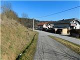 2
2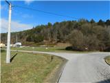 3
3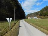 4
4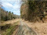 5
5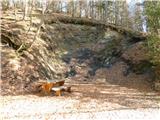 6
6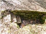 7
7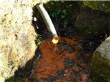 8
8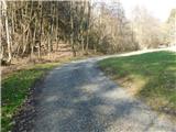 9
9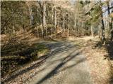 10
10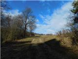 11
11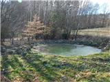 12
12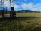 13
13 14
14 15
15 16
16 17
17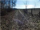 18
18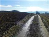 19
19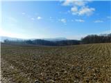 20
20
Discussion about the trip Ocinje - Apneni breg (via Slatinski vrelec Ocinje)
To post a comment you must log in:
If you do not yet have a username, you must first
register.