Nomenj - Grmečica waterfall
Starting point: Nomenj (490 m)
| Latitude/Longitude: | 46,2893°N 14,003°E |
| |
Walking time: 20 min
Difficulty: easy marked way
Elevation gain: 20 m
Elevation difference along the route: 20 m
Map: TNP 1:50.000
Recommended equipment (summer):
Recommended equipment (winter):
Views: 23.067
 | 2 people like this post |
Access to starting point:
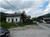
A) We drive to Bled, from there we continue driving towards Bohinj. Still before Bohinjska Bistrica, at the settlement Nomenj, where by the main road there are a bus station, a railway station and the inn Gostilna pri Matičku, the described path begins. At the starting point there are no appropriate places for parking.
B) We drive to Bohinjska Bistrica, and then we continue driving towards Bled. Still before Bled, at the settlement Nomenj, where by the main road there are a bus station, a railway station and the inn Gostilna pri Matičku, the described path begins. At the starting point there are no appropriate places for parking.
Route description:
From the inn Gostilna pri Matičku we continue in the direction of the waterfall Grmečica, where the path at first leads parallel with the main road, and we walk on a worse macadam road. We soon go right through the underpass under the railway track, and then we go once again right in the direction of waterfall Grmečica and Emin's blast furnace plavž. We continue on a macadam road which over pastures brings us to the former parking lot, today parking is allowed only with a permit for fishermen and users of the gorge (canyoning).
From the parking lot we still continue on a macadam road, which quickly brings us to the footbridge over the river Sava Bohinjka. Here a path used to branch off to the left towards the paintball polygon (the paintball polygon no longer exists), and we continue over the footbridge and then on the other side right in the direction of Grmečica. Further on we walk for some time on another forest road, which soon ends, and the path turns into a pleasant forest trail. For some time we still walk along the Sava Bohinjka, and then we arrive at the confluence of the Grmečica and the already mentioned river. We continue through the forest, and the still gentle path quickly brings us to the waterfall Grmečica.
The description refers to the condition in 2018 (May), and the pictures are from various periods.

Photos:
 1
1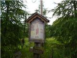 2
2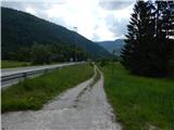 3
3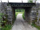 4
4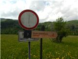 5
5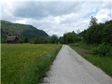 6
6 7
7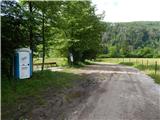 8
8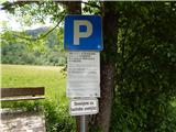 9
9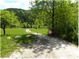 10
10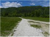 11
11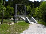 12
12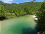 13
13 14
14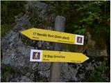 15
15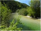 16
16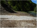 17
17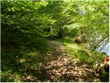 18
18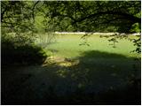 19
19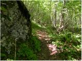 20
20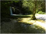 21
21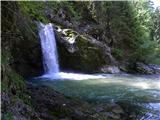 22
22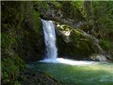 23
23
Discussion about the trip Nomenj - Grmečica waterfall
|
| Majdag3. 08. 2023 11:05:36 |
1.8....Nomenj, Grmečica waterfall, Boh. Bistrica... The trail to the pools at the waterfall was slippery. Some metal railing was helpful.
Towards Bohinj we continued on the bike path. It's not open yet, but we didn't hinder anyone. Nice path, with arranged banks of the Sava Bohinjka river.
Couldn't avoid the rain. Bohinj is lively. We also checked out Ceconi Park. Nice ramble.
https://jelenkamenmajdag.blogspot.com/2023/08/z-vlakom-na-potep-slap-grmecica-in.html
|
|
|
To post a comment you must log in:
If you do not yet have a username, you must first
register.