NC Planica - Visoka Ponca
Starting point: NC Planica (931 m)
| Latitude/Longitude: | 46,476°N 13,7241°E |
| |
Walking time: 4 h 45 min
Difficulty: very difficult marked way
Elevation gain: 1343 m
Elevation difference along the route: 1430 m
Map: TNP 1:50.000
Recommended equipment (summer): helmet, self belay set
Recommended equipment (winter): helmet, self belay set, ice axe, crampons
Views: 53.505
 | 4 people like this post |
Access to starting point:
a) First we drive to Kranjska Gora, then continue our drive towards Rateče. When we reach the roundabout near Rateče, we take the exit in the direction of Planica. This is followed by some more ascent and we arrive at the large parking lot next to the Nordic Centre Planica, where we park in the paid parking lot. The price for passenger cars is 2.5 euros/day (March 2019).
b) Via the Rateče border crossing we drive into Slovenia, then shortly afterwards turn right towards Planica. This is followed by some more ascent and we arrive at the large parking lot next to the Nordic Centre Planica, where we park in the paid parking lot. The price for passenger cars is 2.5 euros/day (March 2019).
Route description:
From Planica we continue along the macadam road towards the Dom v Tamarju, before the road enters the forest it splits into two parts. We continue on the slightly right road in the direction of the footpath to Tamar (slightly left is the drivable road, which is closed to public traffic).
The path ahead leads us along the road which passes the last parking lot of NC Planica, enters the forest and which is converted into a cross-country ski trail in winter. This is followed by an ascent along a gentle road which mostly runs through the forest. When the path leaves the forest, there are viewpoints along the path with inscriptions of what can be seen. Higher up the forest thins out several times or we leave it for a while, so that beautiful views of the mountains rising above Planica and Tamar open up. When we are already quite close to the Dom v Tamarju a wonderful view of Jalovec opens up and the path splits.
We continue slightly left (slightly right to the source of Nadiža) and a few minutes later we join the drivable road, along it past the chapel we arrive at the Planinski dom v Tamarju.
We continue along the marked mountain path in the direction of Jalovec and Ponc (left Slemenova špica). The path ahead leads us through the forest which quickly brings us to the next junction where the path to Ponce branches off to the right. We continue in the mentioned direction (straight Jalovec and Kotovo sedlo) or following the signs for Srednja Ponca, Visoka Ponca.
The path ahead brings us out of the forest and starts ascending to the right of a smaller stream. Higher up the path turns right again and starts ascending through dwarf pine on a fairly steep slope. The path then turns somewhat to the left and brings us past a small cave back into the forest through which we ascend for quite some time. After several steep ascents through the forest the path brings us out of the forest and to the first steel cables on the path. Here the path turns right and ascends steeply. The steepness soon eases and a traverse of the slopes towards the north follows. Towards the end the slopes become quite steep and we are assisted by some steel cables. The path then turns left and starts ascending somewhat more steeply again all the way to the main ridge of Ponc. On the ridge we then turn right (left Zadnja Ponca) and only a few meters of ascent remain to the summit of Srednja Ponca.
From the summit of Srednja Ponca we then descend to the Italian side of the ridge (following the signs for V. Ponca). After a short descent the path brings us to a junction where we turn right, left leads the path towards the Zacchi hut. The path then crosses the slope towards the northeast and brings us to Planiška škrbina (2156 m), where a view to the Slovenian side into the Tamar valley opens up again. At the saddle the path turns left and ascends steeply along a steel cable on a narrow ridge. The path then moves away from the ridge to the southern side and first in a gentle ascent crosses the steep slope towards the northeast, then turns slightly left and ascends steeply on a rocky slope towards the summit. In the last part towards the summit the path is also slightly crumbly.
Planica - Dom v Tamarju 0:45, Dom v Tamarju - Srednja Ponca 3:15, Srednja Ponca - Planiška škrbina 0:15, Planiška škrbina - Visoka Ponca 0:30.

Photos:
 1
1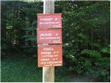 2
2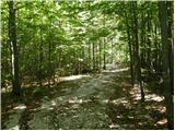 3
3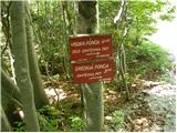 4
4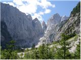 5
5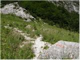 6
6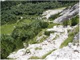 7
7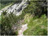 8
8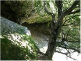 9
9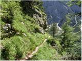 10
10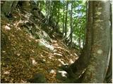 11
11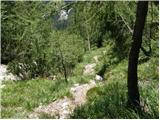 12
12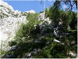 13
13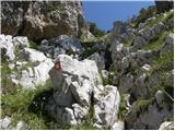 14
14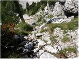 15
15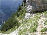 16
16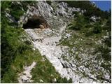 17
17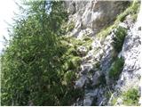 18
18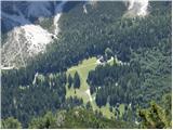 19
19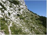 20
20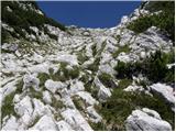 21
21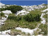 22
22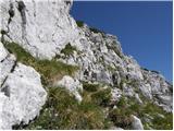 23
23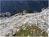 24
24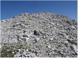 25
25 26
26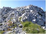 27
27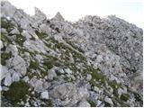 28
28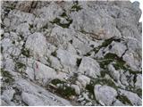 29
29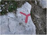 30
30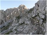 31
31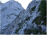 32
32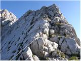 33
33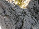 34
34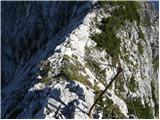 35
35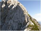 36
36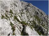 37
37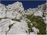 38
38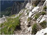 39
39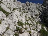 40
40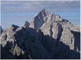 41
41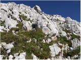 42
42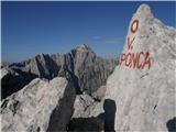 43
43
Discussion about the trip NC Planica - Visoka Ponca
|
| Gost10. 07. 2006 |
Interesting tour, you can spice it up with a descent to the northern side, to koče Zacci and Belopeških jezer. Of course, it must be high summer so that the snow has already melted. Self-belaying recommended.
|
|
|
|
| S.Marko21. 07. 2009 |
I'm wondering if anyone knows what condition the fixed protections are in on the Srednja Visoka Ponca path? LP
|
|
|
|
| matic427. 08. 2009 |
The fixed protections are in good condition, but there aren't many - about 4 steel cables. The path is quite exposed, so it's not for those afraid of heights. The self-belay kit can thus be used for only about 40m.
|
|
|
|
| Virenque1. 08. 2010 |
Is a self-belay kit needed for the trail from Srednja to Visoka Ponca?
|
|
|
|
| StaneK22. 09. 2010 |
I had it with me, but didn't use it anywhere. Where there are fixed cables, you can go easily without it, where there are none, you can't use it anyway. Otherwise no problems, but of course great caution is needed, the path is really quite exposed. Especially to Srednja Ponca, and also very demanding in terms of fitness.
|
|
|
|
| Okmodko7. 07. 2011 |
Can you compare this path with the one from the shelter below Špik to Jalovec, which one is more dangerous?
|
|
|
|
| turbo8. 07. 2011 |
Neither is more dangerous. Both are just demanding. How much, depends on experience.
|
|
|
|
| Okmodko8. 07. 2011 |
I've got plenty of experience, usually I'm not afraid. I've been to most famous mountains in Slovenia, but very demanding paths differ a lot. On Špik it was supposed to be but I didn't notice it, on Bavški Grintavec it almost squeezed me. Both are marked as very difficult. So you could differentiate Ponca and Jalovec a bit if you had the will.
|
|
|
|
| JusAvgustin9. 07. 2011 |
then why are you asking at all?!
|
|
|
|
| Okmodko10. 07. 2011 |
Eh, what do I know. I'm not up to every trail. Usually I inquire beforehand and don't rush into death. You just do what you like.
|
|
|
|
| turbo10. 07. 2011 |
Okmodko, like it or not, you're rushing towards death. We all are. From birth onwards, we have one less day ahead of us every day  Otherwise, I don't go to the mountains to die, but to live. With a capital L Otherwise, I don't go to the mountains to die, but to live. With a capital L 
|
|
|
|
| JusAvgustin10. 07. 2011 |
Look, on VP it's incomparably easier than from below Špička. Satisfied, otherwise everyone has their own criteria... Something is difficult for one, easy for another, or of moderate difficulty. I think you'll manage both, if not, just turn back. You can send me ZS and we'll continue there...
Best, oh and I don't rush to death and I don't like it when someone writes something like that to me, otherwise it's all relative
Juš
|
|
|
|
| Okmodko10. 07. 2011 |
I was just interested in the comparison. Regarding death, it seems no one has signed up. It's good to inquire beforehand where you're going, otherwise you risk a lot. If you disagree, then go with the Czechs to Triglav in winter, in flip-flops of course. In the backpack, let there be mandatory equipment (stove for cooking soups), the rest leave in the car so your spine doesn't suffer 
|
|
|
|
| jersy10. 07. 2011 |
I agree Juš, it's not worth dealing much with such types...
|
|
|
|
| Okmodko10. 07. 2011 |
Anyway, I was just joking. That's why the smiley at the end. You all enjoy.
|
|
|
|
| metod27. 09. 2014 |
And since 2011 no one up there?! Today everything was fine on Srednja, Visoka and Zadnja Ponca. Protections ok, except to Zadnja Ponca, weather and company also ok. LP; M
|
|
|
|
| andrej788. 08. 2016 |
Has anyone been here recently on this path? Or do I have to go check the conditions myself?
|
|
|
|
| Moncula25. 07. 2018 |
Conditions mostly ok, some pegs on cables pulled out, but passable normally. Some markings poorly visible.
|
|
|
|
| RadoPres19. 09. 2018 |
Yesterday I was at Visoka Ponca. Excellent conditions. The path is very, very demanding. Very steep ascent without respite. Every step, even on the return, needs to be taken thoughtfully, all the way back to Tamar. Markings to Srednja Ponca are very poorly visible, further on freshly marked. The tour is really suitable only for properly and otherwise equipped real hikers. In non-ideal weather conditions, I really advise against the ascent. The fixed cables are not a problem, but it would be nice to have them at three spots. The views are fantastic. The reward and satisfaction upon return are complete.
|
|
|
|
| ssimon6. 08. 2020 |
Hello,
I'm interested in what the conditions are like?
Best regards and thanks
Simon
|
|
|
|
| garmont9. 08. 2020 |
The markings are not renewed, the scree along the path has not seen a saw for a long time either. The fixed protections are all in good condition.
I would point out that driving to Tamar has been prohibited for several years, so practically you start the tour in Planica at 930 m a.s.l., therefore the total elevation gain to the top of VP, considering also the descent from SP towards VP, is more than 1500 m.
|
|
|
|
| J.P.24. 06. 2025 19:30:53 |
The current condition is almost the same as Garmont described it in 2020 Only two pegs have been pulled out from the safety gear in the lower, forest part of the trail (which doesn't bother, since there is enough rock and holds). I have to admit that the first part of the trail from the hut is quite strenuous – scree, gravel, leaves, roots, non-stop... But once we reach the rocky world, the trail is excellent! At the top we also met a hiker who arrived via ferrata and shared that the ferrata is in super condition, renovated....
Why choose this starting point? Because there is no living soul anywhere and you go to Velika Ponca via Srednja.
|
|
|
To post a comment you must log in:
If you do not yet have a username, you must first
register.