NC Planica - Jalovec (on scree and over Kotovo sedlo)
Starting point: NC Planica (931 m)
| Latitude/Longitude: | 46,476°N 13,7241°E |
| |
Route name: on scree and over Kotovo sedlo
Walking time: 6 h 10 min
Difficulty: very difficult marked way
Elevation gain: 1714 m
Elevation difference along the route: 1740 m
Map: Kranjska Gora 1:30.000
Recommended equipment (summer): helmet, self belay set
Recommended equipment (winter): helmet, self belay set, ice axe, crampons
Views: 20.285
 | 1 person like this post |
Access to starting point:
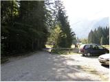
a) First we drive to Kranjska Gora, then continue driving towards Rateče. When we arrive at the roundabout near Rateče, we take the exit in the direction of Planica. There follows some more ascent and we arrive at the large parking lot next to NC Planica, where we park in the paid parking lot. The price for passenger cars is 2.5 eur / day (March 2019).
b) Through the Rateče border crossing we drive into Slovenia, then we soon turn right towards Planica. There follows some more ascent and we arrive at the large parking lot next to NC Planica, where we park in the paid parking lot. The price for passenger cars is 2.5 eur / day (March 2019).
Route description:
From Planica we continue along the macadam road towards Dom v Tamarju, before the road enters the forest it branches into two parts. We continue along the slightly right road in the direction of the footpath towards Tamar (slightly left the drivable road, which is however closed to public traffic).
The path ahead leads us along the road, which passes the last parking lot of NC Planica, enters the forest and which is converted into a cross-country ski track in winter time. This is followed by an ascent along a gentle road, which mostly runs through the forest, when the path leaves the forest, there are viewpoint boards along the path with inscriptions of what can be seen. Higher up the forest thins out several times or we leave it for a while, so that beautiful views open up to the mountains that rise above Planica and Tamar. When we get quite close to Dom v Tamarju, a wonderful view of Jalovec opens up, the path branches.
We continue slightly left (slightly right the source of Nadiža) and a few minutes later we join the drivable road, along it past a chapel we arrive at Planinski dom v Tamarju.
We continue along the marked mountain path in the direction of Jalovec and Ponce (left Slemenova špica). The path ahead leads us through the forest, which quickly brings us to the next junction, where the path to Ponce branches off to the right. We continue in the direction of Jalovec and continue the ascent along the path, which still ascends gently for a short time through the forest. When we come out of the forest we first ascend for some time along extensive, partly already overgrown gravel fields, then gradually we arrive at the scree, which continues towards Jalovčev ozebnik. Along the scree we ascend to the marked junction, where we continue left (right Kotovo sedlo and Jalovec via bivak pod Kotovim sedlom) in the direction of Jalovška škrbina. In the continuation the path still ascends along the scree, then brings us to the next junction, where we continue right in the direction of Kotovo sedlo (slightly left Jalovec via Jalovška škrbina).
The path ahead ascends transversely to the right and gradually passes to less steep slopes. Higher up the path flattens even more and brings us past several large boulders to a junction, where a somewhat more demanding path joins from the right. We continue left and after a few minutes of further ascent we ascend to Kotovo sedlo.
From the saddle, where the path from Loška Koritnica joins us, and from where the path continues towards Mangart, we head left in the direction of Jalovec. We continue along and on the ridge, then the path turns slightly to the right and brings us to the western slopes of Jalovec. Here we ascend along an increasingly rocky slope, and we follow the technically not yet too demanding path to an altitude of approximately 2400 meters. Here the path becomes steep, and the first protections help us (the first protections on the path from Kotovo sedlo onwards).
At the beginning of the climbing part the path crosses the exposed western slopes of the mountain, then turns left, where some easier climbing along the steel cable is needed in the continuation. This is followed by a short descent into a steep gully, which we cross, then on the other side with the help of steel cables it begins to ascend along the exposed slope. This is followed by some easier climbing along the fractured rock, then we arrive at the main ridge, where we join the path via Jalovška škrbina, Vršič, Trenta, Bavšica and the other path from Loška Koritnica.
Here we continue left and there is only a few minutes of ascent along an increasingly scenic ridge and the path brings us to the summit of Jalovec.
Planica - Dom v Tamarju 0:45, Dom v Tamarju - razpotje Mali kot 1:30, razpotje Mali kot - razcep pod Ozebnikom 0:55, razcep pod Ozebnikom - razpotje Veliki kot 0:35, razpotje Veliki kot - Kotovo sedlo 0:10, Kotovo sedlo - vstop v steno 0:50, vstop v steno - razpotje na grebenu Jalovca 1:20, razpotje na grebenu Jalovca - Jalovec 0:05.

Along the route: Dom v Tamarju (1108m), Odcep za Ponce (1119m), Helioport Pod Brkico (1357m), Razpotje Mali kot (1564m), Razcep pod Ozebnikom (1864m), Razpotje Veliki kot (2067m),
Kotovo sedlo (2134m), Vstop v steno (2380m), Škrbina v Prode (2460m), Razpotje na grebenu Jalovca (2613m)
Photos:
 1
1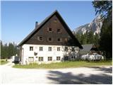 2
2 3
3 4
4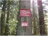 5
5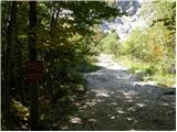 6
6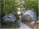 7
7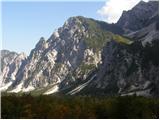 8
8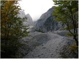 9
9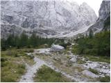 10
10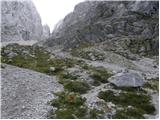 11
11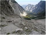 12
12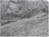 13
13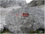 14
14 15
15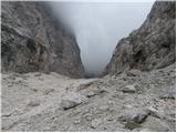 16
16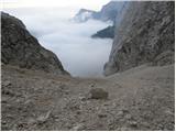 17
17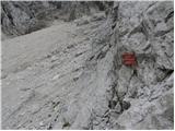 18
18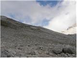 19
19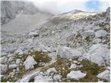 20
20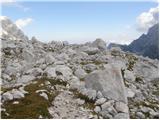 21
21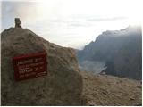 22
22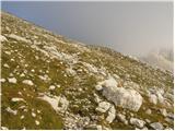 23
23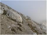 24
24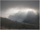 25
25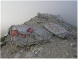 26
26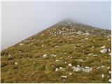 27
27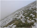 28
28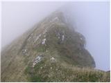 29
29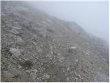 30
30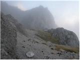 31
31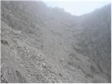 32
32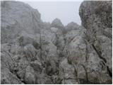 33
33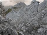 34
34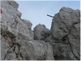 35
35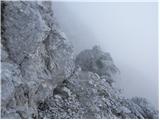 36
36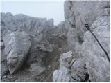 37
37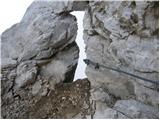 38
38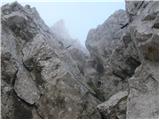 39
39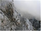 40
40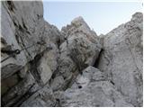 41
41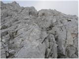 42
42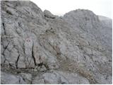 43
43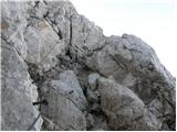 44
44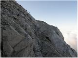 45
45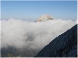 46
46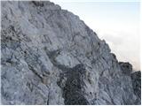 47
47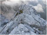 48
48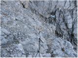 49
49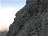 50
50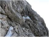 51
51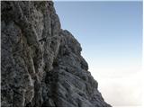 52
52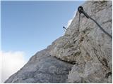 53
53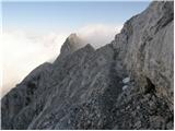 54
54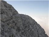 55
55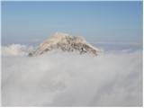 56
56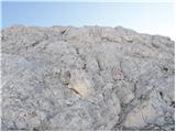 57
57 58
58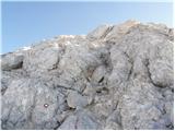 59
59 60
60 61
61
Discussion about the trip NC Planica - Jalovec (on scree and over Kotovo sedlo)
|
| garmont4. 10. 2023 09:14:48 |
Images from no. 15 to no. 29 do not match the description. The description speaks of the path over the scree, but the images show the path past the bivouac, which avoids the mentioned scree.
|
|
|
|
| phobos12. 10. 2023 06:34:31 |
I advise against the path over this scree. For the ascent we know what scree slopes are like anyway, for the descent this scree after the last rockfall from Jalovec is real torture. You're constantly looking for suitable footing which you don't find. Everywhere there are larger, sharp stones, or completely polished ground with little sand.
|
|
|
|
| garmont12. 10. 2023 18:04:21 |
And, as I already wrote…the pictures do not match the description.
|
|
|
|
| Tadej2. 03. 2026 08:12:32 |
Garmont, thanks for the warning. I have now added the correct pictures.
|
|
|
To post a comment you must log in:
If you do not yet have a username, you must first
register.