NC Planica - Jalovec (mimo bivaka in čez Kotovo sedlo)
Starting point: NC Planica (931 m)
| Latitude/Longitude: | 46,476°N 13,7241°E |
| |
Route name: mimo bivaka in čez Kotovo sedlo
Walking time: 6 h 10 min
Difficulty: very difficult marked way
Elevation gain: 1714 m
Elevation difference along the route: 1740 m
Map: TNP 1:50.000
Recommended equipment (summer): helmet, self belay set
Recommended equipment (winter): helmet, self belay set, ice axe, crampons
Views: 243.221
 | 12 people like this post |
Access to starting point:
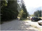
a) First we drive to Kranjska Gora, then continue our drive towards Rateče. When we reach the roundabout near Rateče, we take the exit in the direction of Planica. This is followed by some ascent and we arrive at the large parking lot next to the Nordic Centre Planica, where we park in the paid parking lot. The price for passenger cars is 2.5 euros / day (March 2019).
b) Through the Rateče border crossing we drive into Slovenia, then soon turn right towards Planica. This is followed by some ascent and we arrive at the large parking lot next to the Nordic Centre Planica, where we park in the paid parking lot. The price for passenger cars is 2.5 euros / day (March 2019).
Route description:
From Planica we continue along the macadam road towards Dom v Tamarju, before the road enters the forest it splits into two parts. We continue along the slightly right road in the direction of the footpath towards Tamar (slightly left is the drivable road, which is closed to public traffic).
The path ahead leads us along the road, which passes the last parking lot of NC Planica, enters the forest and is in winter converted into a cross-country ski track. An ascent follows along a gentle road, which mostly runs through the forest. When the path leaves the forest, there are viewing panels along the path with inscriptions of what can be seen. Higher up, the forest thins out several times or we leave it for a while, so beautiful views open up to the mountains rising above Planica and Tamar. When we get quite close to Dom v Tamarju, a wonderful view of Jalovec opens up and the path branches.
We continue slightly left (slightly right is the source of Nadiža) and a few minutes later join the drivable road, along which, past a chapel, we arrive at Planinski dom v Tamarju.
We continue along the marked mountain path in the direction of Jalovec and Ponc (left Slemenova špica). The path ahead leads us through the forest, which quickly brings us to the next junction, where the path to Ponce branches off to the right. We continue in the direction of Jalovec and continue the ascent along the path, which still ascends gently through the forest for a short time. When we come out of the forest we first ascend for some time across extensive, partly overgrown scree fields, then gradually arrive at the scree slope which continues towards Jalovčev ozebnik. Along the scree we ascend to the marked junction, where we continue right in the direction of Jalovec along the path past the bivouac and over Kotovo sedlo (straight ahead Jalovška škrbina and the path to Jalovec which leads over the scree to Kotovo sedlo).
From the junction the path crosses steep slopes over which we begin to ascend. In the continuation the path leads us over some slightly more difficult sections where fixed safety equipment helps us. Higher up the path turns left and gradually flattens. The path continues along a belt of dwarf pines, and on the right side, about 100 meters from the marked path we notice Bivak pod Kotovim sedlom, which is located under a larger boulder (in fog it will be difficult to notice where the bivouac is located).
If we want to reach the bivouac, at this point we leave the marked path and walk through easier terrain without a path to the bivouac.
We continue along a moderately steep slope on which we notice a larger number of boulders and larger rocks. Here the previously mentioned path from the scree joins us from the left, we continue straight and after a few minutes of further ascent we arrive at Kotovo sedlo.
From the saddle, where the path from Loška Koritnica joins us and from where the path continues towards Mangart, we turn left in the direction of Jalovec. We continue along and on the ridge, then the path turns slightly to the right and brings us to the western slopes of Jalovec. Here we ascend along an increasingly rocky slope and follow the technically not yet very demanding path to an altitude of about 2400 meters. Here the path becomes vertical and the first fixed safety equipment helps us (the first protections on the path from Kotovo sedlo onwards).
At the beginning of the climbing section the path crosses the exposed western slopes of the mountain, then turns left, where some easier climbing along the steel cable is required in the continuation. This is followed by a short descent into a steep gully which we cross, then on the other side with the help of steel cables it begins to ascend along the exposed slope. There follows some easier climbing over dissected rock, then we arrive at the main ridge, where we join the path via Jalovška škrbina, Vršič, Trenta, Bavšice and other paths from Loška Koritnica.
Here we continue left and there follows only a few minutes of ascent along an increasingly panoramic ridge and the path takes us to the summit of Jalovec.
Planica - Dom v Tamarju 0:45, Dom v Tamarju - razpotje Mali kot 1:30, razpotje Mali kot - Bivak pod Kotovim sedlom 1:15, Bivak pod Kotovim sedlom - razpotje Veliki kot 0:15, razpotje Veliki kot - Kotovo sedlo 0:10, Kotovo sedlo - vstop v steno 0:50, vstop v steno - razpotje na grebenu Jalovca 1:20, razpotje na grebenu Jalovca - Jalovec 0:05.

Along the route: Dom v Tamarju (1108m), Odcep za Ponce (1119m), Helioport Pod Brkico (1357m), Razpotje Mali kot (1564m), Rob planote (1889m),
Bivak pod Kotovim sedlom (1977m), Razpotje Veliki kot (2067m),
Kotovo sedlo (2134m), Vstop v steno (2380m), Škrbina v Prode (2460m), Razpotje na grebenu Jalovca (2613m)
Photos:
 1
1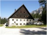 2
2 3
3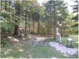 4
4 5
5 6
6 7
7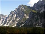 8
8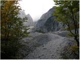 9
9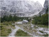 10
10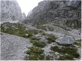 11
11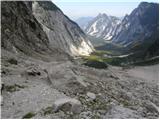 12
12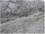 13
13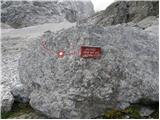 14
14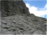 15
15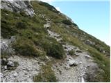 16
16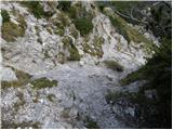 17
17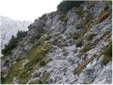 18
18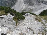 19
19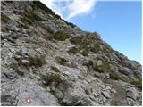 20
20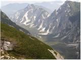 21
21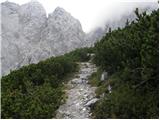 22
22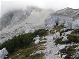 23
23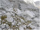 24
24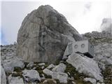 25
25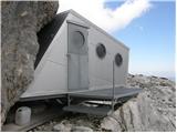 26
26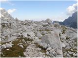 27
27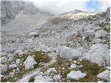 28
28 29
29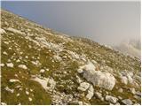 30
30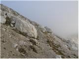 31
31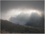 32
32 33
33 34
34 35
35 36
36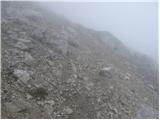 37
37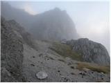 38
38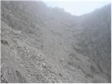 39
39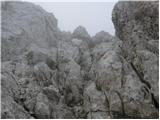 40
40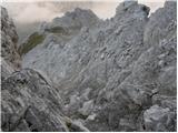 41
41 42
42 43
43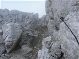 44
44 45
45 46
46 47
47 48
48 49
49 50
50 51
51 52
52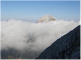 53
53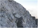 54
54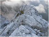 55
55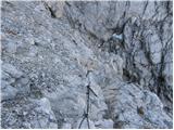 56
56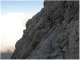 57
57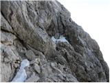 58
58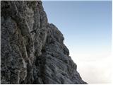 59
59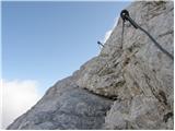 60
60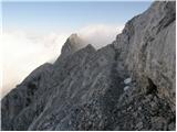 61
61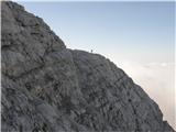 62
62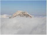 63
63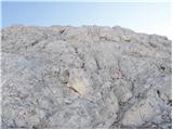 64
64 65
65 66
66 67
67 68
68
Discussion about the trip NC Planica - Jalovec (mimo bivaka in čez Kotovo sedlo)
Show older messages
|
| Gost31. 07. 2006 |
this trip is very good and interesting. although it is very long in time, the time just disappears when you get to the rocky part of the path.
|
|
|
|
| Gost7. 08. 2006 |
Beautiful tour! One advice to all: from Planica it is nicer (and in my opinion, also shorter) than along the road, right after the barrier turn right onto the footpath (marked), which leads to Tamar. What about the descent from Jalovec? Along the same path? Regards
|
|
|
|
| Tadej7. 08. 2006 |
The descent to the shelter under Špiček is nice. We sleep there. The next day to Vršič and from Vršič to Sleme. From Sleme to Tamar. If we have more fitness, this is possible in one day.
|
|
|
|
| Gost1. 09. 2006 |
Outstanding tour, only flaw is faded markers that are poorly visible. Some extra pegs would also be welcome.
|
|
|
|
| Gost10. 04. 2007 |
Igi
the describer could write that upon arriving at Kotovo sedlo, a slightly more demanding path joins from the right side from one of the most beautiful Slovenian valleys, the Koritnica valley.
|
|
|
|
| Gost15. 04. 2007 |
 It was tough when we went to Jalovec. It was demanding (for friends not for me!!!) It was tough when we went to Jalovec. It was demanding (for friends not for me!!!) . But the best view from the top . But the best view from the top
|
|
|
|
| Gost27. 08. 2007 |
Today we tackled Jalovec and it was really phenomenal. Up via Kotovo sedlo, descent to Zavetišče pod Špico on Vršič and over the ridge back to Tamar.
Quite strenuous, but worth it
Best regards to all
|
|
|
|
| Gost7. 11. 2007 |
Interested approx where snow starts on the path and approx how much snow in the climbing section. Thanks for answer
Lp
|
|
|
|
| NEIC00820. 09. 2008 |
Is this the easiest path to Jalovec??
|
|
|
|
| Rok21. 09. 2008 |
I think it's somewhat easier from Zavetišče pod Špičkom.
|
|
|
|
| vojko zupanc3. 08. 2009 |
Yesterday we climbed Jalovec via Kotovo sedlo with friends and as decently trained hikers without real climbing experience, really enjoyed it. With moderate pace we took 4.5 hours to the summit.
We made a mistake on descent though, as we wanted to return via another route and chose the path over Jalovška škrbina and "quite irresponsibly" crossed Ozebnik, true in the very lower part. I don't recommend this to others and ask if on the descent path to Tamar (not elsewhere) besides crossing Ozebnik we had another option. Is there another variant?
|
|
|
|
| tanja7919. 08. 2009 |
Tomorrow we are heading to Jalovec. I'm interested if the road from Planica to Tamar is really closed to cars? How can one get from Planica to Tamar as quickly as possible in that case? Thanks and best regards, Tanja
|
|
|
|
| sh19. 08. 2009 |
When we were there it was open early in the morning, I think until 7 a.m. Best to check at the Planinska koča in Tamar.
|
|
|
|
| turbo19. 08. 2009 |
Driving to Tamar is prohibited for everyone except landowners, the hut keeper and GRS. There is no barrier, just a warning sign. If caught, the fine is 40€. When I was there (about 3 weeks ago, on a weekday), the parking lot in Tamar was empty at 2 p.m., but around the hut it was packed with visitors. So it seems people (we) follow the rules. 
|
|
|
|
| turbo19. 08. 2009 |
Tanja79, you get to Tamar from Planica as soon as possible in three ways:
-fastest by bike
-a bit slower, if you run
-within normal bounds, if you walk a bit faster
I also found it unnecessary to leave the car in Planica, but what can you do.......
|
|
|
|
| Bojan_A19. 08. 2009 |
Probably there is no barrier anymore, because last year a cyclist was killed when he crashed into it.
|
|
|
|
| turbo20. 08. 2009 |
There is definitely no barrier anymore. Just a no-entry sign.
|
|
|
|
| sebanakis20. 08. 2009 |
I would put a barrier there too, for those who find it hard to walk that beautiful path, I think they don't need to force themselves into the mountains either, but that's my opinion, so no mistake, and safe travels
|
|
|
|
| fpetel127. 08. 2009 |
The path in the initial part of the climbing section above Kotovo sedlo is quite crumbly and somewhat poorly secured. My personal opinion is that the path is more suitable for ascent; for descent to Tamar I would suggest Jalovška škrbina (the only hazard is high exposure, but better secured path). Of course, the easier descent is past the shelter.
|
|
|
|
| Virenque28. 08. 2009 |
We went yesterday with a colleague on this path to Jalovec. The path is nice, well maintained, but quite a lot of scree. In terms of difficulty, I'd compare the climbing part to Škrlatica.
There really is no barrier anymore, but there's a sign that transit is possible from 12 to 2 pm with a fee of 4.20 eur, but at three there was no one there, no fines either, the woman in the hut said the road is closed and use at your own risk...
|
|
|
|
| andrej7829. 08. 2009 |
We also went yesterday on this path to Jalovec, the path is exposed mainly in the upper part, where there is a lot of sand on the ledges, we descended through the notch, where we didn't meet any mountaineer. Here it's worth mentioning especially Goličica, which is very poorly protected, locally 2nd grade climbing without protection and the moraine from the glacier, which is very steep and crumbly.
lp
|
|
|
|
| Pohodnik1112. 09. 2009 |
Hi,
I'm wondering if it's possible to reach Jalovec without via ferrata set and helmet. Please give a serious answer.
Best regards
|
|
|
|
| Klin2. 09. 2009 |
Without a helmet? Think about it, you only have one head.
You probably don't need the full kit, but it depends on which route you take.
|
|
|
|
| andrej782. 09. 2009 |
I agree with Klin, helmet mandatory, via ferrata kit no, because there are very few pegs, but there are a lot of pitons.
Best regards
|
|
|
|
| fpetel126. 03. 2010 |
If I were leading the trip myself, I wouldn't lead a mountaineer without a helmet on any path to Jalovec. A safe step is needed everywhere. In dry weather it's fairly safe. In wet weather great caution is required.
|
|
|
|
| EUGEN12. 07. 2010 |
Hello.
What are the conditions like over Kotovo sedlo to Jalovec?
Thanks. Best regards.
|
|
|
|
| Lothar14. 07. 2010 |
You can reach the summit without major problems. On the path through Jalovško škrbina there was still some snow at least two days ago, which was very slippery in places because there was ice underneath. But it was melting quickly, so I think there's not much left now (if any).
|
|
|
|
| masu16. 07. 2010 |
I want to do it on sunday. Are there special problems about snow or other?
Hvala
|
|
|
|
| hambi16. 07. 2010 |
There was some snow and ice over there a few days ago. It was thawing quickly, but it could still be there. There are no other problems, if you are used to hiking in mountains (ferrata as well).
Take care!
|
|
|
|
| hribuc8516. 07. 2010 |
You probably mean snow, not show. No offence.
Good luck!
|
|
|
|
| aonuk116. 07. 2010 |
Stop throwing in that English, I think this is a Slovenian hiking site.
|
|
|
|
| jersy16. 07. 2010 |
It is a Slovenian site, but some basic knowledge of English hasn't hurt anyone's head yet :
|
|
|
|
| NEIC00816. 07. 2010 |
''Slovenian site''???? Hallloooooooo!!! This is one of many internet sites that anyone with a PC has access to.. In the 21st century mentioning that something on the net is slo or similar is like saying that the clouds over Slovenia are ''Slovenian''.. Well, bad comparison but still..
P.S.
Anouk1 is a typically Slovenian name..
|
|
|
|
| hribuc8517. 07. 2010 |
Anouk1, I didn't want to throw this English remark out there, I just warned so that no one looks for some show on Jalovec. Anyway, many foreigners go to the mountains so sometimes you have to say something in English if you have the chance. No hard feelings.
Good luck!
|
|
|
|
| kkXhc23. 08. 2010 |
Hi!
My girlfriend and I went along this route=phenomenal, on the way back we went via Jalovska škrbina. At the exit onto the scree it would be good if there was another piton.
I lost my mobile (Nokia) probably at the parking lot in Planica, if anyone found it please contact me nicely. The mobile isn't worth much, but numbers and pictures are on it.
Best regards!
|
|
|
|
| Ranger2913. 10. 2010 |
Hi!
My friend and I were there on Saturday 09.10.2010 via Kotovo sedlo, back via Jalovška škrbina, the path is dry, weather was bombastic....
Good luck!
|
|
|
|
| Clea14. 10. 2010 |
Ranger29, can you drive to Tamar or did you park in Planica?
Do you think the weather on Saturday will still be suitable for a trip to Jalovec or do we have to wait until next year (Sunday forecasting snow)?
|
|
|
|
| Ranger2914. 10. 2010 |
Clea,
you can drive to Tamar, but given the weather forecast I advise not to go.
Best regards
|
|
|
|
| Clea15. 10. 2010 |
Yes, I see the forecast is pretty bad.. We'll think a bit more
Thanks for the info and advice!
LP
|
|
|
|
| tiyana4. 07. 2011 |
I'm interested in the conditions for Jalovec from Tamar... how much snow is left? Lp
|
|
|
|
| velkavrh4. 07. 2011 |
Same question as tiyana, because in the next two weeks I'm planning this all-day tour, if the weather permits, of course. In the latest Planinski vestnik all approaches from all directions to Jalovec are wonderfully described. Since I went up from Trenta years ago, I'd like to start from Tamar. Can someone assure me if one is allowed to drive by car to the hut or not, because I read that the road is not closed and people are driving there. Thanks! Who is actually responsible for giving the correct answer?
|
|
|
|
| serajko4. 07. 2011 |
lp
I suggest you call Tamar, they'll tell you first-hand what's true and what's not!!
|
|
|
|
| ben4. 07. 2011 |
I was in Tamar yesterday: at the start of the road under the ski jump there's a sign prohibiting driving - for cars and motorcycles!!! And yes, the road is drivable, four cars parked in the parking lot in front of the hut had a notice from the wardens on them. So...
LP B
|
|
|
|
| GregorC4. 07. 2011 |
The road at Velkavrh to Tamar is closed to motorized traffic. Except for hut supply and emergencies. The barrier was removed because years ago there was a fatal accident when someone crashed into it with a bike.
But you can gamble on luck and hope no wardens are there that day...
|
|
|
|
| JusAvgustin4. 07. 2011 |
what does it cost you 30 minutes of walking on a beautiful path with views of our beautiful mountains?
|
|
|
|
| velkavrh4. 07. 2011 |
Thanks, I know everything now!
|
|
|
|
| yahtzee4. 07. 2011 |
When returning from Ponc, I walked the road for a whole hour; thanks to the Kranjska Gora folks for stealing Jalovec from me as my tour is extended by two hours. Don't make excuses about nature protection because Tamar is economically exploited (water catchment). It's said the hut tenant is a former policeman, so no wonder about the fines, as he has "snooping" and "fining" in his genes. KG is so greedy it wants only € without tourists.
|
|
|
|
| VanSims4. 07. 2011 |
No, no, KG folks aren't quite as grumpy as the Bohinj ones.
Otherwise, bring a bike along. Leave the car in KG or even in Rateče if possible (Planica is paid as far as I know), or even somewhere on the Italian side and you're quickly in Tamar.
|
|
|
|
| tiyana4. 07. 2011 |
..still don't know the conditions
|
|
|
|
| yahtzee5. 07. 2011 |
VanSims maybe Kranjska Gora folks are a bit less grumpy except for some rare exception, but if you're dragging Bohinjci into it, they haven't closed any road to normal visitors despite a whole line of exceptions for local bigshots. They didn't close just the road to Tamar, the problem is Jalovec. Good thing the Kranjska Gora idiots don't have Mangart Lakes.
|
|
|
|
| velkavrh5. 07. 2011 |
The debate is unnecessary, it would be nice if someone joined me. Can contact me privately. L.P.
|
|
|
|
| tiyana5. 07. 2011 |
thanks macesen
|
|
|
|
| Arafat7613. 07. 2011 |
Let me tell you what the conditions are like over Jalovčeva Škrbina. On Sunday I went from Tamar over Jalovčeva Škrbina to Jalovec and back to Tamar over Kotovo sedlo. A snowfield that needs to be crossed, about 10m long, at least an ice axe is mandatory, I don't recommend it to inexperienced at all, it's located below the ascent to the wall in the direction of Jalovčeva Škrbina. A problem can arise for some due to cornices, which can be up to 5m deep, if climbing is not a problem for you, you can avoid them that way. A short snowfield appears twice more, but it can be crossed without ice axe and crampons, so of the 250m snowfields I somehow spotted none.
|
|
|
|
| cat enchanter4. 08. 2011 |
Was at the top yesterday, no snow at all, nice weather, good protections... Just some rock might stay in your hand. From parking to hut is a full hour of moderate walking or 40 min fast. Great tour full of enjoyment, time just flies...
|
|
|
|
| aonuk11. 09. 2011 |
On Saturday I'd like to go with my wife to Kotovo sedlo. Wondering if the bivouac is open, where do I get the key? Thanks for the answer.
|
|
|
|
| andrej781. 09. 2011 |
The bivouac is always open.
lp
|
|
|
|
| planinsek1. 09. 2011 |
Which path do you recommend for descent - via Jalovško škrbino or via Kotovo sedlo?
Lp
|
|
|
|
| gajbrina21. 09. 2011 |
What are the current conditions for Jalovec, Kotovo sedlo path!
Let someone report if they've been up there a few days ago!!!!
|
|
|
|
| Ksandi25. 09. 2011 |
Yesterday 24.9. I was on Jalovec via Kotovo sedlo, up and down. It was really beautiful, for which I also thank my companion Vanč from SG. I wish for more such tours.
|
|
|
|
| gajbrina26. 09. 2011 |
I was also up at Jalovec on 24.9. with two friends and the weather was really great... Jalovec is really a beautiful mountain.....
|
|
|
|
| petra30. 03. 2012 |
HEY! Something interests me! Sometimes I don't understand these very demanding trails... so I'm interested if as a somewhat experienced hiker I could reach Jalovec.. for knowledge... I was on Triglav - no problem... not afraid of heights nor cables or pegs... I enjoy them... when is ideal weather??
|
|
|
|
| velkavrh31. 03. 2012 |
Petra, I went last year mid-summer from Tamar over Jalovška škrbina - there still very much ice - my most demanding tour. I have also gone from Trenta past the bivouac, not yet from Vršiča - plan to this year. Easier from Vršiča or Trenta. Definitely in dry season - so mid-July and August. This is a very long tour. If from Trenta there is bivouac in between - hut Pod Špičkom. For many tour No. 1 in Slovenian mountains.
|
|
|
|
| petra1. 04. 2012 |
thanks "velkavrh", noted
|
|
|
|
| MrvdMr-8213. 06. 2012 |
Hi, interested in conditions on this path, is there still snow on the path thanks in advance for answers..
|
|
|
|
| IgorZlodej13. 06. 2012 |
As there is on Triglav, so there is also on Jalovec
|
|
|
|
| ljubitelj gora30. 06. 2012 |
On the path you cross two small snowfields, but no problem, the fixed protections are fine, so go up.
|
|
|
|
| sportnick19. 08. 2012 |
The path from Tamar via Kotovo sedlo is, in my opinion, one of the most beautiful paths in our mountains. The views of Jalovec are truly phenomenal. We returned to Tamar via Škrbina, where the only part that drags on at the end is the scree on the lower part, as it is completely unsuitable for running. I don't want to imagine having to ascend there, especially since the ascent via Kotovo sedlo is an incomparably more beautiful alternative.
|
|
|
|
| ajka6. 09. 2012 |
Hi sportnick!
On Sunday I plan to go to Jalovec, and I'm wondering if the circular route from Tamar via Kotovo sedlo to Jalovec, back via Škrbina is more recommended than the other way around?
|
|
|
|
| ljubitelj gora6. 09. 2012 |
Usually they go up via Škrbina and down to Kotovo sedlo.
|
|
|
|
| Padalka7. 09. 2012 |
We also went up via Kotovo sedlo last year, and back through that scree where the path via Škrbina joins. Great decision... I myself can't imagine going up through that nasty scree, while the path via Kotovo sedlo is really wonderful and offers crazy views
|
|
|
|
| Rutil8. 09. 2012 |
If going up through Škrbina, that scree is really inhuman and I left my soul there multiple times while scrambling up... but the climbing through Škrbina, along the ridge of Goličice and later on the summit section is pure enjoyment in the ascent direction. However, descending that way wouldn't be enjoyable -> it's not some big bogeyman and horror but I think descent via Kotovo sedlo was the right decision. When descending you've already got several hours of hiking behind you and fatigue signs are showing, so in my opinion it's easier to maintain concentration to Kotovo sedlo and then just enjoy the views on descent, rather than maintaining concentration to the end of the notch and then tackling the scree for the grand finale, which really isn't the kind you can run down to the end.
|
|
|
|
| ajka9. 09. 2012 |
Thanks for the tip! Today my husband and I took this path and I must say, apart from the annoying scree, it's fantastic for ascent. Really pure enjoyment of climbing. Descent via Kotovo sedlo is also great. We passed the bivouac, saw a herd of sheep, and the sun warmed us. It would be good to notify the mountaineering association or whoever maintains the paths to remove the sign for the glacier. Today we probably saved two German mountaineers, they wanted to go straight up the glacier because it's marked on the map. Apparently last week they rescued a German tourist from the glacier too.
|
|
|
|
| katja8710. 09. 2012 |
On Friday, 7.9.2012, we headed along the mentioned path to the top of Jalovec. Morning fog limited the view, but once above it, we were stunned by the beautiful vistas of neighboring peaks
The path is quite long, but very interesting due to terrain variety. The summit scramble is quite thrilling, yet enjoyable
Photos from the hike can be viewed on the Planinsko društvo Matica Murska Sobota website: http://www.mojalbum.com/pdmaticams/20120907-jalovec-cez-kotovo-sedlo/foto/20041381
|
|
|
|
| jedriličar9. 10. 2012 |
Can someone tell me if the bivouac under Kotovo sedlo is always open or key must be picked up somewhere? Would probably go Thursday to Jalovec and overnight in bivouac. Tx for reply and best to all...
|
|
|
|
| serznoz9. 10. 2012 |
I wish you all the beauties of Jalovec. Alone last Thursday after long wait for good weather and good forecast I went up through Kotovo sedlo intending to descend via Škrbina. But it happened that the guy had cloud cap all day above 2,200m, fog you could cut with knife. No views at all, not a second, not even at saddle in Log pod Mangartom. Now reading your posts day before and after...
Climbing pleasure enjoyable, wind in gusts, some snowflake in between, occasionally quite dark. Orientation in fog demanding, twice on ledges went ahead when should turn up, turned back in time, one marked with stones. Met only one bearded guy who didn't greet back, ok. Since not yet via Škrbina, returned same way. Will need to go again.
|
|
|
|
| katty7. 08. 2013 |
Today for the first time on Jalovec. The bivouac at Kotovo sedlo is open, cleaned and in excellent condition. The fixed protections we climb from the entrance to the wall are in impeccable condition; what I point out is the timely observation of markings , as the path somewhere turns in a completely different direction than the red-white circles show. On the summit we enjoyed alone, with truly spectacular views. We descended in the direction of ascent. , as the path somewhere turns in a completely different direction than the red-white circles show. On the summit we enjoyed alone, with truly spectacular views. We descended in the direction of ascent.
The ascent via Škrbina next time simply calls for a visit. Good luck!
|
|
|
|
| velkavrh8. 08. 2013 |
The markings are indeed tricky. About a year ago we two descended down this path and those markings really mislead a bit. We completely missed the bivouac then. But on Sunday I'll probably go past it, because I plan to go from Tamar to Mangart. L.P.
|
|
|
|
| mukica8. 08. 2013 |
Congratulations katty...yesterday was a wonderful day for such a beautiful mountain...
|
|
|
|
| sabina19678. 08. 2013 |
Congratulations for the ascent to this wonderful mountain Katty...
|
|
|
|
| Andrej D1. 09. 2013 |
Hello,
yesterday, 30.8.2013, a white Samsung Galaxy S4 mobile phone in a white case was lost on the trail to Jalovec on the section from the point where you exit the forest to the middle of the scree, owner Karine Virovbal.
If anyone finds it, please call 040/751-262 (Andrej).
Reward guaranteed!
Best regards,
Andrej
|
|
|
|
| NEIC0082. 09. 2013 |
Interesting that it got lost alone? Where did it go?? Back home? 
|
|
|
|
| robis5. 09. 2013 |
I'm wondering if anyone is going on Saturday 7.9. along the mentioned path to Jalovec. I'm going for the first time and alone so company would suit me. Thanks
|
|
|
|
| bono6. 09. 2013 |
Robis, yes. Around 6.30 we'll be at the parking lot with a friend. More on private mail, lp
|
|
|
|
| namor217. 06. 2014 |
In early July I would go along this path. I'm interested in snow conditions.
|
|
|
|
| BibaS17. 06. 2014 |
Until the beginning of July, the conditions will probably change some more...
|
|
|
|
| Pero#2415. 07. 2014 |
Hi, does anyone know what the snow conditions on the path are like? Is winter gear needed? lp Peter
|
|
|
|
| Snowman16. 08. 2014 |
Hi,
has anyone been on this path in recent days - I'm interested if there's still snow anywhere?
|
|
|
|
| N0M4D4. 09. 2014 |
Ascent completed on 29.8.2014, the path was dry.
|
|
|
|
| FSkok22. 09. 2014 |
I'm interested in the connection, Kotovo sedlo-Vevnica-Zadnja Ponca- descent to Tamar. If it exists, what are the conditions, times...!
Best, FS
|
|
|
|
| redbull22. 09. 2014 |
today some snow will fall. The connection is such that there is some grade II climbing on Kotovo spica and then to Koncu spica, only then is Vevnica saddle.
Best
Dejan
|
|
|
|
| FSkok22. 09. 2014 |
OK, maybe also, if there's any time estimate for this section, roughly...
Thanks and best, FS
|
|
|
|
| FSkok22. 09. 2014 |
Ugh, that's too much, on the map it looks less, thanks anyway,
Best, F
|
|
|
|
| ajo6231. 08. 2015 |
Yesterday my wife and I repeated the ascent from Tamar past Kotovo Sedlo after 22 years, but this time we descended to the valley via Skrbina. Weather excellent, temperature ideal, views fantastic! Although I have been to this beloved summit several times, from Trenta, from Vršič as well as from Koritnica past Veliki Kot and through Brezice, I think the ascent from Tamar past Kotovo Sedlo is the most beautiful,
We chose the 'upper' variant, which is a bit strenuous in the upper part of the gully, but in my opinion somewhat shorter and faster (I checked this by comparing the ascent of some even faster hikers who chose the lower variant and arrived at the saddle quite a bit later than us). Descent via Skrbina, first through the wall of Goličica, requires sobriety of course, but is short and quick. I wouldn't imagine a strenuous and time-consuming ascent in this direction, as it is also quite viewless. And this data: in the morning some hikers set off from Tamar in the direction via Skrbina and started an hour and a half before us, Although we all had roughly similar pace, they arrived at the summit almost an hour after us. So I fully agree with Sportnick that ascent past Kotovo is better, descent via Skrbina. A. Stritar also advises this in his book 111 Slovene Summits.
So that's it, everyone decide for themselves, the main thing is to have as much enjoyment and hiking satisfaction on the tour! Best regards to all mountain lovers!
|
|
|
|
| masker4. 09. 2015 |
Yes, hats off......to you and your better half, Ajo!! By the way, on Sunday I was hiking right near you. The weather was really fantastic and from the top of Mangart you could see quite a few people on top of Jalovec. All the best for the future too and.....safe steps and a clear head. Come on!

|
|
|
|
| Jurcekk29. 08. 2016 |
Is the bivouac ok? Can you sleep normally? Crowded at this time?
|
|
|
|
| mirohito29. 08. 2016 |
Was there yesterday, bivouac in excellent condition, no one was there
|
|
|
|
| franjo662. 09. 2016 |
Is a via ferrata set for self-belaying necessary?
|
|
|
|
| _sandra_2. 09. 2016 |
Everyone knows for themselves what they need, really strange question. Take a harness and self-belaying set with you and see as you go.
|
|
|
|
| ivat22. 01. 2017 |
Is there a group in Slovenia with which one can go to the mountains? Some society that you pay for and go on trips with? Thanks..
|
|
|
|
| crnistane8. 06. 2017 |
Hello! I'm curious about the current conditions on the path to Jalovec, if anyone has hiked there recently.....thanks and safe steps to all hikers......
|
|
|
|
| mukl3. 07. 2017 |
Yesterday did a trip to Jalovec, ascent via Kotovo sedlo, where there are real meadows of alpine flowers and truly breathtaking views..., return via Škrbina to the glacier, attention!!! the glacier is still full of completely hard snow and at least an ice axe is needed to cross it, if not crampons, even those that strap over the boots.
Otherwise a magnificent circular route.
|
|
|
|
| gor_nik13. 08. 2017 |
Hello. I'm setting off for Jalovec, but first I'd like some more opinions on the difficulty of access and descent from it.
I consider myself an average mountaineer (and nothing more). From higher peaks I've so far been to Triglav, Škrlatica and Mangart. I always hike on marked trails.
So; where would you place Jalovec on this list or what is actually in your opinion the order by difficulty.
|
|
|
|
| Lunatixz13. 08. 2017 |
Hi. If you've been to all three of those peaks, then Jalovec won't be a problem for you either. It's hard to set an order, depending on what suits you. But on Jalovec there are more pegs/free climbing and fewer fixed cables.
|
|
|
|
| redbull14. 08. 2017 |
Where are there many pegs, or where are they?
|
|
|
|
| Lunatixz14. 08. 2017 |
Minor slip - I meant pitons, not pegs. Thanks for the heads-up.
|
|
|
|
| gor_nik14. 08. 2017 |
Thanks to both for the info.
|
|
|
|
| redbull14. 08. 2017 |
I somehow thought you meant that
|
|
|
|
| marepn95513. 10. 2017 |
Today I went from Tamarja over Kotovo sedlo to Jalovec and then past the shelter under Špička to Vršič and then past Slemenova špica back to Tamar and of course to the car in Planica. I would like to warn that from Kotovo sedlo to the summit there are quite a few sections (especially gullies) still quite filled with frozen snow, so without crampons I wouldn't dare to continue, an ice axe which I left in the car would also have been useful. The other side is substantially different and there is almost no snow or significantly less. From the shelter onwards there is no trace of it.
|
|
|
|
| coupet7. 08. 2018 |
Hi.
On Friday I plan to ascend Jalovec from Tamar.
Which path do you recommend? There and back I mean...
|
|
|
|
| Roman297. 08. 2018 |
I think it depends a lot on the individual. I went on Saturday up and down via Kotovo sedlo and it was wonderful. Next time I'll go down via Jalovška škrbina. In terms of time and difficulty it's very similar everywhere. Caution is needed on both sides.
Safe steps!
|
|
|
|
| Jusch23. 07. 2019 |
Just arrived in the valley.
The path is exceptionally beautiful, but currently there is still snow at one spot on the path (below the summit, halfway through the climbing section - on the rear side facing Trenta). The snow patch is short but on extremely steep and exposed scree, we didn't have winter gear with us as we got information in the valley that there is no more snow. Crossing the snow without crampons is very unpleasant and instills fear. But we survived - attaching picture, judge for yourselves...
|
|
|
|
| slagri12. 08. 2019 |
Very nice tour. Tamar-Jalovec-overnight in the shelter below Špica-Vršič-then back to Tamar via Sleme by car. And all praise to the friendly girls in the shelter and good company and offerings.
|
|
|
|
| PrelepaSlovenija12. 08. 2019 |
Hello,
I'm interested if there's still any snow on the path to Jalovec?
Thanks for the reply.
|
|
|
|
| Grenaleva13. 08. 2019 |
The trail is without special features.
|
|
|
|
| Batistuta1. 09. 2019 |
Given the numerous comments and conflicting opinions about this path to Jalovec, I decided to share my own experience with you other hikers:
The path via Kotovo sedlo is an extremely demanding path, I'd say perhaps the hardest in my hiking history. Unlike other similar paths (Škrlatica, Mojstrovka via Hanzova, Kočna, Rinke...), there are simply too few pegs and cables here. Therefore, you have to climb rocks several times, with a 1000-meter drop behind you or even on both sides. Falling into Log pod Mangartom was not in my plan, so I approached the climbing with great respect, cautiously and very slowly. At one point stones were falling down including a rock that would kill anyone it hit on the spot, so we shouted and warned others. Along the path I met two hikers who were quite panicked and didn't know whether to go forward or back. Probably in this case back is even more dangerous.
So to draw a line: extremely demanding path, too few safety features in the wall, drops everywhere and falling stones. I recommend high fitness and experience with pegs and cables.
Of course there will always be some smart aleck who says this path is nothing. But I'm writing this opinion for those who didn't train climbing in childhood and haven't been to the Himalayas.
I descended towards the bivouac under Špica (where I slept), which is significantly easier, I'd rate it medium difficult. I was very glad not to go in the opposite direction. Descent towards Kotovo sedlo is something I don't plan to tackle in this lifetime.
I can say I felt why Jalovec is the king of Slovenian mountains! Happy trails to all!
|
|
|
|
| Domch2. 09. 2019 |
I completely agree. I've done this route twice ascending, for descent I chose Špičko and then Vršič both times. The fixed protections aren't everywhere, but more annoying is the scree and constantly exposed terrain, slabs sprinkled with scree here and there left and right. To Kotovo sedlo there are also at least two very respectable sections and from Kotovo sedlo three times right on the edge, so on descent along the ridge you're already somewhat familiar with it Not for nothing the king of mountains.
|
|
|
|
| Turbolazec27. 06. 2020 |
Hi. Does anyone know if there's still any snow on this path? Is it already passable without winter gear? Thanks
|
|
|
|
| Jerc7. 09. 2020 |
Hello.
On Saturday, a trip to Jalovec is planned. Please provide info on the path. Where is there snow?
Thanks and have a nice day.
|
|
|
|
| Hribovc9113. 09. 2020 |
Quite airy and little protected path but at the same time very beautiful and interesting. Caution is needed due to the crumbly base, otherwise the path is in good condition. For experienced hikers.
|
|
|
|
| Lord Pes16. 07. 2021 15:15:35 |
How much further is it from the Bivouac to the top of Jalovec?
|
|
|
|
| Lord Pes17. 08. 2021 12:13:51 |
15.08.21 was up there, gorgeous weather, gorgeous tour and really wonderful our mountain, highly recommend.
|
|
|
|
| Ayinana10. 10. 2022 07:19:26 |
Hiked this trail yesterday, wonderful but unfortunately with a lot of fog, but dry. From Kotovo sedlo towards the summit there is some snow and patches that can mostly be bypassed or crossed, the only difficult patch is at Kotovo sedlo, where crampons are highly recommended due to ice formation (otherwise it can somehow be bypassed). The trail requires a lot of caution and a confident step, then it goes very smoothly and is a great pleasure. Wonderful tour and mountain. I wish you a steady pace.
|
|
|
|
| Jernej96829. 07. 2024 15:48:13 |
On Saturday I summited Jalovec via this path. The path over Kotovo sedlo is pure pleasure. Varied, in an interesting setting, with views and climbing spice in the upper part. The path is completely dry. The bivouac is in good condition, only the door opens/closes a bit tightly.
|
|
|
To post a comment you must log in:
If you do not yet have a username, you must first
register.