Na Razpotju - Lučka Brana (Baba)
Starting point: Na Razpotju (770 m)
| Latitude/Longitude: | 46,392°N 14,6273°E |
| |
Walking time: 4 h 10 min
Difficulty: difficult marked way, easy pathless terrain
Elevation gain: 1561 m
Elevation difference along the route: 1565 m
Map: Kamniške in Savinjske Alpe 1:50.000
Recommended equipment (summer): helmet
Recommended equipment (winter): helmet, ice axe, crampons
Views: 27.776
 | 2 people like this post |
Access to starting point:
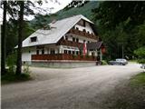
We drive to Luče (to here from Mozirje or over Kranjski Rak) and further towards Logarska dolina. Soon after the village Solčava we come to the intersection, where the road to Logarska dolina branches off to the left. We turn left towards Logarska dolina (toll payment) and drive along the road to the signs for the mountain hut at Klemenča jama. We park on the parking lot near the guesthouse Na Razpotju. In front of the guesthouse only guests are allowed to park.
Route description:
From the parking lot, we head onto the forest road in the direction of Klemenča jama. After a few minutes of walking a wide path branches off to the left towards Klemenča jama. We head onto this path, which starts to ascend. A pretty steep path soon brings us to steep slopes, where with the help of a steel cable we cross a slightly exposed gully. The path, which continues ascending, soon brings us to the spot where a wall blocks the path. In front of us we spot a cave and above it a marking, which directs us into the cave. When we step into the cave we see that it is not a cave, but a nicely made tunnel through which we continue. In the tunnel a steel cable assists us, which we need more on the descent than on the ascent. On the other side along the wide path in a gentle ascent we cross an exposed ledge. The path ahead goes into the forest and continues ascending steep slopes, which when wet are dangerous for slipping. Further over a small bridge we cross another gully, then the path brings us to a less steep part of the path, where the path from the mountain hut Dom Planincev joins us. We continue gently uphill on a wide path, which soon brings us out of the forest. Only a shorter ascent on a grassy slope to the mountain hut Koča na Klemenči jami follows.
From the mountain hut we continue straight in the direction of Ojstrica on the path which after a few tens of meters goes into the forest. The path, which ascends moderately to steeply through the forest, brings us higher below rocky cliffs, which are not overly crumbly. The path then moves away from the cliffs to the right and brings us to a junction, where we continue straight towards Škarje, while to the left branches off the very demanding Kopinškova pot to Ojstrica. The path continues crossing slopes towards the west, then comes out of the forest and turns slightly to the left. Here it starts to ascend somewhat more steeply along the scree, then turns to the right and ascends towards the saddle below Rjavčki vrh (1898 m). From the marked path to Rjavčki vrh there is approximately 10 minutes of ascent on pathless terrain. On the saddle the path to the right also branches off, which leads into the valley towards the mountain hut Koča pod slapom Rinka. The path from the saddle then turns to the left and first ascends past some dwarf pines and then across the scree. A somewhat steeper ascent on rocky terrain towards the saddle Škarje (2141 m) follows.
On the saddle Škarje a sign on the rock directs us to the right. The path ascends steeply and moves away from the ridge somewhat to the south side. We approach the ridge again and ascend a partly grassy slope. The path then bypasses the summit of Baba (Lučka Brana 2244 m), to which from the marked path we have only a few minutes of ascent.

Photos:
 1
1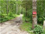 2
2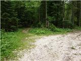 3
3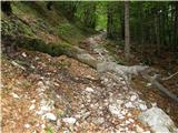 4
4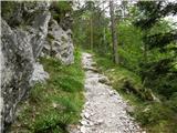 5
5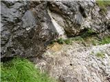 6
6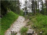 7
7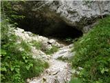 8
8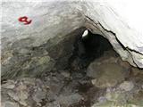 9
9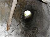 10
10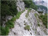 11
11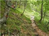 12
12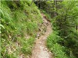 13
13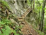 14
14 15
15 16
16 17
17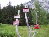 18
18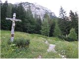 19
19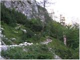 20
20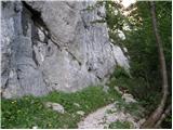 21
21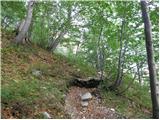 22
22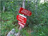 23
23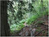 24
24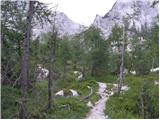 25
25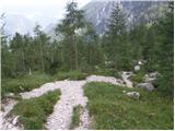 26
26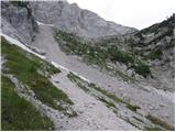 27
27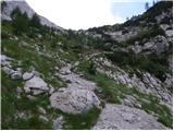 28
28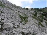 29
29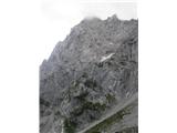 30
30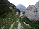 31
31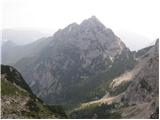 32
32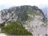 33
33 34
34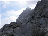 35
35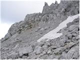 36
36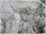 37
37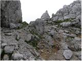 38
38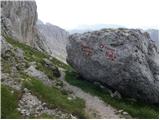 39
39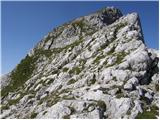 40
40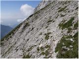 41
41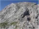 42
42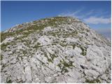 43
43
Discussion about the trip Na Razpotju - Lučka Brana (Baba)
|
| pohodnik3831. 10. 2014 |
Nice path hiked a while ago with nice views, only the markers need renewal.
PICTURES
Regards! Tone
|
|
|
|
| Sorok23. 06. 2015 |
Hello! Since I don't know and can't find the author of this description to send him a private message, I'll ask here, who is the author I'd like to ask him something regarding the summit height
|
|
|
|
| jprim30. 09. 2016 |
We also did this trail on Sunday, but in the opposite direction, we must have met.
Best regards!
|
|
|
|
| Enka4. 08. 2017 |
I'm interested in comparing the path from Škarije to Planjava, say with the path from Kamniško sedlo to Planjava or with paths to Ojstrica (via Mala Ojstrica or directly from Korošica). Is it very exposed? Rubbly?
|
|
|
|
| garmont4. 08. 2017 |
You listed very similar paths.
|
|
|
|
| Enka4. 08. 2017 |
How long does it take, say, for an averagely fast hiker?
|
|
|
|
| sh7. 08. 2017 |
We went from Planjava to Škarji and took one and a half hours for this path.
|
|
|
|
| darinka47. 08. 2017 |
Say, I went for the first time among home hikers over Škarje to Planjava. The path is not difficult at all, gravelly in places. Otherwise nice to me. One walks as one does. Only the last part from Ojstrica to Kamniško sedlo seemed to require a bit more caution.
|
|
|
|
| kalog28. 07. 2025 20:51:48 |
We've been discussing the peaks that form the ridge from Škarije to Planjava for some time. There are quite a few in this group, starting with Lučka Brana (also Baba...) at 2244m, continuing west to the next prominent peak also Baba (sometimes marked Z2 on maps) at 2309m, and finally the Baba mentioned in the path description - Lučka Brana (also Lučka Baba) at 2335m. There's quite a bit of confusion around these peaks. And everyone who goes to Lučka Brana reaches 2335m and not 2244m! Because the summit of Lučka Brana is right behind Škrbina to the right. Very indistinct, yet independent with its height, and only 15-20 minutes walk west from Škrbina. There's no marked path to it, but we can easily reach it via the moderate southern slope, a stone's throw from the path to Planjava. So everyone who has hiked to "Lučka Brana" has actually reached the summit of Lučka Baba and not Brana.
That's all about the naming of the mountains around here, regards.
|
|
|
To post a comment you must log in:
If you do not yet have a username, you must first
register.