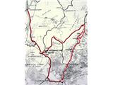
Na Razpotju - Krofička (Krofička Ridge)
Starting point: Na Razpotju (770 m)
| Latitude/Longitude: | 46,392°N 14,6273°E |
| |
Route name: Krofička Ridge
Walking time: 9 h
Difficulty: very difficult pathless terrain
Elevation gain: 1313 m
Elevation difference along the route: 1313 m
Map: Grintovci 1:25.000
Recommended equipment (summer): helmet
Recommended equipment (winter):
Views: 16.236
 | 4 people like this post |
Access to starting point:
We drive to Luče (to here from Mozirje or over Kranjski rak) and further towards Logarska dolina. Soon after the village of Solčava we come to an intersection, where the road to Logarska dolina branches off to the left. We turn left towards Logarska dolina (toll payment) and drive along the road to the signs for the mountain hut on Klemenča jama. We park on the parking lot near the pension Na Razpotju. In front of the pension, parking is allowed only for guests.
Route description:
From the parking lot, we head onto the forest road in the direction of Klemenča jama. After a few minutes of walking, a wide path branches off to the left towards Klemenča jama. We take this path, which starts to ascend. A fairly steep path soon brings us to steep slopes, where with the help of a steel cable we cross a slightly exposed gully. The path, which continues ascending, soon brings us to the spot where a wall blocks the path. In front of us, we see a nicely made tunnel, where a steel cable assists us. On the other side, along a wide path in a gentle ascent, we cross an exposed ledge. The path ahead goes into the forest and continues ascending steep slopes, which in wet conditions are dangerous for slipping. Further, over a small bridge, we cross another gully, then the path brings us to a less steep section, where the path from the Dom Planincev joins. We continue slightly uphill on a wide path, which soon takes us out of the forest. Only a short ascent on a grassy slope to the mountain hut Koča na Klemenči jami follows.
From the hut, we continue straight towards Ojstrica on the path, which after a few tens of meters enters the forest. The path, which ascends moderately to steeply through the forest, brings us higher below rocky cliffs, which are not overly crumbly. The path then veers right from the cliffs and brings us to a junction, where we continue left towards Ojstrica on the Kopinškova pot (right Škarje). Further, we emerge from the forest onto panoramic slopes overgrown with dwarf pines and individual larches, from which a nice view opens towards the northern wall of Ojstrica. Further on, we pay attention as soon soon to the left, from the marked path to Ojstrica, an unmarked hunting path to Krofička branches off. When we notice a cairn (approximately 10 minutes before the Kopinškova pot crosses to the other side of the ridge), we head left onto a poorly visible track, which over partly rocky and partly grassy slopes surrounded by dwarf pines and individual trees brings us below the foot of the northwestern cliffs of Krofička. Further, we ascend a wide gravelly gully, from which soon at the memorial plaque a secured and exposed passage opens to the right. A short very steep ascent follows, which we overcome with the help of a steel cable, and the path brings us to an initially narrow and exposed ridge. The ridge, which is lightly overgrown with dwarf pines, quickly widens and with the help of some fixed protections brings us to the chimney. With the help of a steel cable, we climb the nearly vertical and exposed chimney, which is about 10 m high. The steepness then eases, and the path brings us to sunny meadows (the slope is called Zadnji travnik), where the path gradually fades. We continue the ascent traversing north to northeast on a gradually steeper slope. We look for passages diagonally upwards, following chamois tracks or traces of our predecessors. If the terrain becomes harder to pass, we move more to the right. We reach the summit via the gully to the right—so southeast—from the main summit, to which only a few meters remain.
We start the descent first for a few meters on the same path by which we ascended. The demanding descent follows along the top of the ridge, then we keep to the right slopes and on steep terrain along the ridge look for passages among grass and dwarf pines to the next saddle below the summit part of Krofička. Here the ridge flattens and is heavily overgrown with dwarf pines. On the left slope of the ridge, we can seek passages among the dwarf pines, which we cannot entirely avoid, or descend a few tens of meters lower to bypass the dwarf pines. This way we reach the next peak in the ridge, Travnik, 2029 m.
Further, we descend along the top of the ridge and seek passages over scree and among dwarf pines. (Over the left slopes a few tens of meters lower below the ridge, there is apparently also a track cut into the dwarf pines, most likely made by hunters.) Over somewhat steeper terrain, we reach a small saddle. To continue, we descend a grassy gully to the right, Robanova stran. When the terrain opens up, we keep left and cross the grassy slope below the rear wall of the Travnik ridge, which we bypass until we return to the saddle of the main ridge, 1929 m. It is wide and grassy. If we go a few tens of meters straight ahead, we reach a nice viewpoint towards Logarska dolina.
The Ut ridge is very demanding, as it becomes ever narrower and very exposed on both sides, with no fixed protections. The dwarf pines disappear, and when climbing we must rely solely on a firm step on bare rock, so only very well-trained climbers should attempt it. We return on the same path to the saddle.
At the saddle, without special difficulties, we descend the transitional slope to Robanova stran. The terrain gradually turns left into an interesting cirque below the overhanging wall of Ut, where Roban's shepherd once lived. Now (September 2009), they are renovating his modest cottage. The cirque is incredibly picturesque, one of the most interesting corners of the Savinja Alps. From the cottage, a well-visible path leads slightly uphill towards steep slopes overgrown with larches. Then we descend and cross steep slopes above Robanov kot. The most demanding part is the crossing above the narrow saddle, where the path is now temporarily secured with a rope. An ascent through Vratni žleb follows, where at the top saddle a view already opens to Strelovec. The difficulties end here; a well-trodden track brings us to Movnik, where we soon join the marked path. Here we turn left, cross the slopes of Ut to Puklovec, and descend to Klemenča jama and into Logarska dolina.

The trip can be extended to the following destinations: Matkov kot
Photos:
 1
1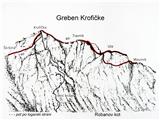 2
2 3
3 4
4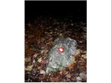 5
5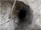 6
6 7
7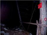 8
8 9
9 10
10 11
11 12
12 13
13 14
14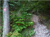 15
15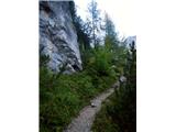 16
16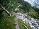 17
17 18
18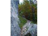 19
19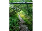 20
20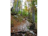 21
21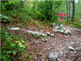 22
22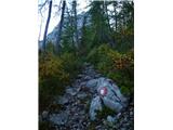 23
23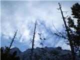 24
24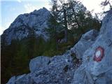 25
25 26
26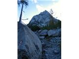 27
27 28
28 29
29 30
30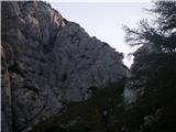 31
31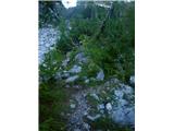 32
32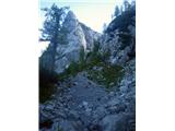 33
33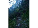 34
34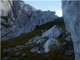 35
35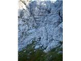 36
36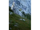 37
37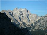 38
38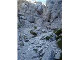 39
39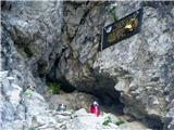 40
40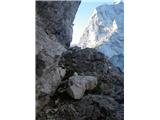 41
41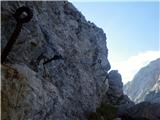 42
42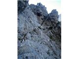 43
43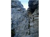 44
44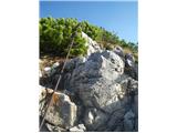 45
45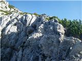 46
46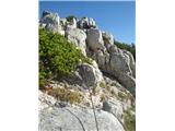 47
47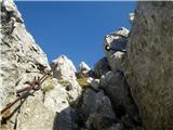 48
48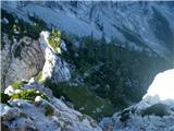 49
49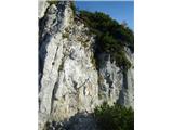 50
50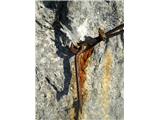 51
51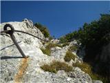 52
52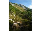 53
53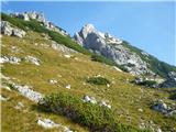 54
54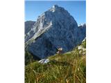 55
55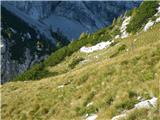 56
56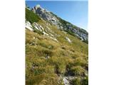 57
57 58
58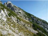 59
59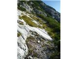 60
60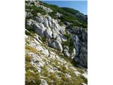 61
61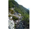 62
62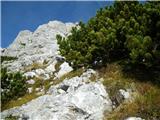 63
63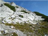 64
64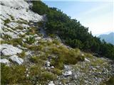 65
65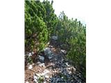 66
66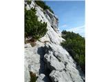 67
67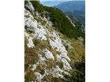 68
68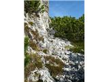 69
69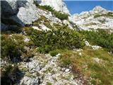 70
70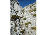 71
71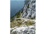 72
72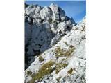 73
73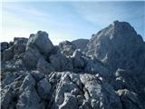 74
74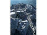 75
75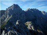 76
76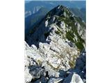 77
77 78
78 79
79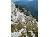 80
80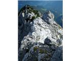 81
81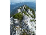 82
82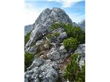 83
83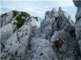 84
84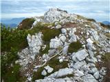 85
85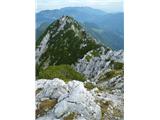 86
86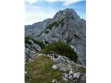 87
87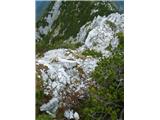 88
88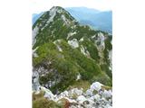 89
89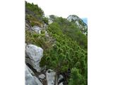 90
90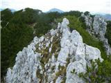 91
91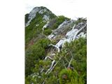 92
92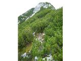 93
93 94
94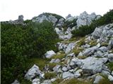 95
95 96
96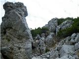 97
97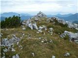 98
98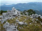 99
99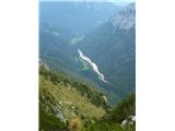 100
100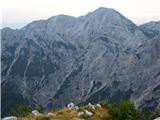 101
101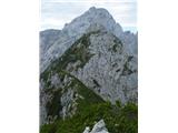 102
102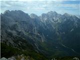 103
103 104
104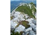 105
105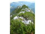 106
106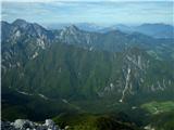 107
107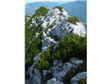 108
108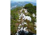 109
109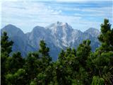 110
110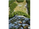 111
111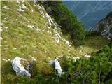 112
112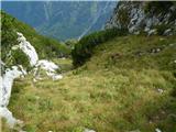 113
113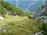 114
114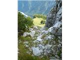 115
115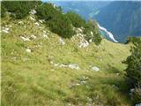 116
116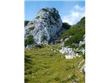 117
117 118
118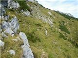 119
119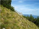 120
120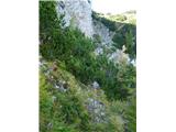 121
121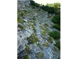 122
122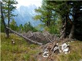 123
123 124
124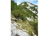 125
125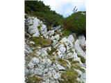 126
126 127
127 128
128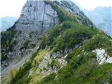 129
129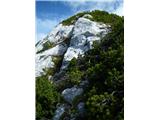 130
130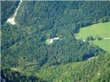 131
131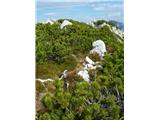 132
132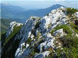 133
133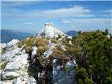 134
134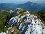 135
135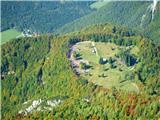 136
136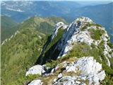 137
137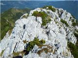 138
138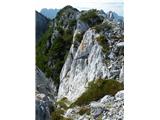 139
139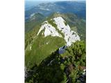 140
140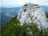 141
141 142
142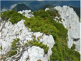 143
143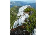 144
144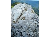 145
145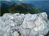 146
146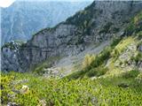 147
147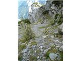 148
148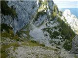 149
149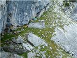 150
150 151
151 152
152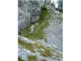 153
153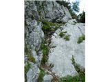 154
154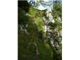 155
155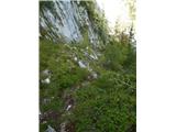 156
156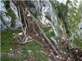 157
157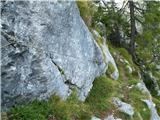 158
158 159
159 160
160 161
161 162
162 163
163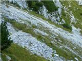 164
164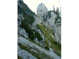 165
165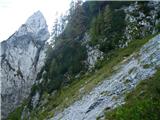 166
166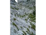 167
167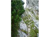 168
168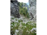 169
169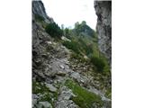 170
170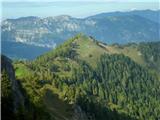 171
171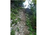 172
172 173
173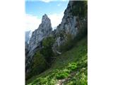 174
174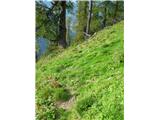 175
175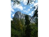 176
176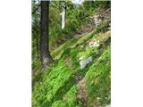 177
177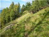 178
178 179
179 180
180 181
181 182
182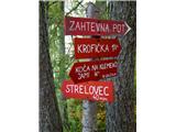 183
183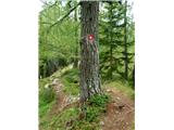 184
184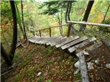 185
185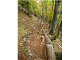 186
186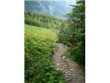 187
187 188
188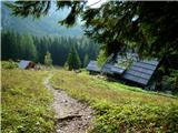 189
189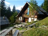 190
190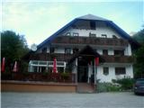 191
191
Discussion about the trip Na Razpotju - Krofička (Krofička Ridge)
|
| medo*11. 10. 2009 |
Hiked the path on 29.9.2009. From Škrbina to Movznik it is very demanding pathless terrain, where the trail gets lost several times. Some fixed ropes from the entrance to Škrbina are damaged. Several times you have to climb on exposed spots. The path is orientationally demanding, overgrown with scree in places and you can easily stray into more difficult terrain. The path is described in the guide Kamniško Savinjske Alpe (Andrej Stritar), p.160. I myself also climbed the Ut ridge in addition to the described one, which only well-trained people should attempt, otherwise it's better to skip it and immediately after the end of the Travnik ridge turn towards the cirque below the overhanging wall of Ut. Among the recommended equipment I would add binoculars.
|
|
|
|
| EUGEN2. 11. 2009 |
Yesterday went from Strelovec to Uta bivouac.
Protection is very useful, especially if it's slippery.Congratulations to those renovating the bivouac.
|
|
|
|
| Jany2. 11. 2009 |
I looked at the path description and all photos with interest, because I already walked part of this path this year (to Krofička summit via hunter's path over Škrbina) and now I can truly appreciate the described "feat". CONGRATULATIONS!
I estimate that the described pathless section from the summit to Uta is too demanding for me, because I already "got lost" several times in the first part and succeeded only on the second attempt.
I wish for even more such descriptions, because pathless terrain attracts me more and more.
Anyway, once again all congratulations for the feat - "medo*"
|
|
|
|
| medo*2. 11. 2009 |
Me too, I didn't succeed the first time. I call this "feat" that Krofička allowed me into her embrace and revealed part of her secrets...
I also know that some are not enthusiastic about such detailed descriptions of pathless terrain... but I'm not afraid that it would become a "crowd" disturbing the mountain peace of solitary paths. If the pictures help someone, the purpose is achieved.
|
|
|
|
| geppo3. 11. 2009 |
I believe that despite the description there won't be crowds! Those rare visitors who go there maintain traces of the path that is visible only to the experienced. Just the sight of the sharp and long ridge deters many!
http://www.shrani.si/f/P/124/vGfQBrK/dsc02322.jpg
|
|
|
|
| Behemot3. 07. 2011 |
On 26.06.2011 my wife and I completed the entire tour, except the ascent to the top of Ut. Magnificent tour that requires, as I expected, quite some sense of orientation. At this point I must praise the excellent path description (Stritar's description in 111 trips can hide), which is on your portal and of course the photos, where among others all key orientation points on the path are precisely depicted. At the beginning of the exit chimney we added our red "sling-strap" to the torn cable, because the existing one is already in such poor condition.
|
|
|
|
| ljubitelj gora16. 08. 2013 |
Why is this circular path called a pathless route when a trail is visible in the pictures.
If anyone plans to do this, I would recommend a group tour, but on ZS. LP
|
|
|
|
| jasminka16. 08. 2013 |
Hello! We were there in June 2012, via the "hunter's" path to the top of Krofička (you have to be careful when turning off the path to Ojstrica!!!!), there were a couple of fixed ropes (you can see what condition they're in!!), but further on there is no marked path to the top! From the top onwards we went along the ridge and looked for the best way ourselves (we had the description and photos from Hribi.), we didn't climb to the top of Ut! The descent towards Robanova koča is very steep!
So, it's really PATHLESS, but beautiful to traverse, although quite strenuous (it took us the whole day from Koča na Klemenči jami along the entire Krofička back to the hut!). I hope you enjoy it, good luck!! 
Photos (maybe helpful) are at https://picasaweb.google.com/JSinkov/KrofickaPoGrebenuLovskaPotIBrezpotje?authuser=0&feat=directlink
|
|
|
|
| dprapr16. 08. 2013 |
In the upper part of the hunter's path to Krofička there is pathless terrain, likewise the ridge to the shepherd's hut below Ut! Elsewhere the trail is really well visible.
|
|
|
|
| nincokl6. 08. 2014 |
I'm interested if anyone has any fresh information about the conditions on this path (snow). I would go this Saturday. Thanks
|
|
|
|
| mukica23. 06. 2016 |
Yesterday from Dom planincev to koča na Klemenči jami and via hunting path to Krofička where we take a short break and enjoy the views. We continue along the ridge towards Travnik and further to Ut ...here and there the well-trodden path gets lost, the battle with the brush begins, which is very welcome here...We descend to Uta past Oltar, a short rest and continue towards Movznik and descend to the hut and to the valley...perfect tour that requires a focused step and some skills in orientation and finding favorable passages.
|
|
|
|
| skokec19. 08. 2019 |
Yesterday we did this nice trail.. The trail is overgrown-ruins the most.. Nothing clears it so it will be harder every year. We descended past Plesnikova planina to Plesnik. I don't recommend this trail as it's neglected except for some newer KM.
|
|
|
|
| jprim19. 08. 2019 |
Well, yeah, you want to say the path is unmaintained. I've been talking about this for a while. But it doesn't matter, I don't care ....
As one song says   
|
|
|
|
| biba20. 08. 2019 |
Jprim, it's a very demanding pathless terrain and not a marked path! Do you expect pathless terrain to be cleared too?
|
|
|
|
| jprim20. 08. 2019 |
@ biba
Let there be different expectations, perhaps yours, perhaps mine,...
How many sharp minds ....
Regards!
|
|
|
|
| dprapr20. 08. 2019 |
Some would just cut straight through off-trail areas, regardless of land ownership.
The path under Rkljeva pečjo is one of the better ones, maintained just right. SVK definitely not an option!
|
|
|
|
| DVas16. 07. 2024 08:45:51 |
What's the latest condition of the path?
|
|
|
|
| geppo16. 07. 2024 09:32:18 |
No peculiarities. Nothing that would deter you from going up.
regards
|
|
|
|
| geppo16. 07. 2024 09:32:59 |
No peculiarities. Nothing that would deter you from going up.
regards
|
|
|
|
| DVas16. 07. 2024 10:58:24 |
Thanks
|
|
|
To post a comment you must log in:
If you do not yet have a username, you must first
register.