Možnica - Možnica river-beds
Starting point: Možnica (520 m)
| Latitude/Longitude: | 46,3798°N 13,5851°E |
| |
Walking time: 30 min
Difficulty: easy marked way
Elevation gain: 60 m
Elevation difference along the route: 100 m
Map: Julijske Alpe - zahodni del 1:50.000
Recommended equipment (summer):
Recommended equipment (winter): ice axe, crampons
Views: 16.795
 | 3 people like this post |
Access to starting point:
From Bovec, we drive towards the border crossing Predel or vice versa. Just a few meters after the road sign 10.5 km, we will notice a smaller parking lot on the left side of the road (if we drive from the direction of Predel, on the right side), where we park.
Route description:
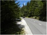
From the parking lot, we descend on an asphalt road some 10 meters (direction Bovec), then we come to a crossroad, where we continue sharply right in the direction of Apnenica. The macadam road, which is closed to public traffic, then crosses a wooden bridge and on the other side brings us to a marked junction, where we continue right (straight private). The marked path then crosses a grazing fence and right after it splits into two parts.
We continue left in the direction of Možnica (straight Apnenica and Log pod Mangartom) on a somewhat steeper path, which transitions into a belt of dense forest. The path soon levels out and brings us out of the forest onto panoramic grassy slopes, beside which we notice individual, mostly abandoned shepherd huts. Higher, the path brings us to a marked junction, where we continue sharply left in the direction of the Možnica gorges. The path further crosses panoramic slopes, then transitions into dense forest, where after a few minutes of further walking we arrive at a bridge over the gorges of the Možnica river.
If we want to see the waterfall with the natural bridge, we must cross the bridge and on the other side continue left downhill on a steep and partly exposed path. Since this section runs under steep and crumbly walls, a helmet is recommended.
When viewing the waterfall, great caution is needed so that we do not slip into the depths. The path from the bridge to the waterfall is demanding.

Photos:
 1
1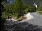 2
2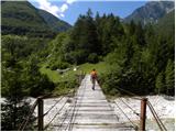 3
3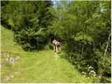 4
4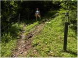 5
5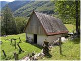 6
6 7
7 8
8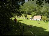 9
9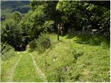 10
10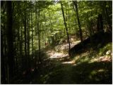 11
11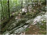 12
12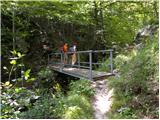 13
13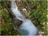 14
14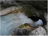 15
15
Discussion about the trip Možnica - Možnica river-beds
|
| Gost24. 08. 2006 |
Hike to Možnica seems COOL to me!
|
|
|
|
| aniTina2. 09. 2020 |
Nice trip. But caution is not superfluous right at the beginning of the path, when we cross the bridge. A dog might surprise us that barks and rushes towards us or after us. We luckily were just closing the gate door through which we pass, otherwise I don't know if someone would have torn pants from us or not hehe 
|
|
|
To post a comment you must log in:
If you do not yet have a username, you must first
register.