Možjanca - Kopa (Partizanski vrh)
Starting point: Možjanca (689 m)
| Latitude/Longitude: | 46,2945°N 14,4507°E |
| |
Walking time: 1 h 30 min
Difficulty: easy unmarked way
Elevation gain: 335 m
Elevation difference along the route: 400 m
Map: Karavanke - osrednji del 1:50.000
Recommended equipment (summer):
Recommended equipment (winter): ice axe, crampons
Views: 2.190
 | 1 person like this post |
Access to starting point:
A) From Cerklje na Gorenjskem, Šenčur or Kranj we drive towards Preddvor. When we reach the main road Kranj - Jezersko we follow it towards Jezersko, then before the settlement Tupaliče we turn right in the direction of Možjanca. In Tupaliče we again turn right, and then on an ascending road we drive to the settlement Možjanca, where near the church of St. Nikolaj or a little above it at the recycling spot we park at an appropriate place.
B) From Zgornje Jezersko we drive on the main road towards Kranj. When we get to a crossroad, where a road towards Preddvor branches off to the right, we continue straight, then at the first crossroad left. After a short ascent, the road flattens, and then at the marked crossroad we continue left in the direction of Možjanca. An ascent follows to the settlement Možjanca, where near the church of St. Nikolaj or a little above it at the recycling spot we park at an appropriate place.
Route description:
From the church of St. Nikolaj on Možjanca in a few dozen steps we ascend to a crossroad at the recycling spot, and from there we continue right in the direction of Kopa, Davovec and Krvavec (left viewpoint). Further on, we walk on the macadam road, from which we soon go slightly right onto the lower cart track, which is also indicated by the sign for the bridle path. The cart track, which further crosses the slopes to the right, quickly branches, and we choose the upper cart track, next to which is the next sign for the bridle path. A little further ahead, the lower path rejoins our path, and the cart track then crosses the slopes to the right for some time, at the junctions following the main path or the one that looks best trodden. After approximately 45 minutes of walking from the recycling spot we arrive at the next marked junction, where we continue left in the direction of Kopa (slightly right the bridle path continues).
The path continues through more plateau-like terrain, and at unmarked junctions we still follow the better trodden path. When we reach a wider cart track, it brings us to an indistinct saddle, where there is the next marked junction.
This time we continue right onto a narrower cart track (straight to Zapečnikova planina and Skutman via the mentioned mountain pasture) in the direction of Kopa. Further on, the path ascends gently to moderately, meanwhile leading us past several unmarked junctions, where we continue to follow the best trodden path. Higher up, the path ascends somewhat more steeply and brings us via a traversing ascent to a small saddle between Skutman on the left and Kopa on the right.
We continue right towards Kopa (left to Skutman 15 minutes) and continue along the ridge. After about a minute the path temporarily deviates from the ridge slightly to the right, then returns to it and ascends along it all the way to the summit of Kopa.
The described path is not marked, but it is indicated at a few junctions.
Description and pictures refer to the condition in 2016 (April).

Photos:
 1
1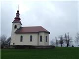 2
2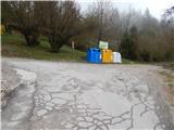 3
3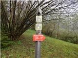 4
4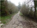 5
5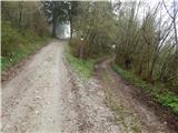 6
6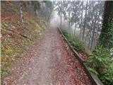 7
7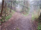 8
8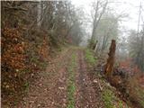 9
9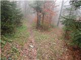 10
10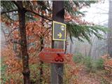 11
11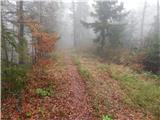 12
12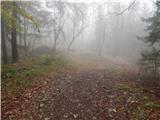 13
13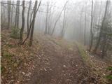 14
14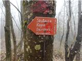 15
15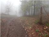 16
16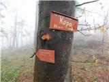 17
17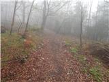 18
18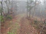 19
19 20
20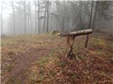 21
21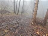 22
22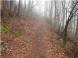 23
23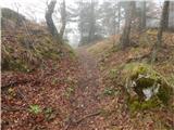 24
24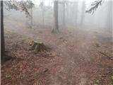 25
25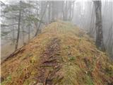 26
26 27
27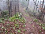 28
28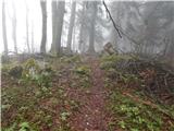 29
29 30
30
Discussion about the trip Možjanca - Kopa (Partizanski vrh)
|
| ijik3017. 06. 2016 |
Pleasant easy partly (at junctions) marked trail, suitable for families...
|
|
|
To post a comment you must log in:
If you do not yet have a username, you must first
register.