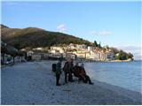
Starting point: Mošćenička Draga (10 m)
Walking time: 3 h
Difficulty: easy marked way
Elevation gain: 870 m
Elevation difference along the route: 880 m
Map: Istra 1:100.000
Recommended equipment (summer):
Recommended equipment (winter):
Views: 15.457
 | 1 person like this post |
Access to starting point:
We reach Mošćenička Draga by the regional road from Reka / Rijeka towards Pula.
Route description:
Description in Croatian.
From the center of Mošćenička Draga, along Potoška vala (named after the village Potoki), to the abandoned village Trebišća. The ascent to Trebišća takes about one hour. Above the village, a path leads to Vojak, the peak of Učka, and the path at the local water supply reservoir sharply turns to the left side of the valley, toward the sea, and upon reaching the plateau, arrives just below the peak Perun. From the plateau, the path partially ascends the eastern side, and along the southern side, it reaches the very peak. From the peak, there is no view of the sea due to the high coniferous forest, but a view opens toward Učka and to the west toward the saddle Bodaj and Istria.
Ascent to the top of Perun, due to snow, took 3.5 hours. Descent to Mošćenica and Mošćenička Draga took 3 hours. From the center of Mošćenica, 753 steps lead to the beach Sveti Ivan and further along the Lungomare to the center of Mošćenička Draga.
Photos:
 1
1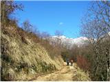 2
2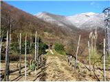 3
3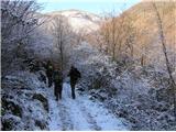 4
4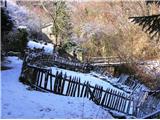 5
5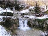 6
6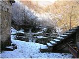 7
7 8
8 9
9 10
10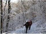 11
11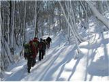 12
12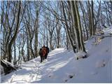 13
13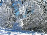 14
14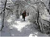 15
15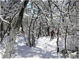 16
16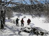 17
17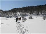 18
18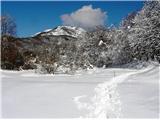 19
19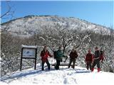 20
20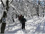 21
21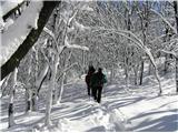 22
22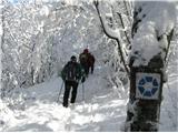 23
23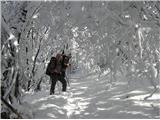 24
24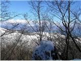 25
25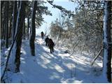 26
26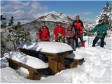 27
27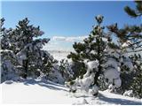 28
28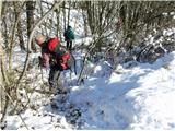 29
29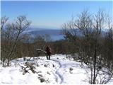 30
30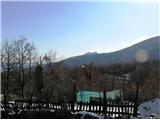 31
31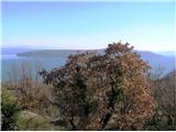 32
32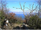 33
33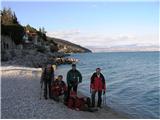 34
34
Discussion about the trip Mošćenička Draga - Perun
|
| Lj13. 03. 2011 |
We walked this path last weekend. The path is well marked, we were only in doubt below the village Potoki, where a steep path branched left, marked with knafeljč marking, but one must follow the blue markers. The idyllic, abandoned hamlet of Trebišća is a destination in itself, worth the effort. The path is so nicely laid out throughout that I don't remember ever making almost 900 m elevation gain so unnoticed. From the village Potoki onwards there are interesting and personal info boards along the path informing about Old Slavic history and legends. From Perun we descended towards Moščenice, this direction was modestly marked and we luckily reached Moščenice from where after 750 steps you return to the starting point in Moščenička Draga. Unforgettable trip, which I hope to repeat, but returning the ascent way and partially circular from Trebišća to the start. Recommended!
|
|
|
|
| MiR5. 02. 2013 |
Has anyone been from Trebišća to Perun or to Vojak, please, what are the snow conditions like. Is there a lot of snow or is the path trodden. Thanks for your help or answers. Good luck!
|
|
|
|
| Lj7. 02. 2013 |
I'd be interested too. Last year at this time the path was snow-free, but so icy that we only reached Trebišča. Info on snow conditions on Učka would also help, if anyone knows?
|
|
|
To post a comment you must log in:
If you do not yet have a username, you must first
register.