Molnarjev breg - Planina Osredek
Starting point: Molnarjev breg (1200 m)
| Latitude/Longitude: | 46,2803°N 14,5359°E |
| |
Walking time: 45 min
Difficulty: easy marked way
Elevation gain: -100 m
Elevation difference along the route: 50 m
Map: Kamniške in Savinjske Alpe 1:50.000
Recommended equipment (summer):
Recommended equipment (winter): ice axe, crampons
Views: 13.200
 | 1 person like this post |
Access to starting point:
A) From the Ljubljana–Jesenice highway, take the Vodice exit, then continue driving to the first traffic-light intersection in Vodice, where continue left in the direction of Cerklje na Gorenjskem and Brnik. When we arrive at the main roundabout in Spodnji Brnik, continue driving in the direction of Cerklje and Krvavec ski resort. At the end of the settlement Cerklje na Gorenjskem, leave the main road which continues towards Velesovo and Visoko and continue driving slightly right onto the road in the direction of the Krvavec ski resort. Further on, we arrive at the village Grad, where signs for the settlement Ambrož pod Krvavcem direct us right onto a steep asphalt road (straight ahead to the bottom station of the cable car to Krvavec and Štefanja Gora). When the steepness on the steep road eases a little, we arrive at an intersection, where we continue left in the direction of the settlement Ambrož pod Krvavcem (straight ahead to the settlements Ravne, Apno and Šenturška Gora). A little further, the road temporarily descends a little, then ascends through occasionally quite panoramic slopes. Higher up, we arrive at Ambrož pod Krvavcem, where we bypass the church of St. Ambrož and the tourist farm Pr Ambružarju on the left side. From the tourist farm onwards, the road enters the forest and ascends relatively steeply diagonally. When we arrive at the left serpentine, we are at the starting point, where we park in a suitable place near the small intersection.
B) From the Jesenice–Ljubljana highway, take the Kranj–East exit, then continue driving towards Brnik, Komenda and Mengeš. When we arrive at the main roundabout in Spodnji Brnik, continue driving in the direction of Cerklje and Krvavec ski resort. At the end of the settlement Cerklje na Gorenjskem, leave the main road which continues towards Velesovo and Visoko and continue driving slightly right onto the road in the direction of the Krvavec ski resort. Further on, we arrive at the village Grad, where signs for the settlement Ambrož pod Krvavcem direct us right onto a steep asphalt road (straight ahead to the bottom station of the cable car to Krvavec and Štefanja Gora). When the steepness on the steep road eases a little, we arrive at an intersection, where we continue left in the direction of the settlement Ambrož pod Krvavcem (straight ahead to the settlements Ravne, Apno and Šenturška Gora). A little further, the road temporarily descends a little, then ascends through occasionally quite panoramic slopes. Higher up, we arrive at Ambrož pod Krvavcem, where we bypass the church of St. Ambrož and the tourist farm Pr Ambružarju on the left side. From the tourist farm onwards, the road enters the forest and ascends relatively steeply diagonally. When we arrive at the left serpentine, we are at the starting point, where we park in a suitable place near the small intersection.
Route description:
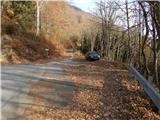
From the starting point, we head onto the forest road that crosses the slopes of Molnarjev breg. We ascend gently along the road, then arrive at a small junction, where we continue slightly left along the upper road (the lower road or cart track soon ends), beside which we also notice the blazes. There follow a few minutes of traverse ascent along the road, from which we occasionally get some views. A little further, the road splits again, and we again choose the left upper road, from which just a dozen steps ahead to the left a steep cart track branches off. We continue along the road, along which we walk to the right bend.
From the bend we continue straight onto the marked footpath, which continues transversely through the forest. In the forest we soon arrive at a signposted junction, where we continue right downhill in the direction of the mountain pasture Osredek and Kamniški vrh (the upper path leads to Kamniški vrh and bypasses the mountain pasture Osredek; it is also possible to continue towards Kriška planina). There follows a somewhat steeper descent, then we cross the road that we left shortly before and continue descending. Lower in the forest, the path turns left and levels out. There follow a few minutes of traversing, then we emerge from the forest onto the mountain pasture Osredek, where a few wooden huts stand.

Photos:
 1
1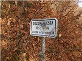 2
2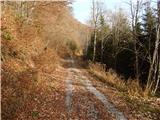 3
3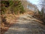 4
4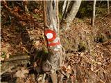 5
5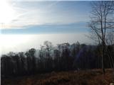 6
6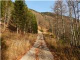 7
7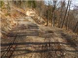 8
8 9
9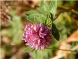 10
10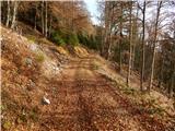 11
11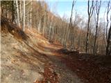 12
12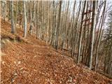 13
13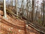 14
14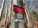 15
15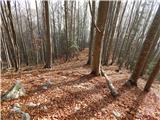 16
16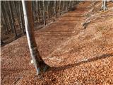 17
17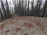 18
18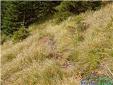 19
19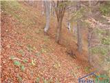 20
20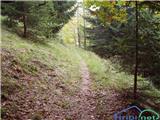 21
21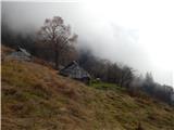 22
22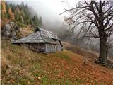 23
23 24
24
Discussion about the trip Molnarjev breg - Planina Osredek
|
| velkavrh17. 04. 2011 |
Today I completed this short hike. You can indeed leave the car at the bend of the asphalted road that continues towards Krvavec. Now at Kmečki turizem Pri Ambrožarju there is a sign permitting driving to the end of the asphalt to Planina Jezerca, which was prohibited from here last year. Very commendable! I extended the hike a bit because I walked from Škerjančevo in Stiška vas. I wouldn't agree that this is a demanding trail. It is indeed a bit steep shortly after the forest path ends going downhill, but nothing special. Before the steep section, you can turn left onto the ridge path to Kamniški vrh. I took that one and then descended from above the planina down to the planina itself. I returned as described. Really suitable also for a walk with a dog. But not recommended for small children.
|
|
|
|
| Raina17. 04. 2011 |
Error in the elevation of the starting point and consequently incorrect elevation gain?
|
|
|
|
| Tadej17. 04. 2011 |
Raina, thanks for the notice. I have corrected it.
|
|
|
|
| velkavrh11. 08. 2012 |
Went on this short but nevertheless pleasant path. On the pasture there has been a box with a stamp and logbook since spring. Currently during the week you cannot go on this path because it is closed due to the construction of a cableway for timber extraction. There are closure signs on both sides. You can only go on weekends. From Ambrož we go to Planina Osredek during the week only to Pokovša.
|
|
|
|
| velkavrh16. 08. 2013 |
On Monday morning I went more for a walk than a serious tour. If I'm already in Stiška vas, I like to stop by Ambrož and then to Planina Osredek. The drought is very noticeable - the spring below the alpine pasture is barely dripping. The pasture is not mown - only paths. But everything is trampled as if deer were looking for certain grass. I met a hiker who was picking medicinal herbs on that clearing in front of the pasture.
|
|
|
|
| nataša725. 08. 2013 |
Yesterday an excavator and a bulldozer were roaring on Planina Osredek. Spruces were falling. The pasture is torn up beyond recognition.
|
|
|
|
| velkavrh27. 08. 2013 |
I usually go to the alpine pasture on foot from Stiška vas near Škerjanc's and I was up there eleven days ago and I don't quite understand what happened to the pasture. It was so beautiful, pristine, full of alpine flowers, butterflies and the spring was trickling thinly. If what I see in the pictures is true, this is certainly irreparable damage done to the pasture and I strongly condemn such behavior!
|
|
|
To post a comment you must log in:
If you do not yet have a username, you must first
register.