Mokrine / Nassfeld - Creta di Aip / Trogkofel (Uiberlacher Steig)
Starting point: Mokrine / Nassfeld (1540 m)
| Latitude/Longitude: | 46,5609°N 13,2758°E |
| |
Route name: Uiberlacher Steig
Walking time: 4 h 30 min
Difficulty: very difficult marked way
Elevation gain: 739 m
Elevation difference along the route: 830 m
Map: Tabacco 18
Recommended equipment (summer): helmet, self belay set
Recommended equipment (winter): helmet, self belay set, ice axe, crampons
Views: 11.378
 | 2 people like this post |
Access to starting point:
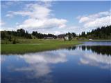
Through the border crossing in Rateče we drive through Trbiž / Tarvisio, Ukve / Ugovizzo to the place Tablja / Pontebba, where we turn right following the signs »Passo di Pramollo / Nassfeld« (Slovenian Mokrine). At the pass, we drive past the lake to the Austrian side, where we park on a large parking lot.
Route description:
From the parking lot on the pass Mokrine / Nassfeld we head onto the macadam road following the signs Rosskofel and Trogkofel. After a few hundred meters, we leave the road and the blazes lead us left onto a path that runs through meadows and past the artificial lake intended for snowmaking. The path then runs through a thin forest and several times crosses the ski slope and numerous streams. Soon we come to a junction, where the signs direct us left onto the path that runs along the ski slope, ascends somewhat more steeply, and in 15 minutes brings us to the road at the hut on Tressdorfer hohe.
At the junction, which is approximately 100 meters from the hut and from where there is a nice view toward our goal Veliki Koritnik / Creta di Aip / Trogkofel, we head onto the right road, which descends slightly. In the right bend we leave the road and again head onto the footpath. The path through the thin forest continues descending and over numerous streams we come to a fork, where we go right following the signs Trogkofel (path 413). Along a somewhat overgrown path that runs along the streams we arrive at a smaller alpine pasture and go left onto the path that runs along the ski slope. The path ascends somewhat more steeply and after half an hour of walking across the ski slope we arrive at the border ridge between Italy and Austria, from where there is an exceptionally nice view of Veliki Koritnik, Konjski Špik / Monte Cavallo / Rosskofel, and the bivouac Lomasti, to which we have only a few minutes' descent on the Italian side. On the border ridge we go right and the path in gentle ascents and descents brings us again to a fork. We go right onto the path (Uiberlacher Steig), which runs along the eastern wall of Veliki Koritnik. The path ahead is marked with orange-blue blazes and first crosses the scree slopes below Veliki Koritnik in a gentle descent. Soon the path from the hut Rudnig Alm joins us from the right.
Here the path begins to ascend steeply and soon brings us to the most difficult part of the path. On the more exposed sections the path is secured with a chain, and on a few more demanding spots ladders are installed. There follows some climbing over rugged rock terrain and a little below the summit the path from the Italian side (Via Ferrata Crete Rosse) joins us from the left. The path from here onward is no longer demanding and to the summit we have only a few more minutes.

Photos:
 1
1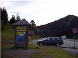 2
2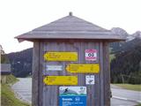 3
3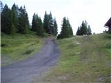 4
4 5
5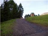 6
6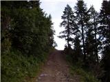 7
7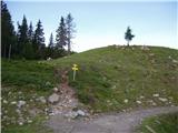 8
8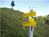 9
9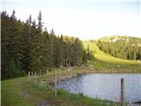 10
10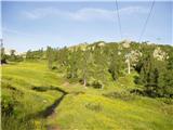 11
11 12
12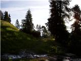 13
13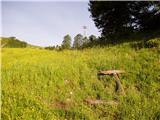 14
14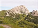 15
15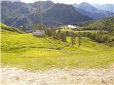 16
16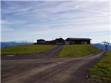 17
17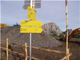 18
18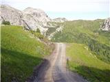 19
19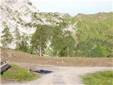 20
20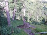 21
21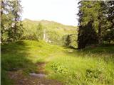 22
22 23
23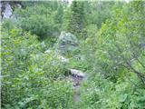 24
24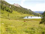 25
25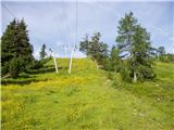 26
26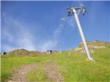 27
27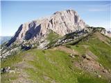 28
28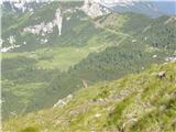 29
29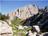 30
30 31
31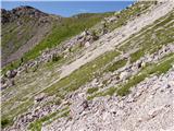 32
32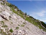 33
33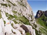 34
34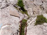 35
35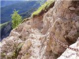 36
36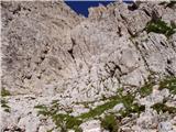 37
37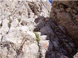 38
38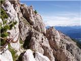 39
39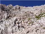 40
40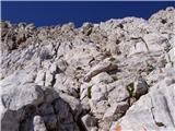 41
41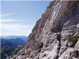 42
42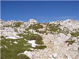 43
43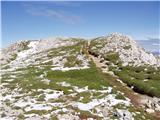 44
44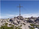 45
45
Discussion about the trip Mokrine / Nassfeld - Creta di Aip / Trogkofel (Uiberlacher Steig)
|
| VidPogacnik1. 06. 2009 |
Uiberlacher Steig is a moderately difficult secured climbing path (via ferrata), rated PP 2-3 on the via ferrata scale.
Even more annoying is the statement that it's a ski route. The rating is "very difficult", but I'm really curious whether ordinary touring ski descent or alpinistic ski descent is meant, and if the latter (which I'd expect given the terrain), whether really in the area of the summer path or some other variant.
Otherwise, the entire path description is poor. The section through the wall gets only two sentences.

|
|
|
|
| jax29. 06. 2013 |
On Uiberlacher there are no more chains, now there are new thick cables there.
Otherwise the path is quite pleasant, although in beauty it doesn't reach the neighboring (harder) Crete Rosse ferrata. Only one spot is a bit more demanding (over the double ledge), the rest is mainly easy scrambling on occasionally very friable terrain, which nevertheless requires caution.
|
|
|
|
| VanSims2. 11. 2014 |
Interesting that the ladders are the hardest for everyone. Even on bergsteigen.at they are marked B, the rest A. But the ladders would deserve say A/B, and in the rest one could certainly find another B. But no more. The B/C rating given by some portals is exaggerated for the via ferrata part of the path.
Otherwise, the main difficulty here is free climbing on exposed and as the predecessor already said, crumbly terrain. Real caution is needed.
There is no non-climbing descent, the easiest (subjectively) is via the Italian normal route. From the summit we follow the ALTA VIA sign but after about half an hour turn left where the climbing part begins: short detail maybe I+, the rest at most I, exposure the same, crumbliness perhaps only slightly less. Then we go back to the Austrian side - through Rudnigsattel to Mokrine, before Rudnig Alm about a quarter of an hour earlier (table), through a somewhat more awkward rocky path to the junction where we left the main road (see next paragraph).
Closer access (saving about 1.5 hours) is from Rudnig Alm (from the road to Mokrine turn right in Tröpolach, where there is a sign). Now out of season there was no problem parking at the otherwise small parking lot, in season maybe there is and question if allowed only for guests. When ascending towards the start of the climbing part, a quarter of an hour before Rudnigsattel you need to watch to turn right off the main road (otherwise you also get there via the saddle but lose about 15 min). Currently for orientation, target poles of the ski slope, on which 'YOUR PHOTO' or something like that is written, the path branches off a couple of dozen meters before (unmarked, but after a few meters there are markings again)
Otherwise thanks to Mr. Pogačnik for the more detailed description of this path and the normal route description on summitpost.org
|
|
|
To post a comment you must log in:
If you do not yet have a username, you must first
register.