Starting point: Mojstrana (675 m)
| Latitude/Longitude: | 46,4552°N 13,9321°E |
| |
Walking time: 3 h 40 min
Difficulty: easy marked way
Elevation gain: 1223 m
Elevation difference along the route: 1255 m
Map: Kranjska Gora 1:30.000
Recommended equipment (summer):
Recommended equipment (winter): ice axe, crampons
Views: 30.694
 | 2 people like this post |
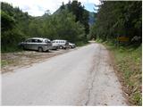
Access to starting point:
We leave the Gorenjska motorway at the Hrušica exit and follow the road ahead in the direction of Kranjska Gora. Just a little before the village of Dovje, the road which goes to Mojstrana (Vrata, Kot and Krma) branches off to the left from the main road. We follow the road ahead in the direction of the Vrata Valley and drive there only a short time, because we will soon notice by the road the mountain signposts for Vrtaška planina. We park on the parking lot by the road, which is situated a few meters ahead.
Route description:
From the parking lot, we descend the road a few meters downwards, where a signpost directs us to a wide footpath. The path initially ascends moderately and brings us to a junction in a few minutes, where we continue straight (right leads the path to the vantage point Grančišče).
The path soon after crosses a shorter muddy section, then turns left and ascends ever more steeply. The path ahead is steep and runs through the forest. After an hour and a half of walking the steepness eases, and the path leads onto scree slopes. This is followed by crossing a wide artificial ledge protected by a fence (the fence is for protecting livestock), from which a nice view opens onto the surrounding peaks. The path then returns to the forest for a while and ascends steeply again. A little higher the steepness eases, we cross a grazing fence and in a few more minutes of walking step onto Vrtaška planina, where on the right side we see a shepherd hut equipped with an emergency bivouac in the attic of the house.
The path ahead ascends across a meadow and then turns sharply to the left into the forest. The path through the forest ascends moderately and after 20 minutes of walking from the mountain pasture brings us to a larger clearing, which we merely cross. The path then returns to the forest, which becomes sparser. The relatively gentle path then brings us after some time to a nice vantage point from which a beautiful view opens up.
A short descent follows, then some traverses with a slight ascent to a large grassy slope below Vrtaški vrh, where an unmarked path from the Peričnik waterfall joins us.
The path then turns slightly to the right and continues gently ascending across the meadow. Here be attentive as the path to Vrtaški vrh branches off to the right.
The start of the path is marked but poorly visible across the meadow. We keep to the edge of the dwarf pines and soon a nice path appears, directing us into the dwarf pines. Now the path ascends moderately among the dwarf pines. After about 15 minutes from the meadow, the path to the summit branches off to the left. The path is marked but much less trodden than the one going straight. From here to the summit it is only three minutes' walk.
Mojstrana - Vrtaška planina 2:00, Vrtaška planina - Vrtaški vrh 1:45.

Photos:
 1
1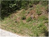 2
2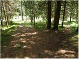 3
3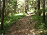 4
4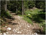 5
5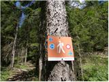 6
6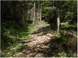 7
7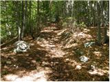 8
8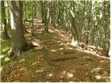 9
9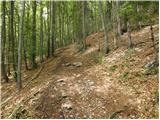 10
10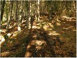 11
11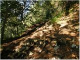 12
12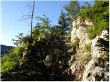 13
13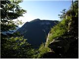 14
14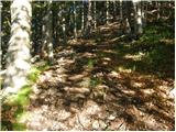 15
15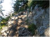 16
16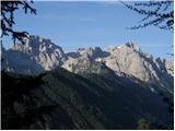 17
17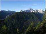 18
18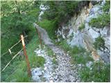 19
19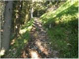 20
20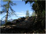 21
21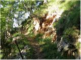 22
22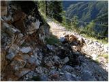 23
23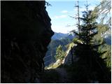 24
24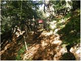 25
25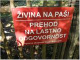 26
26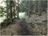 27
27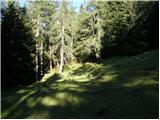 28
28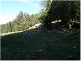 29
29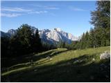 30
30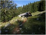 31
31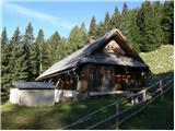 32
32 33
33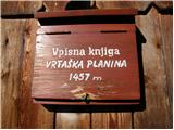 34
34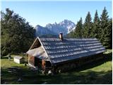 35
35 36
36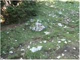 37
37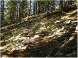 38
38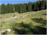 39
39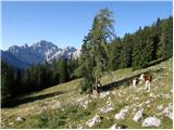 40
40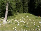 41
41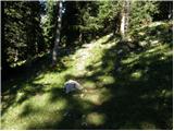 42
42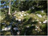 43
43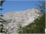 44
44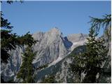 45
45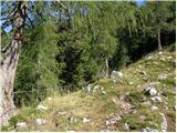 46
46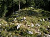 47
47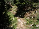 48
48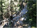 49
49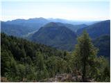 50
50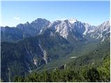 51
51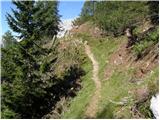 52
52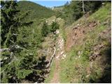 53
53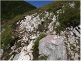 54
54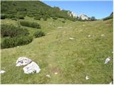 55
55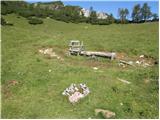 56
56 57
57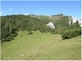 58
58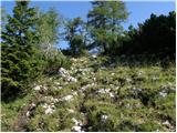 59
59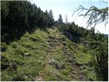 60
60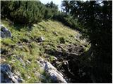 61
61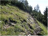 62
62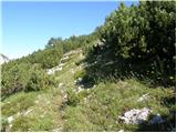 63
63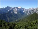 64
64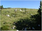 65
65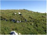 66
66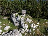 67
67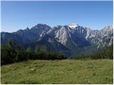 68
68 69
69
Discussion about the trip Mojstrana - Vrtaški vrh
|
| katty31. 12. 2012 |
Yesterday we set off from the foggy valley to this rather neglected peak -at least judging by the posts here. The path is trodden, but among the pines it still sinks up to your butt -at least judging by the posts here. The path is trodden, but among the pines it still sinks up to your butt . Views from the top though....I won't say anything, just head up there, you'll soon understand everything. It's worth it . Views from the top though....I won't say anything, just head up there, you'll soon understand everything. It's worth it . .
|
|
|
|
| gorjanci12. 03. 2013 |
We were there last February. Snow, sun .....the view towards Triglav .....indescribable. Perfect winter idyll. It took us more than 2 hours to the pasture. How is the path further to Vrtaški vrh now in winter time. This year we are setting off on 14.4. and plan to go to the top.
|
|
|
|
| misace19. 01. 2017 |
Vrtaški vrh on Tuesday 17.1.2017 was trampled to the scenic bend below the pasture. Continued through the "compact" gully and from the junction to Sleme a bit through "labyrinths" (keep left) and switchbacks to the top. Elements 
|
|
|
|
| Jusk12. 10. 2018 |
I was there this afternoon for the first time on this peak, to the alpine pasture really quite a steep path, onwards to the summit no sweat really super views the whole way
|
|
|
|
| Jusk5. 06. 2020 |
This afternoon I quickly decided to visit this summit when the rain stopped towards Vrtaška planina quite a few new "steps" on steep rocky sections of the path, noticed that the entire path is also freshly marked further towards Sleme. Despite cloudiness, nice views all the way
|
|
|
|
| Majdag6. 06. 2020 |
Good that you report everything and we are up to date with changes on the paths. Thanks, Jusk..
|
|
|
|
| Jusk6. 06. 2020 |
No problem I'm far from a runner, I just walk fast
|
|
|
To post a comment you must log in:
If you do not yet have a username, you must first
register.