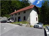
Starting point: Mlinarica (1089 m)
| Latitude/Longitude: | 46,40762°N 13,75471°E |
| |
Walking time: 3 h 40 min
Difficulty: difficult unmarked way
Elevation gain: 1012 m
Elevation difference along the route: 1060 m
Map: TNP 1:50.000, Trenta 1:25.000
Recommended equipment (summer):
Recommended equipment (winter): ice axe, crampons
Views: 17.790
 | 6 people like this post |
Access to starting point:
First, we drive to Kranjska Gora, and then we continue driving through the mountain pass Vršič towards Bovec. We continue driving to the 38th hairpin turn of the Ruska or Vršič road where we park by the old road house. In case there isn't enough space here, we can descend on the road for a few hundred meters where there is another smaller parking lot by the road.
Route description:
At the starting point, we go past the road house on a cart track. On the cart track, we walk approximately 100 meters and then a cairn points us right downwards on a footpath which leads towards Mlinarica. When we descend to the bed of the stream, we can admire numerous pools and smaller waterfalls. We then cross the stream to the other side, also with the help of a trunk which is stuck between the rocks. In case of high water level, caution is needed at the crossing.
On the other side of the stream, we continue to the right and then for some time we cross steep slopes, occasionally we also ascend steeper on the slope upwards. On this part we will also cross a few shorter gullies. At some gullies the footpath was swept away, so that at the crossing a calm step is needed and quite some caution.
The path further still mostly crosses steep slopes through the forest from which only rarely a view opens up on surrounding peaks. Later, the path turns slightly to the left and mostly ascends steep slopes through the forest. On the path, there are also some fallen trees, and occasionally the footpath becomes a little hard to follow.
Higher, the path slowly turns to the right and crosses steep slopes through the forest and dwarf pines. Such a path then brings us to the saddle between Debela peč and Goličica.
On the saddle, the path turns decisively to the left and starts ascending even steeper. Because the slopes are very steep we have to be careful not to go astray from the footpath which is on some spots quite poorly visible. The forest is becoming thinner and beautiful views are starting to open up on surrounding peaks. Higher, we ascend through dense dwarf pines and over a few shorter grassy slopes. When a view towards the summit opens up, we continue left and then for some time still ascend beside the dwarf pines. At that point we ascend steeply a few times and then we soon reach the main ridge of the mountain. Only a short ascent on the ridge follows to the top from which wonderful views open up on all sides.
Description and pictures refer to the condition in the year 2016 (August).

Photos:
 1
1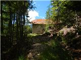 2
2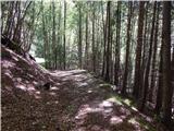 3
3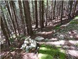 4
4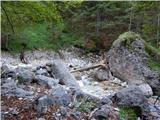 5
5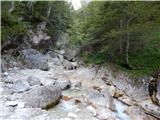 6
6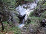 7
7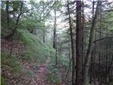 8
8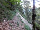 9
9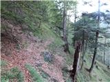 10
10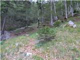 11
11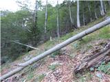 12
12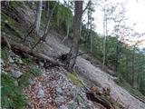 13
13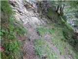 14
14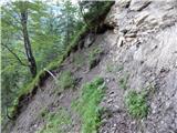 15
15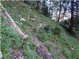 16
16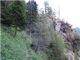 17
17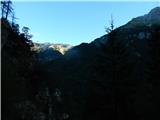 18
18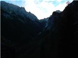 19
19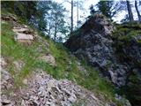 20
20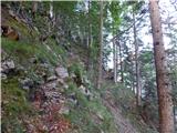 21
21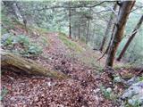 22
22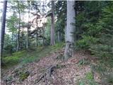 23
23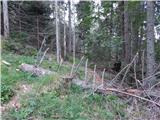 24
24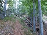 25
25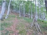 26
26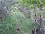 27
27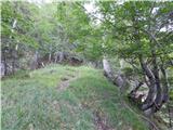 28
28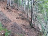 29
29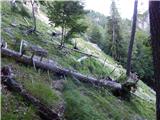 30
30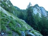 31
31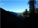 32
32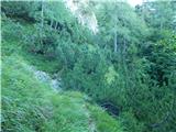 33
33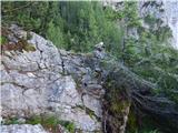 34
34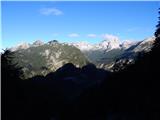 35
35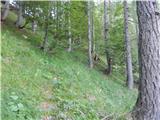 36
36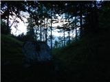 37
37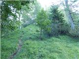 38
38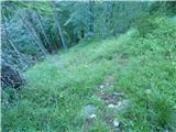 39
39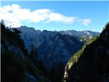 40
40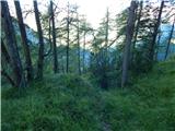 41
41 42
42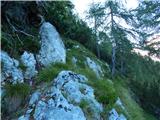 43
43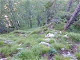 44
44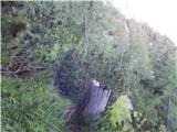 45
45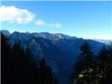 46
46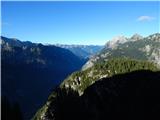 47
47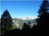 48
48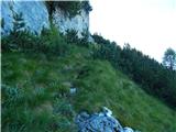 49
49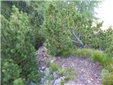 50
50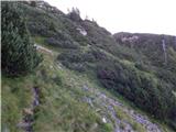 51
51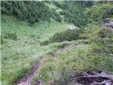 52
52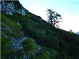 53
53 54
54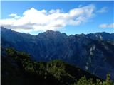 55
55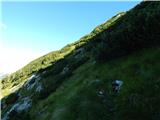 56
56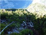 57
57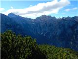 58
58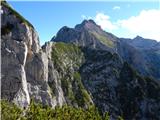 59
59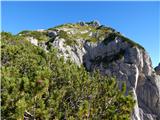 60
60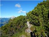 61
61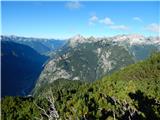 62
62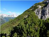 63
63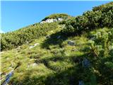 64
64 65
65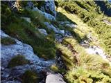 66
66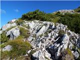 67
67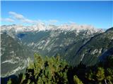 68
68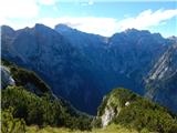 69
69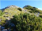 70
70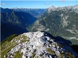 71
71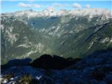 72
72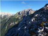 73
73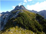 74
74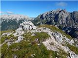 75
75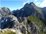 76
76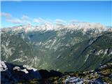 77
77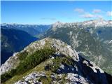 78
78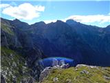 79
79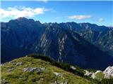 80
80 81
81
Discussion about the trip Mlinarica - Goličica
|
| ločanka19. 08. 2016 |
Nicely shown, it really tempted me to climb up here again.
|
|
|
|
| haridautovic8. 01. 2017 |
Yesterday 7.1.2017, my wife and I made the ascent to Goličica via a little-known trail so far,,Three days ago we tried to reach Goličica from the road workers' hut and turned back at the third landslide (very dangerous),it didn't give me peace, and I went looking for new routes,,while checking various maps I found this route and we went,,Starting point at Kugy monument, 20m before the monument turn left onto a well-trodden path to the bridge over Mlinarica, at the end of the bridge immediately left to the Hunters' hut,,when we spot the Hunters' hut again left onto a visible path, on which we placed a cairn, somewhere at 1050m, we leave the nice path that leads further on, again left and from here carefully the path quite visible occasionally disappears ,,it brings us to the ridge where it joins the path from the road workers' hut,,thus avoiding the landslides on the mentioned path,,but you have to be very careful on the path due to the descent,,,look back several times and remember the part of the path where it joins the path from the road workers' hut,,from here onwards along the already described path to Goličica..
|
|
|
|
| B28. 01. 2017 |
Yes, and in my opinion this is the best and easiest approach to Goličica. There is always enough parking space at Kugy (which there isn't at the road workers' hut), the path to the hunters' hut is nicely trodden, further to the Kukla reserve we nicely follow the old and gentle (probably hunting) path. Yes, we really have to remember a bit where we climbed - otherwise it can be very awkward on the way back...
|
|
|
|
| ločanka8. 01. 2017 |
yes, B2 we have to remember the return also in the first variant
|
|
|
|
| B28. 01. 2017 |
You are right, Ločanka, only the path from the Kukla reserve towards the road workers' hut is very well trodden, downhill towards Kugy you surely won't find it if you don't know where it branches off... And on the path towards the hunters' hut there are quite a few "side paths" that can easily mislead you...
|
|
|
|
| ločanka15. 08. 2017 |
On Sunday along this path. At the traverse (pic 15) you must step boldly without hesitation; if you assess all the risks, you'll likely not cross. No real footholds, grab grass tufts, saw a piton there and grabbed it, but saw on return it was loose, so don't hang on it.
Otherwise boundless summit views, most likely meet no one. Well, maybe someone.
Mihelič said whoever is ready for the tour celebrates a great day on Goličica. Still true!
|
|
|
|
| skiro12319. 07. 2019 |
I was on Goličica from the road hut, 13.7.2019. Three sections exposed due to landslide are not too problematic, but caution and concentration are needed. Also watch not to stray on detours around fallen trees. View incredible, hardly remember anything comparable! On return I recommend viewing waterfalls/gorges/slides above the stream crossing. If anyone has GPS please send it to me ZS
|
|
|
|
| jax19. 07. 2019 |
I disagree. One of the most dangerous sections in our mountains, and I've been to many places.
|
|
|
|
| dprapr19. 07. 2019 |
Jax probably doesn't want you walking around there.
|
|
|
|
| JusAvgustin19. 07. 2019 |
Or doesn't know what is dangerous
|
|
|
|
| skiro12330. 07. 2019 |
Jax, we probably didn't go the same path or you hike completely different mountains than I do. When picking mushrooms in slightly more exposed areas, the passages are more dangerous. If the path were equipped, they would put a cable at such crossings and the issue would be solved. Since there is no cable, a reliable step is important. But if you slip, in my opinion it's still possible to stop after a few meters.
|
|
|
|
| jax30. 07. 2019 |
I don't know where you pick mushrooms, as far as my mountains go, I really didn't have the feeling that I was just going for walks. One of the recent ones was e.g. Tumova on Lepo Špičje. And honestly, it didn't seem half as dangerous as this one. There, at all steep spots with some caution, you can find holds that hold. Here, everything crumbles.
|
|
|
|
| mirank30. 07. 2019 |
Jax, congratulations on Tumova, but everyone has their own view. When we first went there, the hardest detail seemed to us the one in picture 34, as my colleague wanted to take a whole rope. In the end it turned out that this rocky jump is about 1m high . There are such slightly exposed passages where you hardly have anywhere to step on various off-trail paths above Trento and in the Karnic Alps.... . There are such slightly exposed passages where you hardly have anywhere to step on various off-trail paths above Trento and in the Karnic Alps....
|
|
|
|
| skiro12331. 07. 2019 |
Jax, if you think this is one of the most dangerous sections in our mountains, it's right to take action. Either inform someone who "closes" this path or arrange for it to be fixed enough so there's no tragic story. I would certainly do it myself, as it seems responsible and more constructive than arguing your (admitted) fearlessness with climbed routes. I still think you went somewhere else than I did, because I don't believe we have such different views. On my path, the first landslide is quite stable, although the sand beneath it indicates that some rain will deepen it further, but you can hold onto the branches along the path. The second has nicely trodden footsteps, but no third support point. It looks like you can bypass it by climbing a bit higher, but I didn't check. The third is not a serious threat. In any case - as I wrote - caution and concentration are needed. Maybe a good comparison (for those who have been) is the section below the summit of Veliki Grintavec (above Predel/Rabeljsko jezero), where when crossing it's better to hold onto the dwarf pines so you don't end up a few hundred meters lower. This part seems about equally dangerous to me, but much more exposed.
|
|
|
|
| KarmenT28. 06. 2022 08:20:11 |
The path still requires caution and concentration as well as a sure step at key points. It meets the criteria for a demanding path. We've already walked several paths in our mountains, but this one has taken a very special place. It's truly exceptional!
|
|
|
|
| KarmenT28. 06. 2022 08:28:10 |
No information about the natural reserve Kukla can be found on the web. It's marked on the map, and that's where it ends.
|
|
|
|
| darinka45. 07. 2022 09:17:24 |
I'm reading your posts about the path. Is it really that demanding?
|
|
|
|
| Janez Seliškar5. 07. 2022 09:24:02 |
Nothing special for Trento, or "trentarje", only the crossing of the landslide, shortly above the Mlinarica bed, requires considerable caution.
|
|
|
|
| turbo5. 07. 2022 09:46:57 |
Darinka, you or you (three) won't have problems. You've surely done harder or more demanding tours already. You can check with Vink, since you have his phone 
|
|
|
|
| ppegan5. 07. 2022 09:58:18 |
Darinka, for me this path wasn't anything special or demanding. Yes, you do cross some scree gullies, but you can bypass them without problems if you're used to such terrain. The only thing I remember is that it was quite steep. But very nice. And I went with both little tails, who also had no problems. I didn't perceive it as particularly demanding
|
|
|
|
| darinka45. 07. 2022 10:28:10 |
Thanks to all three for the detailed information.
|
|
|
|
| jax5. 07. 2022 10:36:10 |
I still stand by what I wrote.
|
|
|
|
| mirank5. 07. 2022 12:20:59 |
Right, whoever has a different opinion also. Darinka we await the report...and the other opinion
|
|
|
|
| dprapr5. 07. 2022 13:01:12 |
The "trail" itself is nothing special, there are many more beautiful ones in our hills. Otherwise, on off-trail terrain we can't expect a wide, secured path.
But the summit itself is an interesting viewpoint and starting point for a beautiful ridge. Only there, already on the descent from Goličica, do the "difficulties" begin.
|
|
|
|
| andi25. 07. 2022 14:53:07 |
Goličica was ruined by the entry in the then still printed guidebook Julian Alps in the 80s/90s, where the author mentioned the orientationally most demanding off-trail route in the Julians. Then our instincts turned the off-trail into a trodden path and thus enabled relatively mass visits. Fortunately, the mentioned ridge continuation remained inaccessible to most of us. What one internet entry/post can change, we see and notice even more nowadays...
|
|
|
|
| darinka45. 07. 2022 15:21:10 |
Andi 2. True. I just read it in Mihelič's guidebook. Mine is from 1985. Orientationally it is very complicated. The tour ranks among the most demanding in this book! I recommend accompaniment by a guide - mountaineer. I say, when you're there you see ....
|
|
|
|
| andi25. 07. 2022 16:13:11 |
Yes, how our eyes lit up when we were reading The entry nicely reflects the attitude towards mountains and off-trail routes back then. Well, now it's of course trodden and therefore easier Safe and happy!
|
|
|
|
| darinka46. 07. 2022 21:35:53 |
We were there today. Didn't meet anyone. The path is quite okay. If you're used to pathless terrain. The views are really fantastic. Hats off to those who routed this path so nicely. At the beginning there are some sections with harder passages because the path was probably washed away by water. But you can get through carefully. Otherwise, there is dense scree somewhere. If you have such nice weather as we did yesterday, you can't wish for anything better.
|
|
|
To post a comment you must log in:
If you do not yet have a username, you must first
register.