Medvodje - Stegovnik (via Pri lojtri)
Starting point: Medvodje (898 m)
| Latitude/Longitude: | 46,4096°N 14,4016°E |
| |
Route name: via Pri lojtri
Walking time: 2 h 45 min
Difficulty: easy unmarked way, partly demanding marked way
Elevation gain: 794 m
Elevation difference along the route: 800 m
Map: Karavanke - osrednji del 1:50.000
Recommended equipment (summer):
Recommended equipment (winter): ice axe, crampons
Views: 9.189
 | 1 person like this post |
Access to starting point:
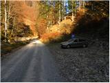
From the highway Ljubljana - Jesenice, take the exit Podnart (Ljubelj), then continue driving on the fast road towards Ljubelj and Tržič. When the fast road ends, we will notice a gas station on the right side, in front of which we turn right downhill towards Tržič. Further, we drive through Tržič, following the narrower road towards Dovžanova soteska gorge and then through the villages Dolina and Jelendol to the hamlet Medvodje. Here at the first crossroad, continue right in the direction of Stegovniški slap waterfall (left Košutnik and mountain pasture Dolga njiva), at the second crossroad left along the river Tržiška Bistrica (right Stegovniški slap). Further, we gently ascend along the upper course of Tržiška Bistrica, following the road to the marked parking lot, where we park.
Route description:
From the parking lot, we continue on a gently sloping road ascending along the river Tržiška Bistrica. Soon we arrive at a gate, behind which we step onto an unmarked crossroad. Here we continue on the right road, which starts to ascend along the stream Fevča, leaving it at the first sharp right turn. From the road, which becomes somewhat steeper, we temporarily get a partial view of Košutnikov turn, then it turns left and crosses a belt of forest. The road then brings us, with a view of Dobrča and nearby Stegovnik, to the next crossroad, where we continue straight ahead (the right road circles the nearby Bukov vrh). We continue walking along the road and after a few minutes arrive at the next crossroad. This time we continue left (straight is a connecting road leading towards the slopes below Konjščica, right road circles Bukov vrh) along a gradually increasingly panoramic road that crosses the slopes to the left. At the next crossroad, we continue sharply right and ascend through the forest to the next crossroad, where we continue left. The road then becomes somewhat steeper, and we follow it to the second levelling or widening. Here, slightly to the right, an unmarked cart track branches off, along which we start ascending more steeply. After a few minutes, the wide cart track turns slightly left, and at that point we choose the right one, initially somewhat less followable. Higher up, at a few forks, we choose the left directions and ascend on an increasingly poor path to the saddle Pri lojtri, where we reach the marked path from Jezersko.
Here we continue right towards Stegovnik (slightly right Javornik, sharply left planina Brsnina, slightly left Jezersko) on a path that gradually starts to ascend ever steeper. Further, a very steep path that is especially dangerous for slipping when wet and continues along a decaying wire fence brings us through increasingly sparse forest to the main ridge of Stegovnik. Here the path briefly retreats from the ridge to the right side, where with the help of steel cable we cross an exposed ledge. The path then returns to the ridge, which we follow with ever better views to the summit, reaching it after another good 10 minutes of walking.

Along the route: Pri lojtri (1486m)
Photos:
 1
1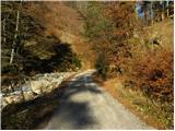 2
2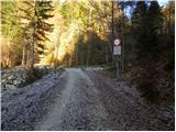 3
3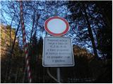 4
4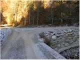 5
5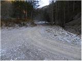 6
6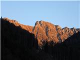 7
7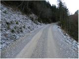 8
8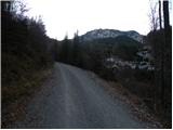 9
9 10
10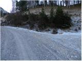 11
11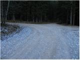 12
12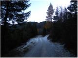 13
13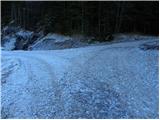 14
14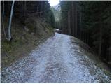 15
15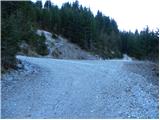 16
16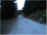 17
17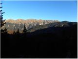 18
18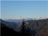 19
19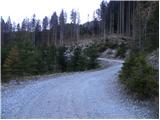 20
20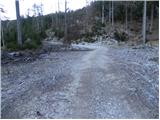 21
21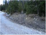 22
22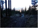 23
23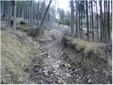 24
24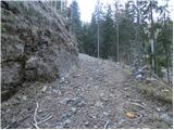 25
25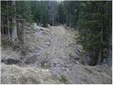 26
26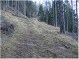 27
27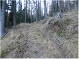 28
28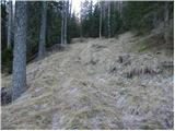 29
29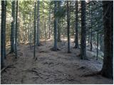 30
30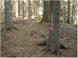 31
31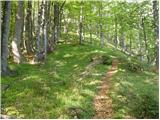 32
32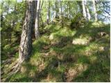 33
33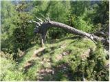 34
34 35
35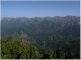 36
36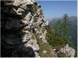 37
37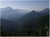 38
38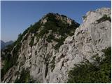 39
39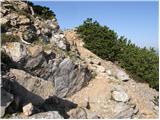 40
40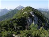 41
41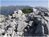 42
42
Discussion about the trip Medvodje - Stegovnik (via Pri lojtri)
|
| eurosrtucka11. 08. 2012 |
Unsuccessful Stegovnik
 A bit blindly, I set off from Bistrica pri Tržiču to Stegovnik. Below at Bornovi, I drove left by car towards Dol. I arrived at a junction where there is a large brown sign with PD Tržič markings. It said Stegovnik 3 hours. I thought it was just right. I continued on foot along the macadam. Past the barrier that prohibits personal traffic in the summer months. I continued the whole way on foot along the main road. I only met 3 cars going down. From where? I found out after a good 2 hours. Somewhere at the top they were picking boletus - I found two myself. Anyway, there was no living soul. But I found a clearly visible sign marking the Stegovnik trail 1 hour. This trail is well marked with markers. But only up to the moor. I reached a plain full of mud and water pools. My sneakers were quite wet. I crossed the moor three times back and forth - no signs anywhere. And left and right of the moor neither. The only passable terrain was down to the right. But the hills and the nearby summit are all to the left, with a cliff in between. I hesitated a bit and decided it wasn't worth the risk. What happened to the markers? Did they cut them down? Who knows? Irena A bit blindly, I set off from Bistrica pri Tržiču to Stegovnik. Below at Bornovi, I drove left by car towards Dol. I arrived at a junction where there is a large brown sign with PD Tržič markings. It said Stegovnik 3 hours. I thought it was just right. I continued on foot along the macadam. Past the barrier that prohibits personal traffic in the summer months. I continued the whole way on foot along the main road. I only met 3 cars going down. From where? I found out after a good 2 hours. Somewhere at the top they were picking boletus - I found two myself. Anyway, there was no living soul. But I found a clearly visible sign marking the Stegovnik trail 1 hour. This trail is well marked with markers. But only up to the moor. I reached a plain full of mud and water pools. My sneakers were quite wet. I crossed the moor three times back and forth - no signs anywhere. And left and right of the moor neither. The only passable terrain was down to the right. But the hills and the nearby summit are all to the left, with a cliff in between. I hesitated a bit and decided it wasn't worth the risk. What happened to the markers? Did they cut them down? Who knows? Irena
|
|
|
|
| Lunca12. 08. 2012 |
Irena, from the main path you should branch off exactly where it is shown in the picture that describes this path here. Then to the saddle Pri lojtri you really need a bit of orientation, further on the path is well marked. Try it once more, because it is really nice from this side too.
|
|
|
|
| vučka1234517. 06. 2023 20:13:09 |
This description is quite incomplete or the path has changed quite a bit since then.
1. The sign for prohibited passage (barrier) is now placed much earlier. I think even up to 1km before that parking lot marked in the google link as starting point. Before that there is a nice gravel parking lot. (That confused me a bit at the start.)
2. All mentioned intersections are now marked with blue signposts for the bike path (without indications where they lead) below them on a metal pole there is a mark. I often wondered if I was right, because from the description I gather the intersections are relatively close, but they are not as close as expected. But now they are marked (with blue signposts), so no worry, no need to wander unmarked sections.
3. Also the road is not as steep as described, steep is mainly the last part, marked here as "unmarked cart track" and ridge. On the ridge it really rises steeply, before that it's more or less level. And the bends are not as sharp as described, oh and the whole path is almost suitable for a car - so don't be confused by comments "we climb through the forest", as the path is along the road more or less the same.
4. The last mentioned "unmarked cart track" (picture 22) is now well marked with red marks and an arrow on the tree. From there the correct marks follow every 5 meters (very well marked section). But it looks quite different now than in the picture and when it says "we follow it to the second leveling" it means it levels twice - first picture 21, second picture 22.
I just wanted to describe the path a bit better so no one else wonders, when will the intersection be? have I passed it? is this cart track unmarked enough to be the right one? haha. It's a great path though - I walked to the window too (really cool thing), but then got a bit lost on the way back. Also poorly marked there. So I recommend planning ahead  and happy hiking! and happy hiking!
|
|
|
To post a comment you must log in:
If you do not yet have a username, you must first
register.