Matizovec - Veliko Kladivo
Starting point: Matizovec (915 m)
| Latitude/Longitude: | 46,4145°N 14,3°E |
| |
Walking time: 3 h 20 min
Difficulty: partly demanding marked way
Elevation gain: 1179 m
Elevation difference along the route: 1260 m
Map: Karavanke - osrednji del 1:50.000
Recommended equipment (summer):
Recommended equipment (winter): ice axe, crampons
Views: 64.304
 | 4 people like this post |
Access to starting point:
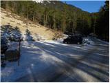
From the highway Ljubljana - Jesenice, we take the Ljubelj exit and follow the road ahead towards the border crossing. We leave the main road at the spot where the signs for »camp and Podljubelj« direct us to the right. When we leave the main road, we will already after a few meters come to a crossroad, where we continue left in the direction of »Kofce«. Further, we drive through the village on a slightly ascending road and then turn right in the direction of »Matizovec and Kofce«. We then follow this occasionally somewhat narrower road, which is asphalted in the lower part, to a larger marked parking lot, about 150 elevation meters below the farm Matizovec.
Route description:
From the large free parking lot we continue on a macadam road, on which in approximately 20 minutes we arrive at the farm Matizovec.
From Matizovec we continue on the right marked road, which through a meadow quickly brings us to a smaller crossroad. We again continue on the right upper road, which then quickly changes into an often quite muddy cart track. After a few minutes' walk we leave the cart track and head onto a footpath, which starts to ascend more steeply through the forest. The marked path then crosses a few cart tracks and higher brings us to a somewhat larger clearing, where we continue slightly right into the forest. The path ahead ascends diagonally, higher turns left and brings us out of the forest, where we join the macadam road (Jelendol). We continue left upwards and after a few minutes of further walking the path brings us to the mountain hut Dom na Kofcah.
From the mountain hut we continue in the direction of Veliki vrh and Kladivo on an initially somewhat less visible path, which starts ascending across a panoramic meadow. After 15 minutes of walking from the Dom na Kofcah hut we reach a nice viewpoint at the cross.
The path then descends slightly and in a few minutes brings us to the steeper slopes of Košuta. The path then ascends through a belt of dwarf pines, bringing us to a junction. We continue right (straight to Veliki vrh) on the path to which an unmarked but signposted path from the mountain pasture Šija joins after just a few meters. We continue left upwards on the path, which ascends steeply and quickly brings us to an exposed passage. Without fixed protection we cross a short but crumbly and slightly exposed ledge, after which we enter a belt of dwarf pines. The path ahead ascends through a short belt of dwarf pines, then continues along the side ridge of Košuta. An increasingly panoramic and quite steep path then joins the ridge path higher up.
We continue right in the direction of Kladivo (left Veliki vrh, straight upwards Kofce gora 10 steps) on a path which starts to descend slightly along the edge of the ridge. The very panoramic ridge path, which runs on and along the main ridge, is slightly exposed in a few places ahead but dry passages pose no problems.
A little further ahead the path approaches the indistinct summit (Malo Kladivo), to which a short steep ascent brings us.
From Malo Kladivo the path starts descending and quickly brings us to a smaller saddle between the two Kladivos. Here an easy unmarked path from the mountain pasture Šija joins from the right (return option), but we continue straight on the path, which starts ascending more steeply up the summit slope of Kladivo. After 10 minutes of steep and slippery walking, the path brings us to the panoramic summit.
Starting point - Matizovec 20 minutes, Matizovec - Kofce 1:15, Kofce - Kofce gora 1:00, Kofce gora - Kladivo 45 minutes.

Photos:
 1
1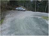 2
2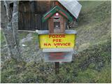 3
3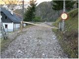 4
4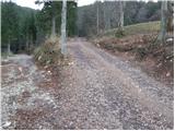 5
5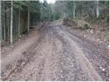 6
6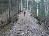 7
7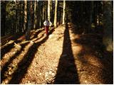 8
8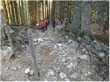 9
9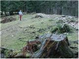 10
10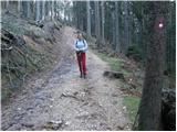 11
11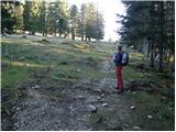 12
12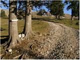 13
13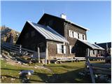 14
14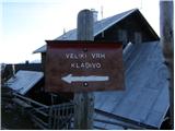 15
15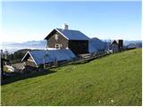 16
16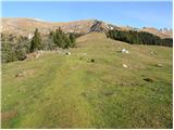 17
17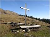 18
18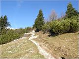 19
19 20
20 21
21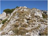 22
22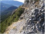 23
23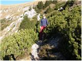 24
24 25
25 26
26 27
27 28
28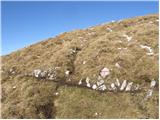 29
29 30
30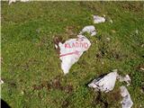 31
31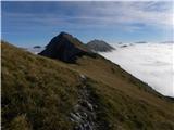 32
32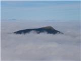 33
33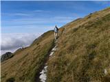 34
34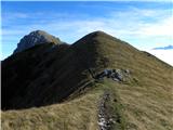 35
35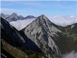 36
36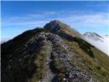 37
37 38
38 39
39 40
40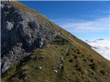 41
41 42
42 43
43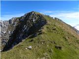 44
44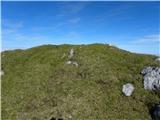 45
45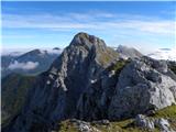 46
46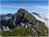 47
47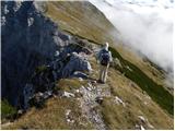 48
48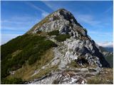 49
49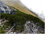 50
50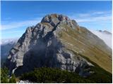 51
51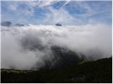 52
52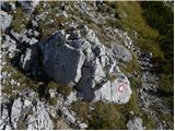 53
53 54
54 55
55 56
56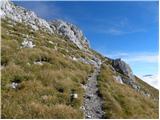 57
57 58
58 59
59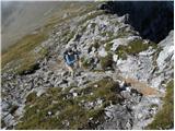 60
60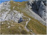 61
61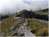 62
62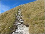 63
63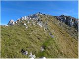 64
64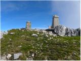 65
65 66
66
Discussion about the trip Matizovec - Veliko Kladivo
|
| robert399721. 10. 2009 |
hello..I think that safety gear on the only exposed ledge would be more than welcome. I hope that people who can contribute something to this are reading this.
|
|
|
|
| efes10. 04. 2011 |
Today we went up with my brother and colleague. For me it was the first tour above 2000 this year. It was awesome
|
|
|
|
| rjudnic10. 04. 2011 |
Hi efes. How much snow is left, or has it all melted?
|
|
|
|
| Matjaz_6525. 09. 2011 |
some of my photos from a similar but circular route from 111 hikes ... from Planina Šija to Kofce .. to Veliki vrh and Kladivo .. and return via Škrbino and Planina Pungrat to Šija
I would rather suggest starting point at Planina Pungrat ... which moves the monotonous walk from Planina Pungrat to Planina Šija from the end to the beginning of the route ... and at the same time shortens the drive on the otherwise quite bad road 
|
|
|
|
| Kokta1. 11. 2011 |
Sunny weather and super tour
|
|
|
|
| alpin2. 11. 2011 |
Maybe someone photographed us yesterday as we were paragliding along the slopes of the entire ridge?
|
|
|
|
| tagec2. 11. 2011 |
On the last holiday day we visit Košuta. We are a bit tired as it's the 4th day in the mountains, but the weather is really great. From Kofce towards V. Vrh we observe five glider pilots who elegantly master the entire ridge of Košuta. At the saddle we turn right towards Kofce gora, where it really pulls across the entire ridge. Most visit V. Vrh, we decide for the more solitary M. Kladivo. Right at the top we find shelter from the wind, where we treat ourselves to a longer break. Three more hikers arrive behind us and all three miss the direct path left upwards to M. Kladivo, which is really less visible. They go to V. Kladivo, we descend to the saddle and right downwards on the unmarked but clearly visible path to Planina Šija and from there back to Kofce, where there was quite a crowd. With very good jota we concluded a fantastic week in the mountains!!
P.S. alpin, I managed to take some photos... if you want, let me know at adezman@gmai.com
|
|
|
|
| alpin2. 11. 2011 |
Great, thanks!!
|
|
|
|
| sodnick24. 02. 2012 |
Anyone able to advise on the ascent to Kladivo from Kofce in winter conditions. Planning a bit for Sunday. Regarding avalanches surely better than Veliki vrh. Any experiences?
|
|
|
|
| tinky24. 02. 2012 |
check teletekst 594 page 11. There is the phone number of Planina Kofce.(041234638)
|
|
|
|
| sodnick26. 02. 2012 |
Today despite everything conquered Kladivo. In the morning snow was good, frozen. On the way back it was already softening. According to forecast colder in higher areas than previous days. Due to avalanche danger we walked the entire exposed ridge. Although some, already when we were returning, used the gully path for ascent. Part of that path buried by avalanche from previous days. At the top a bit windy, weather is what it is. Sun, snow, fog, wind, at the bottom even a bit of rain. Full palette, otherwise nice day.
|
|
|
|
| Meto9. 07. 2013 |
Now there is a free parking lot arranged approx. 15 minutes walk below Matizovec (about 200m after the end of asphalt), although quite a few people still drive higher. A few barriers (fences), which today were by the road and not on it, indicate that it's not really desired.
|
|
|
|
| capraibex9. 07. 2013 |
Quite a few people still don't know traffic signage. The road from the organized parking lot at the end of the asphalt is closed on purpose so that owners of higher farms can carry out their activities with agricultural machinery unobstructedly, vehicles would hinder them. Short, to the point.
|
|
|
|
| VanSims9. 07. 2013 |
Is there any official signage? Because obstacles along the path mean nothing legally. No one has the right to place them on a public path regardless of agricultural machinery up or down.
|
|
|
|
| urbancek9. 07. 2013 |
Same old song as always... Because of twenty minutes more walking everyone would like to drive as far as possible...  Is it really so hard to start walking from organized parking lots onwards? Is it really so hard to start walking from organized parking lots onwards?
|
|
|
|
| @rekar9. 07. 2013 |
VanSman or whatever would make trouble again, or don't you by chance understand what private property is, if the usual signs and physical barrier aren't clear to you, then there's no help for you,
|
|
|
|
| VanSims9. 07. 2013 |
No I don't know what private property is if it's not marked. Obviously no physical barrier if Meto could drive further (if there is one it must be placed by official authorities otherwise it's plain road terrorism)
But I dared to ask if there's any official signage (traffic sign, municipal board) because that's the authoritative one, not homemade signs, crumpled papers,... And if there is why the municipality doesn't enforce it.
@rekar: clear enough or do I need to draw it?
|
|
|
|
| Daaam10. 07. 2013 |
..the sign says parking below is recommended, but it's not forbidden to drive further. So it's pointless to debate about it. Everyone should decide for themselves and that's it. Even the "so-called obstacle" is placed so that you can drive past.
|
|
|
|
| jprim10. 07. 2013 |
On Saturday in this area, as Daam says - it's all true, it's a blockade - actually the personal wish of 2 farms, not an official ban with a traffic sign and defined regulations.
Just for your information.
Best regards!
|
|
|
|
| serajko10. 07. 2013 |
lp
They could put an information board before the parking lot. Then people would know it's a parking lot and not some sand pit. I think those few meters aren't problematic at all, the problem is the lack of information.
|
|
|
|
| Daaam11. 07. 2013 |
@serajko The board is now in place, that this is an arranged parking lot so lack of information is no longer an excuse
|
|
|
|
| capraibex11. 07. 2013 |
What ignorance. It's clearly written on the sign what, why, how. But for some that's not enough, typical Slovenian. For such people the farm could have an open day, then they'd see how to push through with a tractor and trailer past crowds of cars.
|
|
|
|
| VanSims11. 07. 2013 |
@caprabex: We have a similar case here and there's nothing more we can do either. Not to complain but those farmers aren't the only ones!
We have a parking lot in the settlement intended for residents but all sorts of others park there too: half the rest of the town, youngsters who come partying to the nearby bars, craftsmen from the whole town with their vans which occupy not only their own spot but also a quarter of the front, neighboring, and diagonal neighbor's spots i.e. they block four bays,... From around 8 PM, except now during vacation time, it's impossible to find a spot to park.
And what can we do? Nothing! The parking lot is supposedly for residents but it's public, owned by the municipality. We can't prohibit parking, can't install a barrier with cards just for residents, the municipality won't even help by officially putting up a sign,... probably because half the town, craftsmen and bars would revolt as they'd lose half their night customers...
We just have to live with it... that's life...
|
|
|
|
| serajko11. 07. 2013 |
regards
from the debate it wasn't clear that the sign is nice and friendly. I never drive all the way to the house anyway. Those couple of minutes are no problem.
|
|
|
|
| DarjaZaplotnik11. 07. 2013 |
@VanSims... here, borrow a tractor, drive a few laps around your overcrowded parking lot and you'll immediately understand how the tractor drivers from below Kofc feel...
best regards d
|
|
|
|
| slamca11. 07. 2013 |
@DarjaZaplotnik, no point wasting words.....it's clearly written for anyone reasonably literate. The problem is more that everyone wants to drive all the way to the top. Whether it's a hut or Triglav itself. 
|
|
|
|
| VanSims12. 07. 2013 |
@DarjaZaplotnik: I just wanted to say that this case isn't the only one. The world doesn't revolve only around those farmers.
I asked about the signage, got an answer that might be useful to someone else who heads there so they can decide in advance how close to drive based on it. That was the purpose.
|
|
|
|
| Jst_Me9. 10. 2014 |
I always park at the marked parking lot, which in my opinion is excellently arranged. Practically ideal. If pushing towards the farm, you'd gain maybe 25 minutes round trip. For those who like walking it's unnecessary. From there on where there used to be a wooden barrier I wouldn't go by car at all, it's a pity. Let the farmers do what they want in peace.
Otherwise the path to Veliko Kladivo is completely safe, except those 5 exposed meters which are dangerous only in winter. Excellent tour, great views. I recommend extending to Veliki vrh.
|
|
|
|
| navdušena1. 06. 2015 |
Has anyone been to Kladivo or Veliki vrh in these days? How much snow is left?
|
|
|
|
| PlaRinka13. 08. 2015 |
Unfortunately the stamp at the top is torn off.
|
|
|
|
| navdušena13. 08. 2015 |
Maybe they will renew it??
|
|
|
|
| Košutica25. 09. 2016 |
For all who, like me, like to stamp every ascent: new stamps have been installed at Kladivo and Veliki vrh!!
|
|
|
|
| vinkok15. 08. 2017 |
On the ascent to Kladivo near Mali Kladivo there are snakes. One was basking on a rock right in the middle of the path. A bit further, two beside the path. Need to watch your step.http://www.hribi.net/slike/smile.gif
|
|
|
|
| Ursa528. 12. 2019 |
I was on Kladivo this October. It's interesting to me that on the only exposed ledge there is still no protection. Someone wrote about this here 10 years ago. Who can we contact to take action?
|
|
|
|
| 12a3bc23. 06. 2021 00:23:48 |
Super easy trail
Just wondering what some old torn plastic sheet weighted on the mountain top is doing?!? 
Do we really need to carry a bag and pick up trash
|
|
|
|
| Chelsea6. 09. 2023 06:44:29 |
The parking lot is paid, namely 4 euros/day. There is a parking meter....you can pay with cash (coins) or credit card.
|
|
|
|
| Frisvape26. 08. 2025 19:23:38 |
Excellent hike, hut at Kofceh top service and offer but this exposed ledge always without any protection is really a bit uncomfortable
Parking is always 4€ per day coins or card
Road to parking is well-maintained
|
|
|
To post a comment you must log in:
If you do not yet have a username, you must first
register.