Starting point: Martinjak (600 m)
| Latitude/Longitude: | 45,7784°N 14,4033°E |
| |
Walking time: 1 h 15 min
Difficulty: easy marked way
Elevation gain: 514 m
Elevation difference along the route: 514 m
Map: Snežnik 1:50.00
Recommended equipment (summer):
Recommended equipment (winter): ice axe, crampons
Views: 51.200
 | 3 people like this post |
Access to starting point:
From the Ljubljana - Koper motorway, take the Unec exit and follow the road ahead in the direction of Cerknica. From Cerknica, continue on the main road towards Bloke and Lož, then in the village of Martinjak, just before the car wash, turn left onto a narrow road that ascends alongside a small stream uphill. Higher up, the road turns left, ascends steeply for some time, and then brings us to a junction, where we continue right. Further on, drive a few tens of metres and then park in a suitable place near the water intake.
Route description:
Near the starting point, look for the footpath (the beginning of the path is not marked), which first ascends parallel to the road, then turns slightly left and gradually begins to ascend more and more steeply. The path, which further on ascends quite steeply, flattens slightly higher up and then brings us to a marked junction, where a path branches off to the left to the monument. We continue straight (left to monument 1 minute) on the again steeper path, which then joins the path from Grahovo.
We continue left on the path, which ascends diagonally across the increasingly panoramic slopes of Slivnica. The path, from which beautiful views open up on Snežnik, Cerkniško polje and the ridge of Javornikov, brings us a little further to the next junction.
Here we continue right (straight to Dom na Slivnici 3 minutes) and continue the ascent across the already mentioned grassy slope. Higher up we cross a belt of bushes, then along its edge in a few tens of steps of further walking we ascend to the summit of Slivnica.

Photos:
 1
1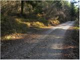 2
2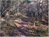 3
3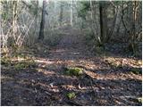 4
4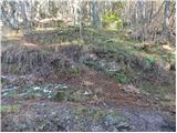 5
5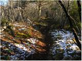 6
6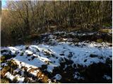 7
7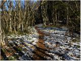 8
8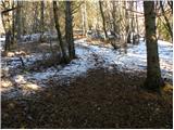 9
9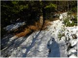 10
10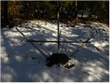 11
11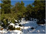 12
12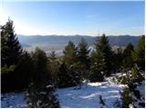 13
13 14
14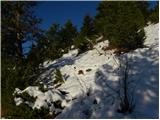 15
15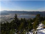 16
16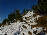 17
17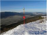 18
18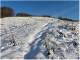 19
19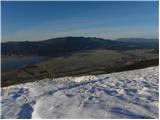 20
20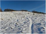 21
21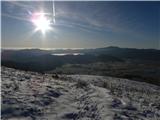 22
22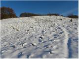 23
23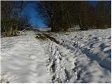 24
24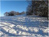 25
25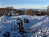 26
26 27
27
Discussion about the trip Martinjak - Slivnica
|
| novinsekp28. 09. 2009 |
Yesterday my husband and I walked this path. The path is really very steep, so from the starting point to the top we took 1:10  min, down we were in 25 minutes min, down we were in 25 minutes . Just to mention that the path to the starting point is very poorly marked or not marked at all. We had to ask locals to tell us where to go, because there are no signposts anywhere. . Just to mention that the path to the starting point is very poorly marked or not marked at all. We had to ask locals to tell us where to go, because there are no signposts anywhere.
|
|
|
|
| Tadeja745. 10. 2009 |
I was there recently and agree. The path to the starting point is not marked and I also had to ask locals to find it. Otherwise this is a great trip for young and old. In good weather meeting mouflons and foals is really wonderful. Well, for those not afraid of their proximity 
|
|
|
|
| akbara13. 12. 2009 |
Does anyone among you know well the approach to Slivnica from Otonica village, I'd ask for a description and posting. Once I headed from that side, but got lost soon because as far as I know, this trail isn't marked
|
|
|
|
| sk213. 12. 2009 |
The trail is not marked, but easy to follow. Usually I do a loop Begunje-Medvednica-hunting hut-Slivnica-Zatrepi-Brezje-Begunje.
At opportunity I'll post a picture.
|
|
|
|
| robi210714. 11. 2015 |
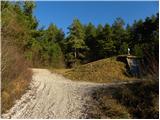
We walked it today. Regarding the marking of the starting point and the path itself, the above description and comments no longer hold today. The starting point is not hard to find. We chose the Martinjak bus stop from the Cerknica direction and proceeded along the asphalt road that descends the hill right opposite the stop. A red signpost a few meters above the intersection alerted us to the path start (it's also visible on Google Street View). The path led past some houses, after approx. 100 m we went from asphalt to gravel. After approx. 200 m we reached a fork and turned right onto the forest road. A few meters behind the water intake shown in picture 1, there is another red signpost directing us left steeply uphill to the forest trail. Further on, the path is excellently marked, and it's so well-trodden that it can be followed easily even without markers.
The path is indeed quite steep, but our almost 5-year-old managed it uphill with occasional slight assistance, completely. From the forest road junction to the hut we took approx. 1 hour 40 min. Down it required a bit more help, but it worked. So the path is no bogeyman. At the top we were rewarded with a beautiful view of Cerkniško polje, friendly staff served us tasty jota, strudel and pancakes. Very pleasant trip also for families with toddlers.
|
|
|
|
| kontiki18. 10. 2025 19:33:30 |
Coprniška jama. Is this really Coprniška jama or a collapsed Rupnik bunker?
|
|
|
|
| turbo18. 10. 2025 19:38:35 |
|
|
|
To post a comment you must log in:
If you do not yet have a username, you must first
register.