Starting point: Martinčev Rovt (1150 m)
| Latitude/Longitude: | 46,4718°N 14,0294°E |
| |
Walking time: 1 h 35 min
Difficulty: easy unmarked way
Elevation gain: 603 m
Elevation difference along the route: 603 m
Map: Karavanke - osrednji del 1:50.000
Recommended equipment (summer):
Recommended equipment (winter): ice axe, crampons
Views: 13.978
 | 2 people like this post |
Access to starting point:
From the Ljubljana–Jesenice motorway, take the Lipce exit (Hrušica also possible) and follow the road ahead towards Jesenice, where signs for Planina pod Golico direct us onto an ascending road (the turn-off is marked and located at the health centre in Jesenice). After an initial steeper ascent, the road brings us to a junction, where we turn left over the bridge towards Plavški Rovt. The steep road brings us into the village, and we follow it onwards to the point where the asphalt ends. Shortly after the village, the road descends slightly and brings us to a junction, where we take the left upper road. The road then brings us to a smaller hamlet, where we continue straight on the right side of the houses. We follow the road ahead to the next junction, where we park nearby (a larger parking lot is a few tens of metres back in the direction of travel).
Route description:
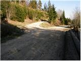
At the junction we take the left upper road, which ascends moderately. The road then goes past the barrier and soon after brings us to a meadow on the edge of which there is a pleasant spring. The road then goes into the forest and slowly turns into a cart track, which ascends more steeply. The cart track brings us out of the forest onto Jeseniška planina, where a nice view opens up on the slopes of Belščica and parts of the Julian Alps.
From the shepherd's hut on the mountain pasture, we continue upwards across the meadow (slightly left) along an initially poorly visible path. A little higher we will notice a path along which we then ascend. Occasionally we can spot some blazes, which are mostly already faded. After 20 minutes of ascent across the meadow, the path turns left into a short stretch of forest. The path then crosses the slopes of Klek towards the west through the forest. When we step out of the forest, we cross a somewhat awkward but in dry conditions not dangerous passage through the gully. Further on there are several paths that bring us to the hunting hut on Rožca in a few minutes.
From the hunting hut we immediately leave the marked path and continue the ascent along a less trodden path that brings us to the border ridge (direction north) in a few dozen steps. Here we continue right towards the east along the border line on a path that gradually starts to ascend more steeply along a path surrounded by dwarf pines. Higher up the path turns slightly left, levels out and brings us to the summit of Klek in a few more steps.
Starting point - Jeseniška planina 45 minutes, Jeseniška planina - Rožca 30 minutes, Rožca - Klek 20 minutes.

Photos:
 1
1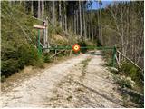 2
2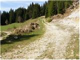 3
3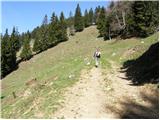 4
4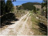 5
5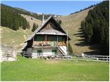 6
6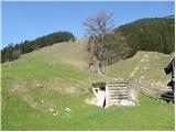 7
7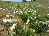 8
8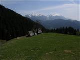 9
9 10
10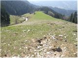 11
11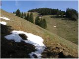 12
12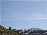 13
13 14
14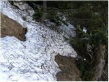 15
15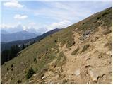 16
16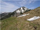 17
17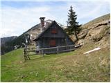 18
18 19
19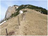 20
20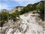 21
21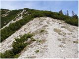 22
22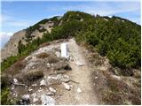 23
23 24
24
Discussion about the trip Martinčev Rovt - Klek
|
| Gost31. 10. 2007 |
Attractive excursion spot in all seasons. Also in winter when there is plenty of snow.
|
|
|
|
| Medvedka10. 05. 2008 |
On Thursday I visited Klek and was very satisfied with the trip. The whole path was accompanied by abundant flowers, which are really plentiful on this mountain. Recommended to all lovers of flowers and mountains. 
|
|
|
|
| grega_p26. 10. 2009 |
Excellent outing on a beautiful autumn day! At the summit caught the sunset over Škrlatica..
You can shorten the outing even more by the left road from the fork uphill, of course if the forest hut is open, as it was today..
|
|
|
|
| heinz26. 10. 2009 |
The forest hut is open from October to June, when there's no activity on the pastures.
Then you can drive to Molzišča by car, but it doesn't cost you much anyway, if you leave it at least at the bend before the hut.
(Around 4 pm you were ascending from the Rožca saddle towards the summit, on the scree below Klek two chamois were racing.. -you didn't see that)
Good luck!
|
|
|
|
| grega_p28. 10. 2009 |
Thanks Heinz,
this with the chamois is a big question mark?
Were you descending from Hruškov vrh or do you have a camera somewhere:-)?
Too bad about the chamois, I was just thinking that I haven't seen them anywhere for a long time..
Safe return!
|
|
|
|
| heinz28. 10. 2009 |
Yes, I went exactly from Hruškov vrh (locally Rožce), when I observed the mentioned thing. I was there yesterday too, when besides Hr.Vrh I also visited Koprivnjak (Malo Baba) and Dovška Baba. Again I ran into two chamois. Possibly even the same as on Sunday.
Otherwise in (western) Karavanke you can quite often encounter chamois, just that they are a bit more shy, because of which it's almost impossible (from my experience so far) to photograph them closer.
Good luck!
|
|
|
|
| J.P.13. 01. 2018 |
On 31.12.2017 there was too much snow on this path for crampons. The path was only for ski tourers and snowshoers.
|
|
|
|
| Majdag12. 07. 2019 |
Klek - We started the ascent at the end of the road, the bend before the cart track to Jeseniško planina. We drove by car through Plavški Rovt, the barrier is not locked. But due to numerous thunderstorms, the road is quite battered. Livestock is already grazing. At the Rožca saddle, a campsite with views. It's nice up there and not far.
https://jelenkamenmajdag.blogspot.com/2019/07/klek-petelinjek.html
|
|
|
|
| Jusk22. 06. 2020 |
Today I returned from Klek via this trail, up I went by road straight at the fork (left Jeseniški rovt). The road goes quite a while around Klek, ends and turns into a path, soon splits into straight or up and I went up the track, steeply up for a while along indistinct ridge. Midway crossed another track going flat along the slope, I continued up the track.. reached the top of Jeseniške planina meadows, few more minutes to Golica-Rožca path and to Klek summit. All paths ok, nice wind today
|
|
|
To post a comment you must log in:
If you do not yet have a username, you must first
register.