Markova raven - Planina Koren (unmarked way)
Starting point: Markova raven (980 m)
| Latitude/Longitude: | 46,29690°N 14,56180°E |
| |
Route name: unmarked way
Walking time: 1 h 50 min
Difficulty: easy unmarked way
Elevation gain: 695 m
Elevation difference along the route: 695 m
Map: Kamniške in Savinjske Alpe 1:50.000
Recommended equipment (summer):
Recommended equipment (winter): ice axe, crampons
Views: 5.098
 | 1 person like this post |
Access to starting point:
We drive to Kamnik and follow the road ahead towards the valley of Kamniška Bistrica. Just a few dozen meters before the bottom station of the cable car, a forest road branches off to the left downwards into the valley of Korošica. The road then crosses a bridge and soon after that comes to a crossroad, where we continue straight. The road then again brings us to a crossroad. Ahead we have two options: 1. We turn left over the bridge and ascend along the road upwards. We follow this road to a smaller parking lot at Markova raven. We recognize Markova ravan by the fact that by the road there is a smaller parking lot, a torrent and wide cart track which goes left upwards, and the road starts steeply descending. 2. We continue straight and ascend along the road which brings us to the next crossroad. We continue on the left road which becomes very steep and we follow it to the parking lot at the left turn from which wide cart track branches off straight. We park at the parking lot by the road.
Route description:
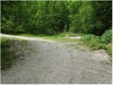
From the parking lot, we go on a wide cart track which after a few dozen meters brings us to the next parking lot. Over the parking lot we continue straight and we are then ascending on a cart track which turns left. After a few minutes of walking, the cart track has a crossing, where we go on the right marked cart track. We follow it a few minutes to the spot, where the footpath branches off to the right towards Krvavec and mountain pasture Koren. The turn-off isn't specifically marked so we have to carefully follow the blazes. The path ahead is ascending on the right side of the torrent quite steeply upwards. The path then brings us to a crossing, where we continue right in the direction of "ZA VRATA". The path ahead slowly passes into less dense forest so that in parts we cross some smaller meadow or even short scree. Views are also becoming increasingly beautiful. Further, the path brings us below the foot of a shorter wall from which right upwards unmarked path branches off to the mountain pasture Koren (straight marked path). We go on the right path which starts to ascend diagonally on the scree, which is partly vegetated with grass. After a few minutes, the path turns slightly to the right and crosses an indistinct already partly vegetated torrent. Immediately after that the footpath brings us into a strip of forest. Here is a crossing of two unmarked paths. Left poorly visible one which we go on leads to the mountain pasture Koren, and right (straight), which is a little better, leads to the cave Medvedja jama. Our left path is then ascending through the forest upwards and after a few minutes brings us into a smaller valley. In parts quite overgrown and poorly visible footpath leads us on the bottom of the valley by a torrent. The path is getting worse and again brings us to a crossing, which we barely notice. We go to the left very overgrown footpath which through dwarf pines, a little further through a meadow brings us to the mountain pasture Koren.
PP: Orientation is difficult and I advise against access by this path in fog.

Photos:
 1
1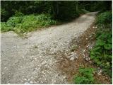 2
2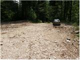 3
3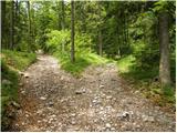 4
4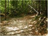 5
5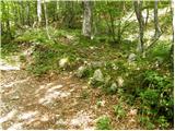 6
6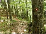 7
7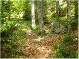 8
8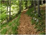 9
9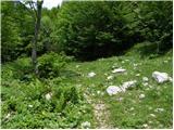 10
10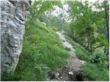 11
11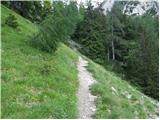 12
12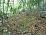 13
13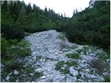 14
14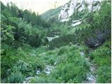 15
15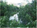 16
16 17
17
Discussion about the trip Markova raven - Planina Koren (unmarked way)
|
| pclop14. 06. 2020 |
I was on this trail a couple of days ago ... I have some doubts, because neither from the published photos nor from the description am I entirely sure this is really the trail, but probably there aren't many other options. Anyway, the trail from the junction to the fork (at the top of "grebenčka") is very clear, there on the grebenčku (at the top of serpentines over "melišču") where a larger rocky mass rises into the air on the right, the junction to the left is poorly visible. Perhaps the descent itself down toward Medvedji jami will alert someone, as it did me, that the trail is wrong.
From this less visible junction to the right the trail first goes among the trees, then up the gully, just before the top of the gully turn right and along a nice trail reach the edge, from where you soon spot planina Koren.
The trail is not very demanding, perhaps partially dangerous in wet weather due to the quite steep slopes, I used Google Maps for easier orientation.
It is a nice alternative to the marked trail, so go up this variant and down the marked one so as not to repeat too much. Good luck!
One more thing, around the junction from the official trail, on the maps the black dotted trail on this side is more accurate than that red line. Definitely the junction is a bit before the steps with water.
|
|
|
|
| pclop14. 06. 2020 |
"From this less visible junction to the right the trail first goes among the trees" - at this junction of unmarked trails you actually turn left and not right.
|
|
|
To post a comment you must log in:
If you do not yet have a username, you must first
register.