Markova raven - Košutna (marked way)
Starting point: Markova raven (980 m)
| Latitude/Longitude: | 46,2969°N 14,5618°E |
| |
Route name: marked way
Walking time: 2 h 50 min
Difficulty: partly demanding marked way
Elevation gain: 994 m
Elevation difference along the route: 1000 m
Map: Kamniške in Savinjske Alpe 1:50.000
Recommended equipment (summer): helmet
Recommended equipment (winter): helmet, ice axe, crampons
Views: 14.031
 | 3 people like this post |
Access to starting point:
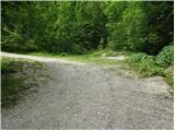
We drive to Kamnik and follow the road ahead towards the valley of Kamniška Bistrica. Only a few dozen meters before the bottom station of the cable car a forest road branches off to the left downwards into the valley of Korošica. The road then crosses a bridge and soon after that comes to a junction, where we continue straight. The road then again brings us to a junction. Ahead we have two options: 1. We turn left over the bridge and ascend along the road upwards. We follow this road to a smaller parking lot at Markova raven. We recognize Markova ravan by the fact that by the road there is a smaller parking lot, a torrent and a wide cart track which goes left upwards, and the road starts steeply descending. 2. We continue straight and ascend along the road which brings us to the next junction. We continue on the left road which becomes very steep and we follow it to the parking lot at the left turn from which a wide cart track branches off straight. We park on a parking lot by the road.
Route description:
From the parking lot, we head onto a wide cart track which after a few dozen meters brings us to the next parking lot. Across the parking lot we continue straight and then ascend along the cart track which turns left. After a few minutes of walking, the cart track has a junction, where we take the right marked cart track. We follow it for a few minutes to the spot where a footpath branches off to the right towards Krvavec and mountain pasture Koren. The turn-off is not specifically marked so we have to carefully follow the blazes. The path ahead ascends on the right side of the torrent quite steeply upwards. The path then brings us to a junction, where we continue right in the direction of ZA VRATA. The path ahead slowly transitions into less dense forest so that occasionally we cross a smaller meadow or even a short scree. Views also become increasingly beautiful. Further, the path brings us below the foot of a shorter wall from which to the right upwards an unmarked path branches off to mountain pasture Koren. We continue on the left side of the wall slightly upwards. The path ahead slightly descends and brings us to a pleasant spring. The path ahead goes to the left side of the spring and starts ascending again. The path ahead crosses a shorter belt of dwarf pines, then starts ascending on grass. Further the path is harder to follow as it quickly disappears among the grass but the rarer blazes will help us. After 20 minutes of ascent from the spring the path brings us to a wooden hut. The path behind the hut turns left into the forest and after a short ascent joins the path from Kriška planina (Krvavec). We continue sharply right and without major ascent or descent cross a belt of forest. Further the path starts ascending on slopes which are overgrown with dwarf pines and some trees. After 20 minutes of ascent the steepness eases and ahead we spot the shepherd hut on mountain pasture Koren. The path then descends past the watering place for animals to the shepherd hut on the mountain pasture.
Here at the hut slightly to the right (southeast direction) a path branches off which leads to mountain pasture Košutna. The path first crosses the slopes almost horizontally, then brings us to a technically demanding spot. The path ascends steeply over a shorter rocky step, where fixed protections assist us. The path then levels out and past a cross brings us to mountain pasture Košutna, where there is a chapel and shepherd station.
From the mountain pasture we continue on a poorly trodden path which goes on the left side of the chapel among dwarf pines. The path ahead ascends slightly on a moderately steep and panoramic slope of Košutna. When the path completely levels out a path to the summit of Košutna branches off to the right (the turn-off is marked, but the path is wrongly marked). We follow this very poorly visible path all the way to the summit which we reach after 15 minutes of further walking (we stick to left passages, although the blazes in the lower part direct us right).
The path is marked but in places harder to follow. If we lose the path we look for a passage among dwarf pines and take care not to get entangled in dwarf pines.
Markova raven - planina Koren 2:00, planina Koren - Košutna 50 minutes.

Photos:
 1
1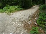 2
2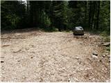 3
3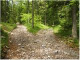 4
4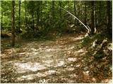 5
5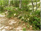 6
6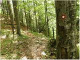 7
7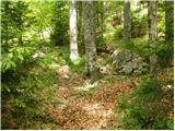 8
8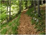 9
9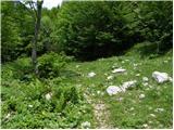 10
10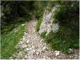 11
11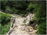 12
12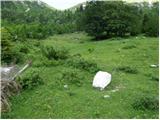 13
13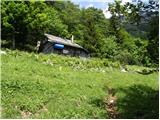 14
14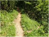 15
15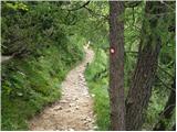 16
16 17
17 18
18 19
19 20
20 21
21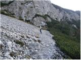 22
22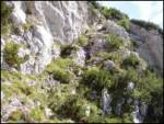 23
23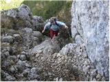 24
24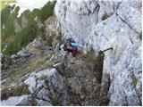 25
25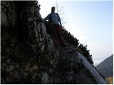 26
26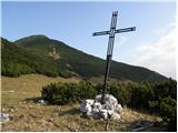 27
27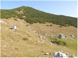 28
28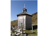 29
29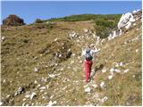 30
30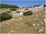 31
31 32
32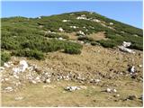 33
33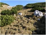 34
34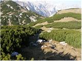 35
35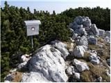 36
36
Discussion about the trip Markova raven - Košutna (marked way)
|
| grega_z_brega26. 10. 2015 |
Yesterday I headed to Košutna from Markova raven.
For starters, the left road is in better condition than the right, there's a fallen tree across it, but no obstacle for a lower car.
Anyway, the weather was fantastic, warm and lots of hikers in the mountains. To avoid crowds I turned right in the scree short before the water troughs onto unmarked path past Dedec.
The path is picturesque offering nice views and of course no living soul.
More in pictures.
...once I sort them..
|
|
|
|
| Kman5. 04. 2021 16:22:55 |
Hello,
today on the descent (presumably somewhere near the hut - 14th photo) I lost classic crampons Black Diamond Serac. If anyone found them, please write/call 070771324.
Thanks in advance.
|
|
|
|
| Spelcarocket9. 06. 2023 18:05:18 |
Very nice and solitary path. However, the road (left after the fork) is very bad and I do not recommend it for non-off-road vehicles.
|
|
|
To post a comment you must log in:
If you do not yet have a username, you must first
register.