Markova raven - Kompotela (marked way)
Starting point: Markova raven (980 m)
| Latitude/Longitude: | 46,2969°N 14,5618°E |
| |
Route name: marked way
Walking time: 3 h
Difficulty: easy marked way
Elevation gain: 1009 m
Elevation difference along the route: 1050 m
Map: Kamniške in Savinjske Alpe 1:50.000
Recommended equipment (summer):
Recommended equipment (winter): ice axe, crampons
Views: 27.066
 | 2 people like this post |
Access to starting point:
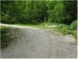
We drive to Kamnik and follow the road ahead towards the valley of Kamniška Bistrica. Just a few dozen meters before the lower station of the cable car, a forest road branches off to the left downhill into the valley of Korošica. The road then crosses a bridge and soon after that comes to a junction, where we continue straight. The road then again brings us to a junction. Ahead we have two options: 1. We turn left over the bridge and ascend the road uphill. We follow this road to a smaller parking lot at Markova raven. We recognize Markova raven by the fact that by the road there is a smaller parking lot, a torrent and a wide cart track which heads left uphill, and the road starts steeply descending. 2. We continue straight and ascend the road which brings us to the next junction. We continue on the left road which becomes very steep and we follow it to the parking lot at the left bend from which a wide cart track branches off straight. We park on a parking lot by the road.
Route description:
From the parking lot, we head onto a wide cart track which after a few dozen meters brings us to the next parking lot. Across the parking lot we continue straight and further ascend along the cart track which turns left. After a few minutes of walking, the cart track has a junction, where we take the right marked cart track. We follow it for a few minutes to the place where to the right a footpath branches off towards Krvavec and mountain pasture Koren. The branch-off is not specifically marked so we must carefully follow the blazes. The path ahead ascends along the right side of the torrent quite steeply uphill. The path then brings us to a junction, where we continue right in the direction of ZA VRATA. The path ahead slowly transitions into a less dense forest so that occasionally we cross a smaller meadow or even a short scree. The views also become increasingly beautiful. Further on the path brings us below the foot of a shorter wall from which to the right uphill an unmarked path branches off to mountain pasture Koren. We continue along the left side of the wall slightly uphill. The path ahead descends slightly and brings us to a pleasant spring. The path ahead goes to the left side of the spring and starts ascending again. The path ahead crosses a shorter strip of dwarf pines, then starts ascending through grass. Further on the path is harder to follow as it quickly disappears among the grass but the sparser blazes will help us. After 20 minutes of ascent from the spring the path brings us to a wooden hut. The path behind the hut turns left into the forest and after a short ascent joins the path from Kriška planina (Krvavec). We continue sharply right and without major ascent or descent we cross a strip of forest. Further the path starts ascending the slopes which are overgrown with dwarf pines and a few trees. After 20 minutes of ascent the steepness eases and ahead of us we see the shepherd hut on mountain pasture Koren. The path then past the watering place for animals descends to the shepherd hut on the mountain pasture.
Here our path continues slightly left (slightly right mountain pasture Košutna) across meadows along the valley bottom (the path is initially poorly visible). The path then becomes increasingly steep and after less than 30 minutes of walking brings us to a smaller pond, where there is a poorly marked junction. We continue straight (right Košutna) and follow the gentle path to the next junction, where we continue on the right path in the direction of Kompotela (left Vrh Korena). From here orientation is somewhat harder, and in fog very difficult. The path ahead slowly starts to ascend gently along the grassy slope overgrown with dwarf pines. The path then in beautiful views brings us to the summit of Kompotela.
Markova raven - mountain pasture Koren 2:00, mountain pasture Koren - Kompotela 1:00.

Photos:
 1
1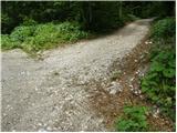 2
2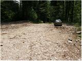 3
3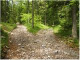 4
4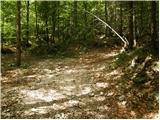 5
5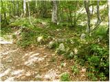 6
6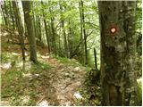 7
7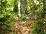 8
8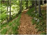 9
9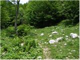 10
10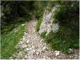 11
11 12
12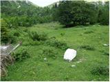 13
13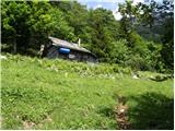 14
14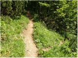 15
15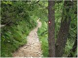 16
16 17
17 18
18 19
19 20
20 21
21 22
22 23
23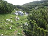 24
24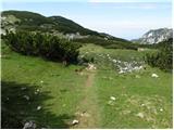 25
25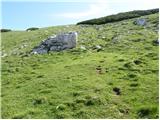 26
26 27
27
Discussion about the trip Markova raven - Kompotela (marked way)
|
| fpetel128. 05. 2011 |
Around Krvavec you really have to watch the markings. I've been on this path several times already. Past Mokriška jama on pathless terrain in good weather there are no problems - but here you really have to watch out not to stray from the path.
|
|
|
|
| abes2. 12. 2011 |
Yesterday visited Kompotela, approach direction Markova raven, I turned right onto the hunting path towards planina Košutna, below the summit I got a bit off track, but successfully "forded" the junipers.  Nice, steep path, but only in dry weather! I returned via the marked path back to the valley. Views yesterday fantastic, sea of fog, ... Nice, steep path, but only in dry weather! I returned via the marked path back to the valley. Views yesterday fantastic, sea of fog, ...
|
|
|
|
| atena8527. 12. 2011 |
The access road to the starting point is circular - if we go in the direction of 1. variant (see above access to starting point) the road from that direction is somewhat longer, but gentler, scenic and perhaps in slightly better condition. If we don't go left over the bridge but straight, variant 2, the road is somewhat steeper but you arrive sooner.
Otherwise the path is very beautiful, much nicer than the adjacent one to Kriška planina (Krvavec) and less steep. From planina Koren there are also quite a few options further (Kompotela, Mokrica, vrh Korena, Košutna).
|
|
|
|
| Hribovc9127. 03. 2022 22:54:19 |
27.3.2022 - The road (1st variant) is not in very good condition (2nd variant would be even worse). With higher clearance cars or smaller cars (Clio) it's still okay, otherwise I don't recommend. Lots of falling, sharp stones on the road. The hiking trail from Markova raven onwards is very nice anyway. Maybe it's better to leave the car a bit lower and do a couple hundred meters more elevation.
|
|
|
|
| frover8. 10. 2022 05:55:44 |
Yesterday we walked this trail. The road, variant 2, is nice, passable even for lower cars, variant 1 however much worse. The trail is very nice, well trodden and nicely marked. Never any doubt about orientation. Thanks to the trail markers At the top beautiful vistas.
|
|
|
To post a comment you must log in:
If you do not yet have a username, you must first
register.