Marija Reka (Strgarjev kamnolom) - Dom pod Reško planino
Starting point: Marija Reka (Strgarjev kamnolom) (350 m)
| Latitude/Longitude: | 46,2112°N 15,0913°E |
| |
Walking time: 1 h 30 min
Difficulty: easy marked way
Elevation gain: 314 m
Elevation difference along the route: 350 m
Map: Posavsko hribovje - zahodni del 1:50.000
Recommended equipment (summer):
Recommended equipment (winter): ice axe, crampons
Views: 7.056
 | 1 person like this post |
Access to starting point:
We leave the Štajerska highway at the Šentrupert exit, then follow the signs for Prebold and further signs for Podmejo and Trbovlje. Further, we drive through the Reka valley, and the starting point is located approximately 2300 meters ahead from the sign marking the beginning of the Marija Reka settlement. It is recognizable by a small parking lot by the road, situated about 10 meters before the start of the path, where we notice red hiking signposts.
Route description:
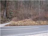
From the parking lot, we first walk across the main road to the start of the footpath, a cart track, then ascend on the path toward Dom pod Reško planino, which leads into the forest (past the former quarry on the left side). Then the path a little ahead from the quarry turns to the left and steeply ascends on a poorly trodden but marked footpath which is very slippery when wet!. The still poor and overgrown path, a little higher, leads us to a signpost (Prebold straight ahead, Golava and Mrzlica back), where we turn left onto a marked path over a small ridge. After the ridge, the path begins to steeply ascend again on a poorly trodden marked path, which brings us to a meadow. We continue across the meadow, where we reach a house and a hayrack, on which there is a stamp for Gradišče!
We continue along the macadam road to the chapel, where we join the usual path from Prebold. From the asphalt road, a footpath branches off upward, quickly turning into a cart track. This path, which first slightly descends, then slightly ascends, we follow all the way to the mountain hut Dom pod Reško planino.

Along the route: Podbregar (701m)
The trip can be extended to the following destinations: Reška planina
Photos:
 1
1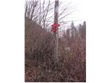 2
2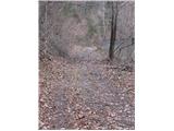 3
3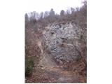 4
4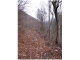 5
5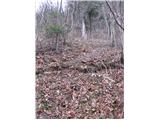 6
6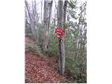 7
7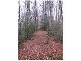 8
8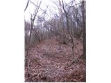 9
9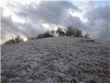 10
10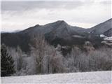 11
11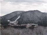 12
12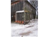 13
13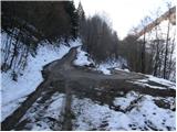 14
14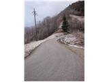 15
15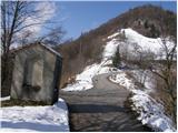 16
16 17
17 18
18 19
19 20
20 21
21 22
22 23
23 24
24 25
25
Discussion about the trip Marija Reka (Strgarjev kamnolom) - Dom pod Reško planino
|
| caniggia6. 02. 2012 |
WELCOME SAVINJA PEOPLE AND ALL OTHER HILL WALKERS TO A HIKE TO MARIJA REKA, ONE OF THE POSSIBLE PATHS IS ALSO (ŠD. MARIJA REKA-DOM POD REŠKO PLANINO), BEAUTIFUL VIEW OF VELIKA REKA AND MRZLICA. LP.
|
|
|
|
| Hribovc887. 02. 2012 |
You are kindly invited to an ORTHOGRAPHY COURSE   
|
|
|
|
| jprim7. 02. 2012 |
Well, the men's world criticizes each other too - regarding spelling, I mean. - regarding spelling, I mean.
LP!
|
|
|
|
| seinfeld16. 06. 2021 14:49:50 |
The trail is well marked, nevertheless you need to carefully follow the markers because due to overgrowth you can easily miss the direction.
|
|
|
To post a comment you must log in:
If you do not yet have a username, you must first
register.