Marija Reka (Strgar) - Mrzlica (permanently closed path)
Starting point: Marija Reka (Strgar) (450 m)
| Latitude/Longitude: | 46,2079°N 15,0884°E |
| |
Route name: permanently closed path
Walking time: 2 h 30 min
Difficulty: easy marked way
Elevation gain: 672 m
Elevation difference along the route: 720 m
Map: Posavsko hribovje - zahodni del 1:50.000
Recommended equipment (summer):
Recommended equipment (winter): ice axe, crampons
Views: 23.632
 | 3 people like this post |
Access to starting point:
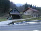
From the Ljubljana–Celje highway, take the exit Šentrupert (from Ljubljana) or Šempeter (from Celje) and continue driving in the direction of Prebold and Trbovlje. After Prebold, the road brings us to the village of Marija Reka, where we continue driving along the stream. When we notice the mountain signposts on the left side of the road (they are located across a small bridge, on the other side of the stream by the edge of a house), we park on the parking lot by the road (the parking lot is located 100 m before the beginning of the path, and another parking lot is 500 m above the beginning of the path).
Route description:
The described path, due to passage through private land, is no longer passable. The new beginning of the path is located slightly lower along the road near Strgar's quarry.
From the parking lot, we first walk along the main road to the start of the footpath, cross a small bridge and then, between two houses and gardens, ascend to the path that leads into the forest. The path, which ascends steeply, brings us already after a few dozen steps to a cart track, which we quickly leave as the blazes direct us right upward onto a poorly trodden but marked path. The still bad and overgrown path then brings us a little higher to a decaying house. Before the house, the path turns left (poorly marked) and ascends diagonally above it. After approximately half an hour of walking, we come to a farm, where there is a junction.
We continue right in the direction of Mrzlica on a cart track that, without major changes in elevation, after a few minutes brings us to an asphalt road. We follow this road for about 5 minutes to the place where a footpath branches off to the left upward. The path soon brings us to a farm, where we continue left upward on a poorly marked path to another farm. Further, we ascend diagonally across a panoramic meadow to the forest, where the steepness eases. The path further brings us to a road, where we continue in the direction of Mrzlica (left Golava). After a few minutes, we leave the road and continue the ascent on a cart track in the direction of Mrzlica. Soon we come back to the road, where we continue left upward and follow it to the end. From the end of the road, we continue left upward on a poorly marked cart track. After a half-hour ascent from the end of the road, we come to an extensive grassy ridge, where we again reach the road. Here we continue left upward and follow the gentle road all the way to the mountain hut on Mrzlica.
From the hut to the top, we have less than 5 minutes of ascent.

Photos:
 1
1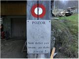 2
2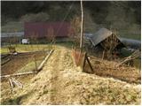 3
3 4
4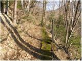 5
5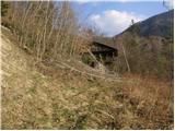 6
6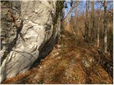 7
7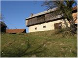 8
8 9
9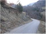 10
10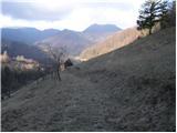 11
11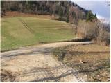 12
12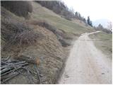 13
13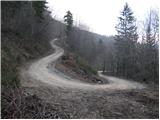 14
14 15
15 16
16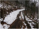 17
17 18
18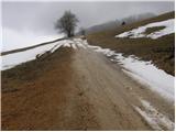 19
19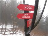 20
20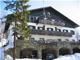 21
21 22
22
Discussion about the trip Marija Reka (Strgar) - Mrzlica (permanently closed path)
|
| iztok15. 03. 2008 |
We extended the path today to Kalški hrib, descended to the hut and returned via Zg. Lemeška. Nice circular path, which partly follows the partisan path . Highly recommended . Highly recommended
|
|
|
|
| IvoK6. 10. 2012 |
The starting point is no longer valid. A barn has a sign stating that passage is prohibited because it is private property. The markings have also been erased. We looked for another starting point nearby and then gave up and drove to Podmeja, from where we then went to Mrzlica.
|
|
|
|
| di6. 05. 2015 |
Poorly recognizable or visible path; not really recommended for "non-locals".
|
|
|
|
| eva148817. 07. 2017 |
The starting point is now in the direction Prebold - Marija Reka about 100 meters before the house in the picture. Across the stream there is a wooden footbridge, the path then goes uphill, so no need to wander through people's plots.
The trail itself is very poorly marked in some sections... We reached Mrzlica in two hours, spending about half an hour getting lost.
|
|
|
To post a comment you must log in:
If you do not yet have a username, you must first
register.