Starting point: Maribor (275 m)
| Latitude/Longitude: | 46,564°N 15,6481°E |
| |
Walking time: 30 min
Difficulty: easy marked way
Elevation gain: 151 m
Elevation difference along the route: 165 m
Map: Pohorje 1:50.000
Recommended equipment (summer):
Recommended equipment (winter):
Views: 4.698
 | 4 people like this post |
Access to starting point:
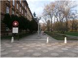
The start of the path can be practically in the center of the city at the beginning of the city park by the sign for the path over Kozjak or anywhere in the park up to the Three Ponds.
With a car, take the Melje exit on the expressway through Maribor and continuing by the railway station, at the first intersection without traffic lights turn left onto Tomšičeva ulica, also known as the avenue in the direction of Ribniško selo, and somewhere by the park we park the vehicle.
Route description:
At the beginning of the city park, at the sign "Pot čez Kozjak" or at the Three Ponds is the concrete start of the path. We simply follow the mountain path practically from urban Maribor through Ribniško selo. Halfway along Terčeva ulica the path over Kozjak turns right, while we continue straight to the end of the above-mentioned street where there are mainly row houses. At the intersection we turn left onto the walking path; right by the path are immediately the premises of KS Trije ribniki and the building of a closed grocery store. We continue in a gentle ascent upwards among houses and cottages, asphalt turns into well-compacted macadam and somewhere the summit with the chapel of St. Rozalija is mostly always in view. Before the chapel, where there is a nice viewpoint, we turn left and beside it continue through the forest higher up along a pleasant path to the highest point,...Samotni bor, the goal of the path. The summit is unmarked; it offers no views.
Photos:
 1
1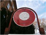 2
2 3
3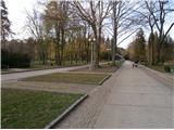 4
4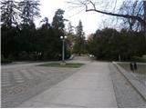 5
5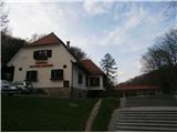 6
6 7
7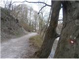 8
8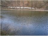 9
9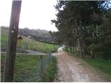 10
10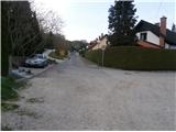 11
11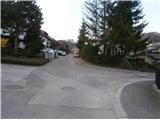 12
12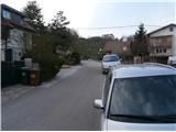 13
13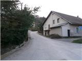 14
14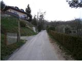 15
15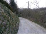 16
16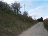 17
17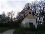 18
18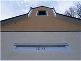 19
19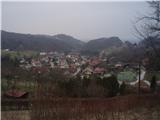 20
20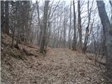 21
21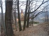 22
22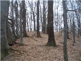 23
23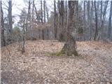 24
24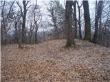 25
25
Discussion about the trip Maribor - Samotni bor
|
| martin49. 04. 2014 |
Hello,
it's no longer Ribniško selo, but Ribniško naselje!
regards
m4
|
|
|
|
| bruny10. 04. 2014 |
Since when!? Search engines don't (yet) recognize Ribniško naselje, probably completely new... Regards
|
|
|
|
| planika775. 09. 2015 |
Nice, thanks for the description, I didn't know this one, I'll go check out this little hill too! 
|
|
|
|
| bruny5. 09. 2015 |
Thanks... This description is my modest contribution/tribute to the Styrian metropolis - Maribor... I recommend three more continuations further into the world of Kozjak/Kobansko... Sv. Urban, Sv. Križ/Gaj above Maribor and Petnikov vrh. Maybe I'll add some more descriptions in the future, currently it's  this, this. Regards this, this. Regards
|
|
|
|
| bruny29. 12. 2019 |
Short walk from the town. From urban to something a bit less urban today but still very suburban... Nice greeting!
|
|
|
|
| PoloncaM18. 02. 2020 |
I'll write here too :-) This is the chapel of St. Anne and not St. Rosalia. Next time I'll check where this Samotni bor is. Otherwise Samotni bor is beautiful, a hidden peak with a nice view of Pohorje.
|
|
|
|
| Ninđa19. 02. 2020 |
@PoloncaM, Samotni bor has no view of Pohorje since the summit itself is surrounded by trees. The view of Pohorje is on the northern side, near the abandoned vineyards. Otherwise, @bruny is right about the name. It is indeed Rozalija's chapel.
Lp, Nino
|
|
|
|
| PoloncaM19. 02. 2020 |
In winter there is a view, in summer really not. If you don't believe me about the chapel's naming, ask the Franciscans who take care of it: https://www.bazilika.info/
|
|
|
|
| Ninđa19. 02. 2020 |
There is no view even in winter I'm up there at least once a week 
Lp, Nino
|
|
|
|
| bruny27. 11. 2022 14:41:44 |
Today to the point/chapel in photo 18 and back...
|
|
|
|
| bruny16. 04. 2025 13:56:27 |
Today along the described route to point/picture number 18 and back in the broader context of the path...
|
|
|
To post a comment you must log in:
If you do not yet have a username, you must first
register.