Mallnitz - Kleine Ankogel
Starting point: Mallnitz (1215 m)
| Latitude/Longitude: | 47,0148°N 13,1853°E |
| |
Walking time: 6 h 30 min
Difficulty: partly demanding marked way
Elevation gain: 1881 m
Elevation difference along the route: 1930 m
Map:
Recommended equipment (summer):
Recommended equipment (winter): ice axe, crampons
Views: 6.116
 | 2 people like this post |
Access to starting point:
From Spittal we drive towards Lienz, but only to the settlement Möllbrücke. In the mentioned settlement we notice signs for Mallnitz and the alpine road to Großglockner. We follow this road to the settlement Obervellach, where signs for Mallnitz point us to the right. Behind the village, the road starts ascending steeper and after a few kilometers of ascent brings us to the alpine town Mallnitz. We then drive a few more kilometers to the lower cableway station on Ankogel (Ankogelbahn), where we park on a large parking lot.
Route description:
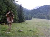
At the end of the parking lot, we will notice signposts on the left side of the road, which direct us left onto the ski slope. The path then ascends quite steeply along the ski slope and occasionally also runs through the forest or along the mountain road. If we stray from the marked path somewhere along the way, we can also follow the mountain road or ski slope. After a good hour of walking from the starting point, we arrive at the intermediate cableway station, where there is also the hut Hochalmblick.
A little above the hut are signposts that direct us ahead along the ski slope. The path first runs along the grassy slopes on the left side of the cableway, then turns slightly to the right and brings us across a few streams to the right side of the cableway. The path then ascends parallel to the cableway towards the saddle Etschlsattel (2546m). A little before the saddle, the path from the hut Mindener Hütte also joins us from the left. At the saddle, we turn left and only a short ascent to the upper cableway station follows.
From the upper station we continue straight in the direction of Hannoverhaus, while to the right a direct and a few minutes shorter path leads towards Ankogel. From the upper cableway station we have about 15 minutes of ascent to the hut.
At the hut we follow the signs for Ankogel. First we descend slightly to a smaller saddle where we turn right, the left path leads towards the peaks Grauleiten and Plattenkogel. A few meters below the saddle we reach a junction again where the direct path from the upper cableway station joins us from the right. This time we go left and then cross the southern slopes below the aforementioned peaks in a gentle descent. When we reach the signposts we continue straight in the direction of Ankogel. After a few minutes of walking we reach signposts again where we turn left following the signs for Ankogel. After a short ascent on a relatively gentle slope, the path turns slightly to the left and begins to ascend along the glacier Lassacher Kees. The glacier is relatively gentle and has no crevasses. The path then turns left again and ascends towards the notch Radeck Scharte. At the notch we turn right and along the rocky ridge reach the summit of Kleine Ankogel. The ridge from the notch to the summit is slightly exposed in a few places but when dry it causes no difficulties.

The trip can be extended to the following destinations: Ankogel
Photos:
 1
1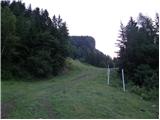 2
2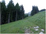 3
3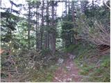 4
4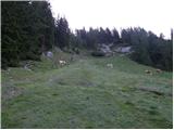 5
5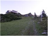 6
6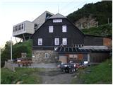 7
7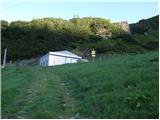 8
8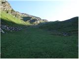 9
9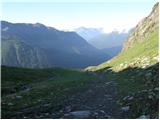 10
10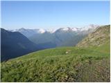 11
11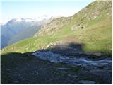 12
12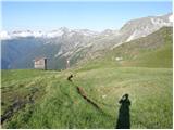 13
13 14
14 15
15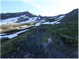 16
16 17
17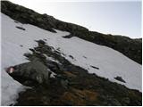 18
18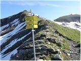 19
19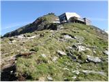 20
20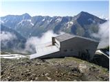 21
21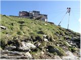 22
22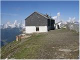 23
23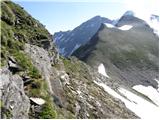 24
24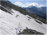 25
25 26
26 27
27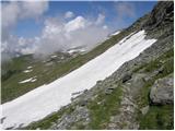 28
28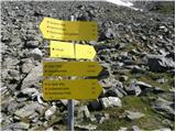 29
29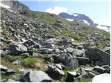 30
30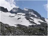 31
31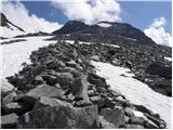 32
32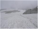 33
33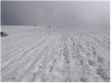 34
34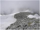 35
35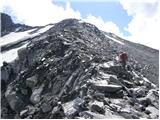 36
36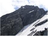 37
37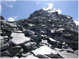 38
38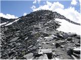 39
39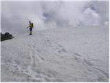 40
40
Discussion about the trip Mallnitz - Kleine Ankogel
To post a comment you must log in:
If you do not yet have a username, you must first
register.