Starting point: Mallnitz (1215 m)
| Latitude/Longitude: | 47,0148°N 13,1853°E |
| |
Walking time: 7 h
Difficulty: difficult marked way
Elevation gain: 2037 m
Elevation difference along the route: 2100 m
Map:
Recommended equipment (summer): helmet
Recommended equipment (winter): helmet, ice axe, crampons
Views: 22.798
 | 4 people like this post |
Access to starting point:
From Spittal we drive towards Lienz, but only to the settlement Möllbrücke. In the mentioned settlement we notice signs for Mallnitz and the alpine road to Großglockner. We follow this road to the settlement Obervellach, where signs for Mallnitz point us to the right. Behind the village, the road starts ascending steeper and after a few kilometers of ascent brings us to the alpine town Mallnitz. We then drive a few more kilometers to the lower cableway station on Ankogel (Ankogelbahn), where we park on a large parking lot.
Route description:
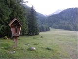
At the end of the parking lot, we will notice signposts on the left side of the road, which point us to the left onto the ski slope. The path then ascends quite steeply on the ski slope and occasionally runs also through the forest or on the mountain road. If somewhere on the path we go astray from the marked path we can also follow the mountain road or ski slope. After a good hour of walking from the starting point, we get to the midway cableway station where there is also the mountain hut Hochalmblick.
A little above the mountain hut are signposts, which point us ahead on the ski slope. The path at first runs on grassy slopes on the left side of the cableway, and then turns slightly to the right and over some streams brings us on the right side of the cableway. The path is then ascending parallel with the cableway towards the saddle Etschlsattel (2546m). A little before the saddle from the left also joins the path from the mountain hut Mindener Hütte. On the saddle, we go left and only a shorter ascent to the upper station of the cableway follows.
From the upper station, we continue straight in the direction of Hannoverhaus, and to the right runs a direct and a few minutes shorter path towards Ankogel. From the upper station of the cableway we have to the hut approximately 15 minutes of ascent.
At the mountain hut, we follow the signs Ankogel. First, we descend a little to a smaller saddle where we go right, left path runs towards the peaks Grauleiten and Plattenkogel. A few meters below the saddle we come again to a crossing where from the right joins the direct path from the upper station of the cableway. This time we go left and then in a gentle descent cross south slopes below mentioned peaks. When we come to the signposts we continue straight in the direction towards Ankogel. After a few minutes of walking, we come again to the signposts where we go left following the signs Ankogel. After a short ascent on a relatively gentle slope, the path turns slightly to the left and starts ascending by glacier Lassacher Kees. The glacier is relatively gentle and doesn't have cracks. After that, the path again turns to the left and it ascends towards the notch Radeck Scharte. On the notch, we go to the right and on a rocky ridge we reach the peak Kleine Ankogel. The ridge from the notch towards the summit is on some spots slightly exposed but dry it doesn't cause problems.
From the top, we go to the left and we continue on the main ridge. The path towards the summit Ankogel then runs by the right side of the ridge and becomes a little more demanding. Eastern slope of Ankogel on which we are ascending is quite steep and on some spots also dangerous for slipping. We also have to be careful, because granite plates on which we are ascending are not all very stable. Towards the summit path then turns slightly to the left and it brings us to the cross and inscription box. We reach the real peak if from the cross we continue a few dozen meters on exposed ridge.

Photos:
 1
1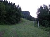 2
2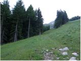 3
3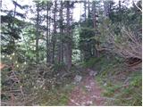 4
4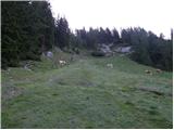 5
5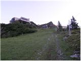 6
6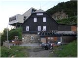 7
7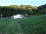 8
8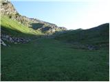 9
9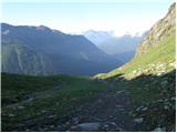 10
10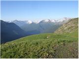 11
11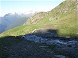 12
12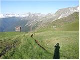 13
13 14
14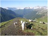 15
15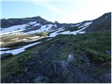 16
16 17
17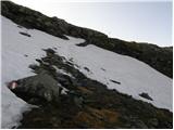 18
18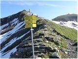 19
19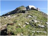 20
20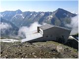 21
21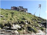 22
22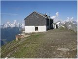 23
23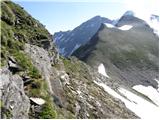 24
24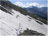 25
25 26
26 27
27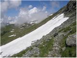 28
28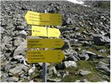 29
29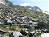 30
30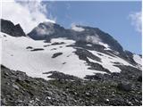 31
31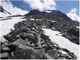 32
32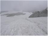 33
33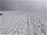 34
34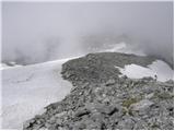 35
35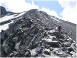 36
36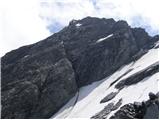 37
37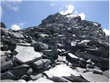 38
38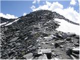 39
39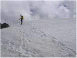 40
40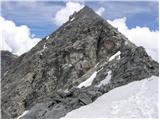 41
41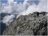 42
42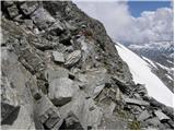 43
43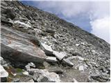 44
44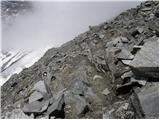 45
45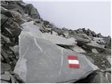 46
46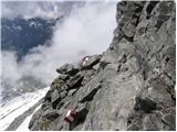 47
47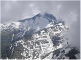 48
48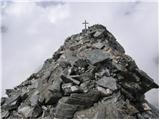 49
49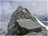 50
50
Discussion about the trip Mallnitz - Ankogel
|
| triglavski8. 07. 2008 |
Last year on September 25th, the weather didn't look promising, but since everything was already packed, I set off in the afternoon on the route Bovec - Trbiž - Spittal - Obervellach - Mallnitz. The evening in Mallnitz seemed quite rundown, so I went to rest soon. Based on the weather forecast that it would hold somehow at first, I started before 4 a.m. From the lower cable car station, I took the ski slope and partly the road towards the Hochalmblick hut (closed during the week) and of course continued right away. On the otherwise long path, I shortened it by observing the sky and cloud development as well as searching for markers. At first light, I reached the upper cable car station and detoured to the Hanoverhaus hut, which is a bit off the path. This one was also closed at that time, but I found a bivouac in the lower room intended only for emergencies, with 6-8 beds and a wood stove. To here 2h45m. Of course, I continued immediately on path 502, initially slightly downhill and around to the junction where path (520) finally turns uphill. Snow starts around 2600m, first just patches, above 2700m at the moraine edge it's continuous, but still possible on bare ground. The snow holds well, so walking is comfortable. The summit part was already covered in fog at that time, like the neighboring peaks, only clear down towards the valley. On Mali Ankogel, I put on crampons and swapped poles for an ice axe. I followed the tracks of predecessors from a few days ago, who pushed more into the bare rocks than stuck to the marked path, so I took my own way on the snow. Soon I reached the cross but continued a few meters along the ridge to the highest point. The path from the upper hut to the summit took me 2 hours. Then I returned to the cross, even the fog slowly cleared thanks to a light SE wind. After about half an hour stop on the summit, I turned in the opposite direction and by 13:30 I was already in the sunny valley. And on such a famous mountain that day, besides a few chamois and marmots, I didn't meet anyone.
|
|
|
|
| NEIC00825. 08. 2008 |
Isn’t it necessary to hire a guide to visit mountains in Austria?
|
|
|
|
| Mravlja19839. 07. 2009 |
Hello.
I'm interested in the mentioned tour. I'm curious about the glacier. Is it possible in summer to the summit without crampons and ice axe? It says that in summer it's not necessary but I'd rather check. And what about the helmet in Austria? Is it mandatory?
Thanks and regards
|
|
|
|
| čemšeničan9. 07. 2009 |
I was on Ankogel on 21.7.2007, that year winter wasn't generous with snow, but I still had crampons with me and didn't need either crampons or ice axe, crossing the glacier was possible without, but carefully, I was without helmet. For this year's ascent I recommend you take crampons and ice axe, because there's still a lot of snow in the high mountains, I think between little and big Ankogel it won't go without crampons and ice axe this year. For the helmet decide yourself, back then no one had it, neither we who were the only Slovenes on the summit that day nor the Austrian mountaineers. When you do the tour let me know. Good luck on the trail.
|
|
|
|
| nisa20. 07. 2010 |
Hello,
how much time does it take from Ljubljana to the lower cable car station, and how much from the upper station to the summit of Ankogel. If anyone has been there this year, please write to me what the conditions are like: snow etc...
Best regards!
|
|
|
|
| mmalok21. 07. 2010 |
From the upper station to the summit we took 2.5 hours on Saturday the 17th, crossing only one snowfield (glacier), which has a track and is not problematic, on the return you can use the glacier for descent (which concretely shortens the descent time). Conditions with pictures at http://www.pdmaticams-drustvo.si under photo album. I wish you at least the same conditions as we had.
LP
|
|
|
|
| VanSims29. 08. 2011 |
First cable car goes up at 8:30 in the morning, last one down at 16:00 (status August 2011).
The final ridge is technically demanding, exposed and by no means for those afraid of heights.
Nevertheless, I warmly recommend the tour to everyone who already has experience with demanding paths (not necessarily very demanding), but let this not be the first demanding path.
Regarding the glacier, we cross its upper remnant. Poles are very helpful, or we can go around on the rocks, but carefully (unstable, crumbly). Status: summer, 2011.
|
|
|
|
| Okmodko3. 09. 2011 |
What is the price of the cable car?
|
|
|
|
| VanSims4. 09. 2011 |
I also forgot to say that it doesn't operate on Monday and Tuesday
|
|
|
To post a comment you must log in:
If you do not yet have a username, you must first
register.