Makekova Kočna - Češka koča na Spodnjih Ravneh
Starting point: Makekova Kočna (925 m)
| Latitude/Longitude: | 46,3931°N 14,5009°E |
| |
Walking time: 2 h
Difficulty: partly demanding marked way
Elevation gain: 617 m
Elevation difference along the route: 650 m
Map: Kamniške in Savinjske Alpe 1:50.000
Recommended equipment (summer):
Recommended equipment (winter): ice axe, crampons
Views: 49.983
 | 2 people like this post |
Access to starting point:
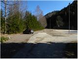
From the Ljubljana - Jesenice highway, we take the Kranj - East exit and follow the road ahead in the direction of Jezersko. At Jezersko by the bus stop, we turn right into the valley of Makekova Kočna (direction Čedca waterfall, Veliki vrh and Češka koča mountain hut). The road then crosses Jezernica over a bridge, and we, just a few meters further at the crossroads by the chapel, turn left towards the nearby sports field by which we park.
Route description:
From the parking lot, we return to the chapel, then for some time continue on the asphalt road which ascends through a panoramic meadow. Higher, the road passes along the edge of the forest, and at this spot we continue left in the direction of the Češka koča mountain hut and Zupan homestead (straight to Čedca waterfall and Veliki vrh). After 150 m the road at the mentioned farm ends, and we continue the ascent on a marked cart track, which quickly brings us to a somewhat larger clearing. Here the blazes direct us left onto the mountain path, on which in a few minutes we ascend to the nearby forest road. We follow the road to the left, and it soon makes a sharp right turn and then above a lonely house ascends even steeper. We continue on the road only for a short while, then the mountain direction sign for Češka koča directs us left onto an ascending cart track. We continue the ascent for some time on the cart track, and it higher crosses a quite ruined forest road. The cart track, which runs through the forest, gradually changes into a pleasant forest footpath, and it quickly brings us to a spring.
Above the spring the path ascends steeply, then turns a little to the right, where after a few minutes of further walking it joins the cart track. We continue straight on an occasionally quite panoramic path, and it higher passes into dense forest and brings us to the saddle Kačji rob.
Further, we continue in the direction of the Češka koča mountain hut almost levelly. After more than ten minutes of traversing we come to the difficult part of the path. The path crosses very steep slopes, which in wet are very dangerous for slipping, in dry do not cause bigger problems. The fence assists us, which is not exactly safe, just the sense of security is a little greater. After this part we join the path from the cableway to the Češka koča mountain hut. The path then soon comes out of the forest onto panoramic slopes, where fixed safety gear assists us, which is not strictly necessary. The increasingly panoramic path then over a ladder soon brings us into Mrzla dolina. Here through an indistinct little valley cold air descends. In the morning hours we can notice that at this spot it is a little colder (in windy weather there is no difference). Further follows only a few minutes of easy walking to the Češka koča mountain hut.

Photos:
 1
1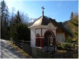 2
2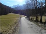 3
3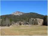 4
4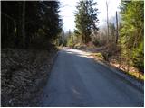 5
5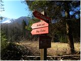 6
6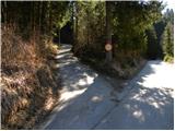 7
7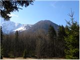 8
8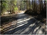 9
9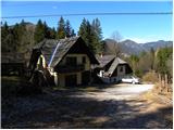 10
10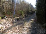 11
11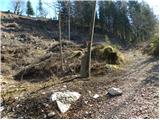 12
12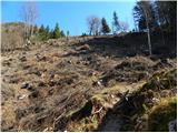 13
13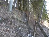 14
14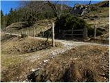 15
15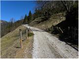 16
16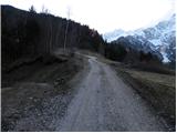 17
17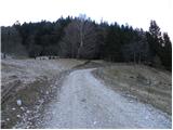 18
18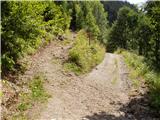 19
19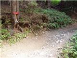 20
20 21
21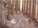 22
22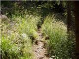 23
23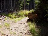 24
24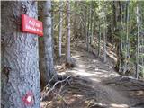 25
25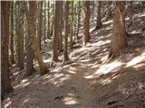 26
26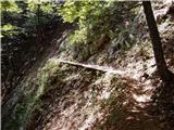 27
27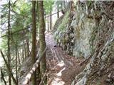 28
28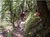 29
29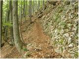 30
30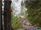 31
31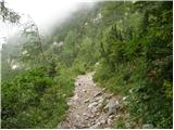 32
32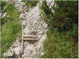 33
33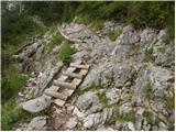 34
34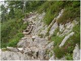 35
35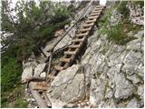 36
36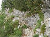 37
37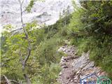 38
38 39
39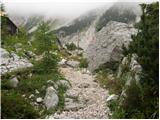 40
40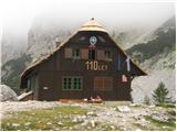 41
41
Discussion about the trip Makekova Kočna - Češka koča na Spodnjih Ravneh
|
| janko8716. 06. 2010 |
Does anyone know if there is on this site (hribi.net) a description of the path between Češka koča na Spodnjih Ravneh and Kranjska koča na Ledinah?
|
|
|
|
| Rokovnjacica31. 05. 2013 |
In a few days I'd like to go to the Češka koča. Please, can someone tell me if the path is suitable for a four-legged friend.
|
|
|
|
| John31. 05. 2013 |
My opinion is that the path is not suitable for a dog.
|
|
|
|
| ejti31. 05. 2013 |
If the dog is used to hiking, this path shouldn't pose any problem.
|
|
|
|
| Enka1. 06. 2013 |
The only problem could be the ladder in picture no. 36. Everything else is suitable for dogs accustomed to walking in the mountains.
|
|
|
|
| serajko1. 06. 2013 |
lp
Depends on the dog, if it has ever gone on a ladder there will be no problem. Ours is smaller and didn't hesitate at all. You can help it by holding it by the collar. But watch your balance.
|
|
|
|
| mojca844. 07. 2013 |
I'm wondering if the road from Makekova Kočna to Češka koča is maintained!?
Lp vsem 
|
|
|
|
| Mrki8. 08. 2014 |
The stated route description in the lower part from Zupan farm to the sharp right bend of the forest road no longer applies. The path at Zupan farm is routed left and steeply through the forest right above the stream and joins the forest road at the sharp bend. Not very pleasant!
|
|
|
|
| fantazija9. 08. 2019 |
Mrki, what do you mean by "not very pleasant"?
|
|
|
|
| georgia26. 06. 2021 12:43:08 |
Yesterday for the first time to the Češka koča via this trail.
With "not very pleasant" Mrki probably meant the actual steepness of this new section of the trail from Zupana to Makekov marof.
More important information is that the trail in the upper part (from Kačji rob to the junction with the trail from Štularjeva planina) is currently impassable due to fallen trees. There are notices about the trail condition on both sections. So we made a detour via Štularjeva planina (a bit down and up again). We then asked at the hut about passability and they don't recommend it, so we didn't even try, went back via the detour.
Otherwise, really pleasant, solitary and shady trail, which I recommend if you want to avoid the crowds at the parking lot in Ravenska kočna and on the trail itself! There could be a few more markers though.
We also went up to Visoki vrh along the way.
|
|
|
|
| mandeljc18. 05. 2023 14:39:27 |
Does anyone know what the situation is between Kačji rob and the junction with the path from Štularjeva planina? Is it normally passable yet?
|
|
|
|
| ločanka22. 05. 2023 06:24:24 |
It's passable, you do have to step over two fallen trees once, but a little further ahead they have been sawn. So it's actually resolved, and there are no major problems.
|
|
|
|
| mandeljc22. 05. 2023 09:07:26 |
Thanks ločanka for the information. I'll check it out in person as soon as possible.
|
|
|
|
| Kafetarca28. 06. 2023 14:30:43 |
Hello everyone, tomorrow I plan to go on this path. Is there somewhere in the pictures that part where it says there's a risk of slipping when wet?
|
|
|
To post a comment you must log in:
If you do not yet have a username, you must first
register.