Makekova Kočna - Čedca waterfall
Starting point: Makekova Kočna (945 m)
| Latitude/Longitude: | 46,3857°N 14,5043°E |
| |
Walking time: 1 h
Difficulty: easy marked way
Elevation gain: 405 m
Elevation difference along the route: 325 m
Map: Kamniške in Savinjske Alpe 1:50.000
Recommended equipment (summer): helmet
Recommended equipment (winter): helmet, ice axe, crampons
Views: 25.463
 | 1 person like this post |
Access to starting point:
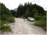
First, we drive to Preddvor or to the settlement Tupaliče (to here from the Gorenjska highway or Kranj), and then we continue driving in the direction of Jezersko. When we get to Zgornje Jezersko, on the part where the road flattens, we leave the main road and continue driving right in the direction of the ecological tourist farm Makek, Češka koča, Veliki vrh and the Čedca waterfall (we leave the main road before the Petrol gas station). Immediately after the turn-off from the main road, we first descend a little and then follow the road in the direction of the Makek farm. Further on, the road starts ascending, and we drive along it to a smaller crossroad, where to the left the road continues towards the Makek farm, and straight ahead continues the road which leads further past the turn-off of the path towards the Čedca waterfall and past the turn-off of the path to Veliki vrh. We park in an appropriate place near the crossroad, namely in such a way that we don't hinder frequent forestry work.
Route description:
From the parking lot, we continue on the right road, which slightly ascends through the forest. After a good 10 minutes of walking, we get to the sharp right turn where we notice signs for the Čedca waterfall. Here we continue left on a poorer road slightly downwards and follow it only a few meters to the next poorly marked junction. We continue right on a cart track, which moderately ascends and after a few minutes of ascent brings us to the marked turn-off of the path to the Čedca waterfall. Signs direct us to the left and the path after a few additional minutes brings us out of the forest onto slopes covered with dwarf pines. A gentle ascent follows among the dwarf pines with a nice view of the waterfall.
PS: Because of the great danger of falling stones (large rockfall in June 2008), we approach the waterfall only up to the spot where we are sure it is safe.
Photos:
 1
1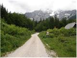 2
2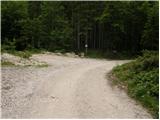 3
3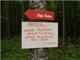 4
4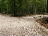 5
5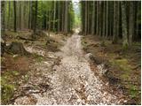 6
6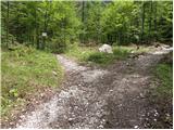 7
7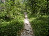 8
8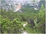 9
9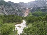 10
10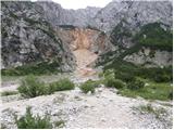 11
11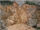 12
12
Discussion about the trip Makekova Kočna - Čedca waterfall
|
| Sam.volk9. 06. 2010 |
The 2008 landslide made a real mess. I visited it today. Markings poor. But worth looking at. Regards Franc
|
|
|
|
| velkavrh24. 05. 2015 |
Need to go see what the current condition is. Its primacy was taken by Kloma waterfall -128m in Trenta. It would be accessible only to alpinists.
|
|
|
To post a comment you must log in:
If you do not yet have a username, you must first
register.