Starting point: Mače (586 m)
| Latitude/Longitude: | 46,3131°N 14,4187°E |
| |
Walking time: 2 h 30 min
Difficulty: easy marked way
Elevation gain: 948 m
Elevation difference along the route: 950 m
Map: Karavanke - osrednji del 1:50.000
Recommended equipment (summer):
Recommended equipment (winter): ice axe, crampons
Views: 83.507
 | 6 people like this post |
Access to starting point:
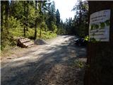
a) From the Ljubljana-Jesenice motorway take the Kranj-east exit, then continue driving towards Jezersko. Upon arriving in Preddvor, leave the main road and continue left towards the centre of the mentioned place, from there follow the signs for Mače. When arriving in Mače, at the marked junction continue right (left Bašelj, straight church of St. Nicholas (church not accessible by car)) and drive up the narrow road above the village, where there is a larger marked parking lot.
b) From the Jesenice-Ljubljana motorway take the Kranj-west exit and in the first junction continue left. Continue driving through the underpass under the motorway, then arrive at a roundabout, from which continue driving towards Golnik. The road ahead leads through the settlement Mlaka pri Kranju, but we, at the end of the settlement, continue right towards the settlement Srakovlje. Driving continues through Srakovlje, Spodnja Bela, Srednja Bela to Zgornje Bela, where we continue right towards Preddvor. In Preddvor we notice signs for Mače, which direct us left past the primary school to the road that climbs to Mače. When arriving in Mače, at the marked junction continue right (left Bašelj, straight church of St. Nicholas (church not accessible by car)) and drive up the narrow road above the village, where there is a larger marked parking lot.
Route description:
From the parking lot, return a few dozen steps back, i.e., to the road from which we drove to the parking lot and continue uphill along it in the direction of Dom na Kališču and Storžič. We walk along the road for just under half an hour, then at Studenci the path forks.
Choose the left path, along which there are signs for Kališče (right Srednji vrh), where we cross a stream, then immediately start ascending steeply. A few minutes higher we reach a forest road, which we also immediately leave and continue following the markers. We continue on the marked path that runs between two forest roads, higher up we ascend moderately in switchbacks for a while. Higher up we reach the forest road again, follow it uphill, after a minute leave it and head to the marked path, which brings us to a rest area and viewpoint with a bench in a few minutes of further ascent.
The path ahead returns to the forest and initially ascends gently, but the easy walk ends quickly as after crossing the forest road we start ascending in switchbacks through the forest again.
Here, even before we start ascending steeply, the path from Bašelj joins from the left, we then ascend in switchbacks on the steeper slope, where we cross the forest road several times, all the time following the markers. Higher up, we occasionally get nice views towards Gorenjska, followed by a somewhat longer traverse to the right. Later, at about 1330 m altitude, the path turns left and, with the exception of a few switchbacks, ascends to the left. When we leave the forest, we are already at the edge of Planina Kališče, a little further at the junction at Spodnje Kališče, where there are a few benches for rest.
When the path above Spodnje Kališče returns to the forest, the path from Laškega (also the path from Bašelj past Partizanska bolnica Košuta) joins from the left. A few more minutes of walking through the forest follow and we arrive at a nice viewpoint, from which a beautiful view opens towards the nearby Dom na Kališču, Mali Grintovec, the ridge of Lanež, Krvavec... From the viewpoint, only a short ascent follows and we are at Dom na Kališču.
Starting point - Studenci 0:25, Studenci - za Goro 0:40, za Goro - Spodnje Kališče 1:10, Spodnje Kališče - Dom na Kališču 0:15.

Photos:
 1
1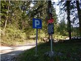 2
2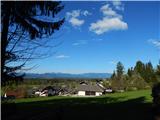 3
3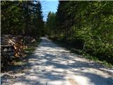 4
4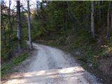 5
5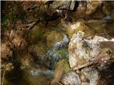 6
6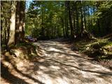 7
7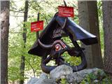 8
8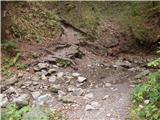 9
9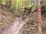 10
10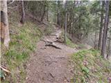 11
11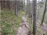 12
12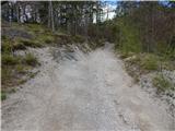 13
13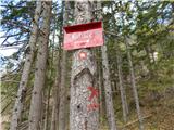 14
14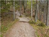 15
15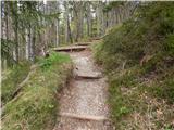 16
16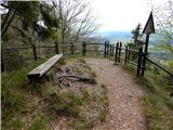 17
17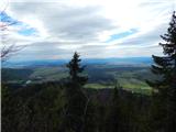 18
18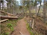 19
19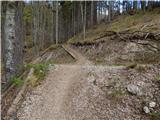 20
20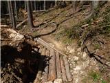 21
21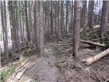 22
22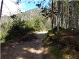 23
23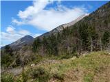 24
24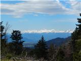 25
25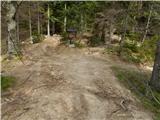 26
26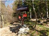 27
27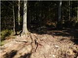 28
28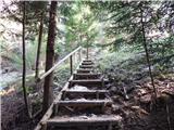 29
29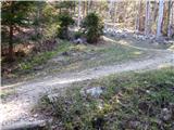 30
30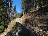 31
31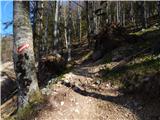 32
32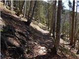 33
33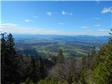 34
34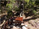 35
35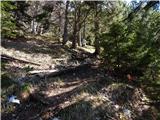 36
36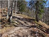 37
37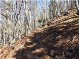 38
38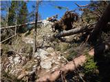 39
39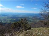 40
40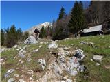 41
41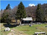 42
42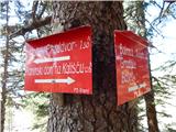 43
43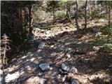 44
44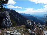 45
45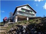 46
46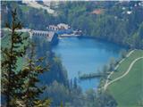 47
47 48
48 49
49
Discussion about the trip Mače - Dom na Kališču
|
| ljubica17. 08. 2006 |
The walk is not too panoramic, but the hut has an extraordinary location and a terrace for sunbathing. LpLj
|
|
|
|
| Gost2. 01. 2008 |
Yesterday I was at Kališče. The path is mostly dry, only in the last section there is a little snow.
|
|
|
|
| velkavrh2. 07. 2008 |
I was at Kališče on 27.06.2008. I prefer the approach from Jezersko over Kanonir.
|
|
|
|
| NAVDIH11. 07. 2011 |
NICE PATH FOR A NOT TOO DEMANDING SATURDAY TRIP
|
|
|
|
| ciklama23. 03. 2013 |
Today we had our club's traditional winter ascent to Kališče. The day was literally gifted to us, as warm sun spoiled us up there. On the way back, it already started clouding over and according to the forecast, a new batch of snow awaits us! Brrr - this winter is lasting too long already...
|
|
|
|
| kališčar30. 03. 2013 |
I'm curious what the path from Kališče to Tolsti vrh or to Kriška is like
|
|
|
|
| otiv30. 03. 2013 |
In snowy conditions it's probably dangerous, as it goes under the southern slopes of Storžič from which avalanches often slide.
|
|
|
|
| mici.maci27. 05. 2013 |
on Saturday we were at Kališče! True, it was snowing and there weren't many views, but we had a great time! The trail is well maintained! The hut was pleasantly warm, which was very welcome, and thanks to the warden for his friendliness!
|
|
|
|
| nordkap19. 02. 2015 |
hi,
does anyone know the conditions for this path. How much snow is there in the forest and generally at the hut, has it mostly melted.
Thanks
|
|
|
|
| gj19. 02. 2015 |
Path well trodden. You need crampons or microspikes. Best regards. Good luck.
|
|
|
|
| crnistane6. 01. 2016 |
...I'm curious what the path from Mače to Dom na Kališču is like....is there still a lot of snow.....thanks
|
|
|
|
| Viper6. 01. 2016 |
Snow-covered, but trodden. 10 cm snow.
|
|
|
To post a comment you must log in:
If you do not yet have a username, you must first
register.