Lož - Grad Lož (Pusti grad)
Starting point: Lož (602 m)
| Latitude/Longitude: | 45,7242°N 14,4683°E |
| |
Walking time: 20 min
Difficulty: easy marked way
Elevation gain: 96 m
Elevation difference along the route: 100 m
Map: Snežnik 1:50.000
Recommended equipment (summer):
Recommended equipment (winter):
Views: 2.602
 | 2 people like this post |
Access to starting point:
A) From the highway Ljubljana - Koper, take the Unec exit, then follow the road in the direction of Cerkni ca and further in the direction of Bloška Polica. At Bloška Polica, at the intersection, continue right towards Lož, Loški dolina and Snežnik. Further on, the road leads past the turn-off to the road to Križna jama, and after a short descent we arrive in the settlement Lož, where we park in a suitable spot. Best somewhere near the company Kovinoplastika Lož d.d., or TIC Lož.
B) From Velike Lašč or the surroundings of Ribnica, we continue driving to Nova vas na Blokah, from there continue the drive towards Cerkni ca, but only to the settlement Bloška Polica, where we turn left towards Lož, Loški dolina and Snežnik. Further on, the road leads past the turn-off to the road to Križna jama, and after a short descent we arrive in the settlement Lož, where we park in a suitable spot. Best somewhere near the company Kovinoplastika Lož d.d., or TIC Lož.
Route description:
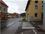
From the place where we parked, we first walk to TIC Lož (19th October Street 49), where we notice information boards. We continue along the asphalt road that runs between the TIC on the left and the factory of Kovinoplastika Lož d.d. on the right. At the end of the factory, the asphalt road turns into macadam and begins to ascend gently. After a few dozen steps on the macadam, we reach a small intersection, where signs for Loški grad direct us onto the road that continues straight ahead. Beyond the nearby cross, the increasingly poor road, which in the meantime has already turned into a cart track, emerges from the forest for a while, turns left and leads us along the pasture. At junctions, follow the signs for Loški grad; the cart track we are walking on quickly returns to the forest or partly to scrub. Signs for Loški grad direct us a little further to the left onto a moderately steep path that first ascends transversely to the right, then, with the aid of another sign, turns sharply left. This is followed by an ascent on a somewhat more overgrown path that climbs towards the ruins of the castle. When we step onto a small junction just before the wall, we continue left (the right path leads around the wall but, due to overgrowth, ends before we reach halfway around the castle), then through a somewhat lower passage in the wall we step onto the inner side of the wall, from where a short ascent to the panoramic summit follows.
The description and photos refer to the conditions in 2014 (September).

Photos:
 1
1 2
2 3
3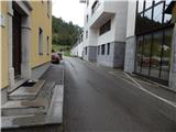 4
4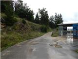 5
5 6
6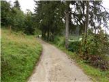 7
7 8
8 9
9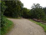 10
10 11
11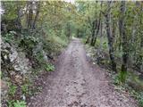 12
12 13
13 14
14 15
15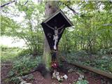 16
16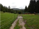 17
17 18
18 19
19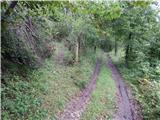 20
20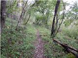 21
21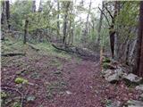 22
22 23
23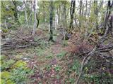 24
24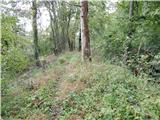 25
25 26
26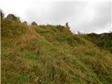 27
27 28
28 29
29
Discussion about the trip Lož - Grad Lož (Pusti grad)
To post a comment you must log in:
If you do not yet have a username, you must first
register.