Loška Koritnica - Plešivec (Loška stena)
Starting point: Loška Koritnica (727 m)
| Latitude/Longitude: | 46,4147°N 13,6295°E |
| |
Walking time: 3 h 55 min
Difficulty: very difficult marked way, partly demanding unmarked way
Elevation gain: 1457 m
Elevation difference along the route: 1457 m
Map: Julijske Alpe - zahodni del 1:50.000
Recommended equipment (summer): helmet, self belay set
Recommended equipment (winter): helmet, self belay set, ice axe, crampons
Views: 22.450
 | 2 people like this post |
Access to starting point:
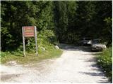
From Bovec we drive towards the Predel border crossing. In the village of Log pod Mangartom, immediately after the bridge over the Predilnica we turn right in the direction of Koritnica. The road, initially asphalted and then macadam, quickly takes us to the parking lot at the beginning of the entrance to the central part of TNP.
Route description:
From the parking lot we turn onto the right road, which is closed with a barrier. The road runs all the time close to the stream and crosses it several times. Towards the end the road becomes narrower and leads us past a few houses to a junction. We head slightly to the right on the footpath following the signs for Jalovec, Pod Špičkom, Mangrt (left Planina Brdo). The path then goes into the forest and soon brings us to a marked junction.
We continue right following the signs for Zavetišče pod Špičkom, to the left the path leads towards Kotovo sedlo and Mangart.
The path soon brings us to a stream which we must cross, then we ascend for a short time through sparse forest. This is followed by an ascent along a grassy slope and a short ascent over scree to the entry into the climbing part of the path.
When we enter the wall, we first ascend left upwards along the steel cable. The path soon becomes even steeper and ascends almost vertically several times along the steel cable with the help of numerous pegs. In the continuation we continue ascending along the steep slope with the help of steel cables, then the path turns somewhat to the right and soon brings us into the forest, where the steepness eases somewhat. From the forest the path brings us to a slope overgrown with bushes and tall grass. The bushes then end, followed by an ascent along an increasingly beautiful valley. From the path beautiful views open up towards Mangart, Jalovec and the precipitous walls of Plešivec under which we are ascending. In the last part the valley turns slightly to the right, followed by an ascent over scree to the saddle Čez Brežice.
At the saddle we leave the marked path and head right towards the west on an unmarked trail. The trail initially runs on the right side of a short steep ridge. Then it turns slightly to the left and begins to ascend along a quite steep grassy slope. The path is quite poorly trodden, but with some effort we can still follow it. Due to the steep terrain, considerable caution is also required. In the last part the path turns to the right and ascends towards the ridge. When we reach the ridge we continue to the right and in a few steps we reach the scenic grassy summit.
Starting point - Mlaka 0:45, Mlaka - Čez Brežiče 2:35, Čez Brežiče - Plešivec 0:35.

Along the route: Šujč (895m), Mlaka (959m), Čez Brežiče (1980m)
Photos:
 1
1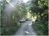 2
2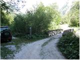 3
3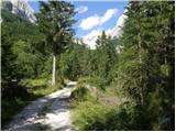 4
4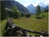 5
5 6
6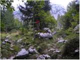 7
7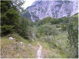 8
8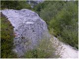 9
9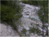 10
10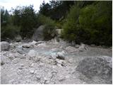 11
11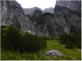 12
12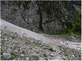 13
13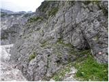 14
14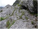 15
15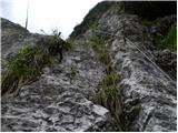 16
16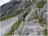 17
17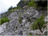 18
18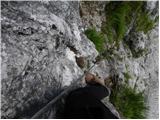 19
19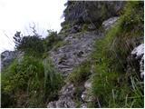 20
20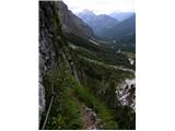 21
21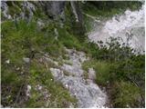 22
22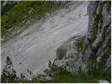 23
23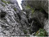 24
24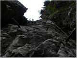 25
25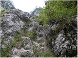 26
26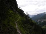 27
27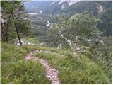 28
28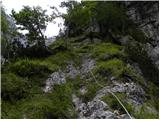 29
29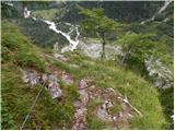 30
30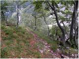 31
31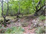 32
32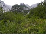 33
33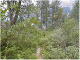 34
34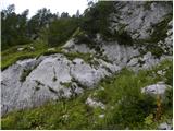 35
35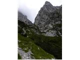 36
36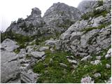 37
37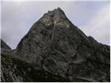 38
38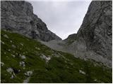 39
39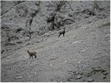 40
40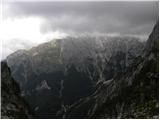 41
41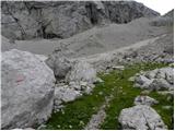 42
42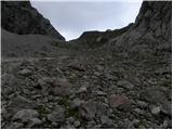 43
43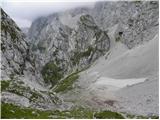 44
44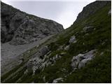 45
45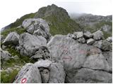 46
46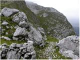 47
47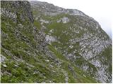 48
48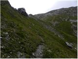 49
49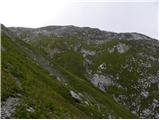 50
50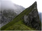 51
51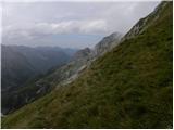 52
52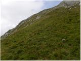 53
53 54
54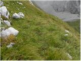 55
55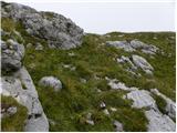 56
56 57
57 58
58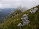 59
59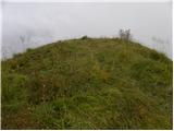 60
60
Discussion about the trip Loška Koritnica - Plešivec (Loška stena)
|
| turbo1. 08. 2011 |
There's nothing better than stepping out of the bedroom (outdoors!) in the morning and having Triglav within reach (hands or feet?). And Pihavec with Šplevta is no slouch either. We have such a "mom" here in Zadnjica, no doubt. The forecast was promising, so I don't know who kicked it into the dark. Weather development and unexpected disturbance or those who forecasted the weather. Otherwise, car in front of the barrier in the morning and off on the trail. The weather wasn't promising already before eight, but that it would turn into such a mess, not even in dreams. Wire ropes and pegs come in very handy, the lower part is quite exposed. Higher up, something between pathless terrain and dwarf forest. Grasses and bushes up to the subalpine zone, wet rocks, you can't see where to step... In short, from the end of the secured section to the scree below the saddle, you have to be quite attentive, because the path is hard to follow. It started drizzling at the top of Plešivec, from the saddle down and all the way back to the valley and further to the temporary home in Zadnjica, it poured properly. I rarely come this wet even from the shower. Regardless of the weather, an excellent tour. And I felt very, very at home. Just like it has washed me several times in Loška stena and today too, nowhere else has it.
|
|
|
|
| lakkon13. 08. 2017 |
I already asked under conditions, but repeating here too:
would go there first time. Has anyone been on this path recently?
interested if the fixed protections of the climbing section are in OK condition?
any other features, difficulties on the entire path?
|
|
|
|
| B215. 08. 2017 |
@lakkon, hello!
Cable in entire climbing section over wall is OK, step pitons almost all bent. Trickier on descent esp. due to damp slippery wall. From hunting path junction onwards some cables torn "fixed" with power line aluminum braid. Otherwise nothing special. Path in grass less visible above, middle needs bush trimming.
|
|
|
|
| mirank23. 08. 2018 |
Path condition more or less the same, just markers renovated in places. In the middle section there's even a wire rope as thick as a bike brake  and of course the overgrowth has increased further. Descent from Plešivec through Bala much more trodden. According to two hikers, to whom I thank for the ride back to the start and of course the overgrowth has increased further. Descent from Plešivec through Bala much more trodden. According to two hikers, to whom I thank for the ride back to the start  , today they were renovating the connecting section Škrbina behind the castle - pass over the hills. , today they were renovating the connecting section Škrbina behind the castle - pass over the hills.
|
|
|
|
| darinka42. 07. 2020 |
I doubt anyone has hiked it this year, but hope dies last. I'm interested in the condition of the fixed protections?
|
|
|
|
| lojze18254. 07. 2020 |
Today from Loška koritnica first to Škrbina behind the castle and then to Plešivec. The entire path without issues, no more snow, fixed protection everywhere ok, only the middle part is outrageously overgrown.
|
|
|
|
| padez6. 07. 2020 |
The path through the wall from Loška Koritnica is exactly as B2 described it in a previous post. The middle section is catastrophically overgrown. On Skrbina behind the castle, the safety gear was renewed last year. The path is maintained by PD Bovec, if they can't repair the safety gear and cables in the lower part, they could at least cut the scrub in the middle section of the path.
|
|
|
|
| lubadar6. 07. 2020 |
since Igor is no longer there, the paths in the Bovec area are much more overgrown, last week I struggled through the scrub towards Zadnjiški Ozebnik....
|
|
|
|
| padez7. 07. 2020 |
Yes, PD Bovec has another Igor (former KPP chief), who instead of dealing with maintaining the hiking trails under PD Bovec's care engages in completely different politics and looks for mistakes in other PDs, and interferes where it's not necessary
... Unfortunately it's like that!!!
|
|
|
|
| bbugari17. 07. 2020 |
Why doesn't this PD open Pl. dom Petra Skalarja, the gondola is OK, all conditions are here...?
|
|
|
|
| padez8. 07. 2020 |
It's a pity that in Bovec they would like others to do everything for them, they would just cash in. And this applies from Kaninska vas to the cable car and also to Peter Skalar's hut. In Bovec they are building a new hotel - three nice hotels are closed! At the Boka waterfall, the private business was doing well, they had to drive him out and demolish the old building, and build a new one that is closed! The same project is planned at the airport. Here too, drive out the private owner whose business is flourishing, demolish the building and build a hotel that won't run! For whom? Camps are full - because they are private! There's nothing to add! The road reconstruction through the town dragged on for two seasons
..
|
|
|
|
| mirank8. 07. 2020 |
I used to wonder why there is no hut at the source of the Soča managed by the Bovec people. Well, over the years it's becoming clearer to me. The hut on Mangart Saddle collapsed on them, the Zlatorog hut in Trenta no longer exists, they burned the Kanin hut in the 70s during New Year's celebration. There's not much to waste words on about path maintenance, good that the military mulatieras (where they are) hold up so well. Obviously things aren't right there and I think the first sentence of Padež's record holds very true.
|
|
|
|
| bbugari18. 07. 2020 |
"The hut on Mangart Saddle collapsed on them, the Zlatorog hut in Trenta no longer exists"
Signed.
|
|
|
|
| raubšic9. 07. 2020 |
All you do is criticize! Our mountains are pristine and let them stay that way. Who marked the path to Z. Ozebnik? Certainly not the locals! Do you want processions in our parts? Who would understand you "experts"? You have no idea!
|
|
|
|
| darinka49. 07. 2020 |
Hm, yesterday my wish came true, I don't know if it belongs here. Namely from Bavšica to Bavški Grintavec. But not via sedlo Kanja, but on the marked path via about three peaks Vrh Brda, vrh Ruš, and one more. What I wanted to say. The path is steep, long and ridge-like over all these peaks. Especially long and strenuous. Not a single peg or protection on this path. Except at the beginning a couple of pegs when crossing the water. The path is not maintained. Although it is marked. I want to say that few will set off on this path.
|
|
|
|
| padez9. 07. 2020 |
Well, another mountain path that's in the domain of PD Bovec - and PZS... Praise for both institutions!!!
|
|
|
|
| ljubitelj gora9. 07. 2020 |
We are also co-responsible and have all the opportunities to become helpers to the path markers or to educate ourselves and become path markers ourselves, then action.... the paths are like this because there are too few people. I like them and I know how to find the direction of ascent, even though the path is supposed to be marked.
|
|
|
|
| bbugari19. 07. 2020 |
I disagree. Maintaining hiking trails is the responsibility of individual mountaineering associations (PD), not random people, mountain lovers, Janez or Mojca.
If an individual PD is no longer able to maintain it and this trail, it is necessary to notify about the trail closure, because it is better to know that the trail is no longer maintained than false hope about marking and safety. 
|
|
|
|
| ljubitelj gora9. 07. 2020 |
Just contact them, they will be happy for help carrying cables, pegs, bolts and tools. Path markers are volunteers and full praise that they do at least as much as time allows them.
|
|
|
|
| povhica20. 07. 2025 18:38:01 |
Yesterday we went to Plešivec from Koritnica. The trail is well traceable but overgrowing with greenery (flowers, ferns). Poetry of flowers, alpine bells where the snowfield recedes, Turkish lilies, marmot, globeflowers, even single edelweiss found. Markings are there but some covered by vegetation. Need to be careful, especially mornings when rocks among plants are wet. From Brežice saddle the start to Plešivec is well visible, upper part footprints fade. Paradise solitude, wilderness and views. Beautiful!
|
|
|
To post a comment you must log in:
If you do not yet have a username, you must first
register.