Loška Koritnica - Mangart
Starting point: Loška Koritnica (727 m)
| Latitude/Longitude: | 46,4147°N 13,6295°E |
| |
Walking time: 7 h
Difficulty: very difficult marked way
Via ferrata: B/C
Elevation gain: 1952 m
Elevation difference along the route: 2050 m
Map: Julijske Alpe - zahodni del 1 : 50.000
Recommended equipment (summer): helmet, self belay set
Recommended equipment (winter): helmet, self belay set, ice axe, crampons
Views: 43.288
 | 4 people like this post |
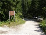
Access to starting point:
From Bovec, we drive towards the border crossing Predel. In the village Log pod Mangartom, immediately after the bridge over Predilnica, we turn right in the direction of Koritnica. Initially asphalted, then macadam road quickly brings us to the parking lot at the beginning of the entrance into the main part of TNP.
Route description:
We turn onto the right road which is closed with a barrier. The road runs all the time near the stream and crosses it a few times. Towards the end the road becomes narrower and brings us past a few houses to a junction. We turn slightly to the right onto the footpath following the signs for Jalovec, Mangart (left Planina Brdo). The path then goes into the forest and soon a path branches off to the right towards the saddle Čez Brežice and further towards Zavetišče pod Špičkom. Out of the forest the path brings us onto grassy slopes and on the left side of the path we will notice a hunting cottage. For some time we still walk on grassy terrain, then we come again for a short time into the forest. When we come out of the forest we will soon notice a smaller waterfall on the left side. Again we ascend on grassy terrain along the bed of a torrent and all the time we have wonderful views of the surrounding peaks (Briceljk, Jalovec, Mangart, Vevnica). From the grassy slopes we then slowly come onto the scree, which brings us to a path junction. The path branches off to the right towards Kotovo sedlo, we continue to the left towards Mangart.
We ascend on scree below the walls of Vevnica towards the north. At the end of the scree we turn left and with the help of some steel cables we ascend to somewhat steeper southern slopes partly covered with grass. Still in a gentle ascent we cross increasingly steep slopes towards the west. When we approach the ridge we come from the grassy slopes into a somewhat more demanding part of the path. Along the steel cable we cross a slightly exposed slope towards the west, which brings us to a somewhat less visible junction. The path branches off to the right onto the ridge towards bivouac Tarvisio and further towards Vevnica. We continue on the left path towards Mangart. Soon we come to a small notch from where a view opens onto the northern side towards Belopeška jezera. A short descent follows with the help of some steel cables and pegs, then the path after a short crossing brings us to a window. The path goes through the window and brings us to a vertical descent into Huda škrbina. This part of the path is also well secured with pegs and a steel cable. From the notch we then continue by crossing steep slopes towards the west, which at the beginning are still well secured with a steel cable. Later, when we come onto very steep grassy slopes the path is not secured and especially when wet it is very dangerous to slip. The path then ascends on steep grassy slopes towards the west and brings us to the border ridge. The path becomes less exposed and soon brings us to a junction, where we join the Italian path from Mangartsko sedlo.
At the junction we continue slightly to the left and an ascent on a panoramic slope awaits us. Then we cross the gully and to the top we have only the last steep slope which we overcome in zigzags.

Along the route: Šujč (895m), Mlaka (959m), Pri starih hramih (1083m), Lovska koča (1078m), V koncu (1361m), Razpotje pod Kotovim sedlom (1742m), Pod Zagačami (1902m), Prod (1878m), Pod Malim Koritniškim Mangartom (1992m), Goli Hriber (2162m), Razpotje Huda škrbina (2401m), Razpotje na grebenu Mangarta (2528m), Huda škrbina (2401m)
Photos:
 1
1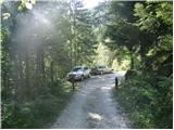 2
2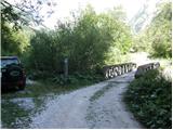 3
3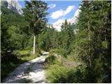 4
4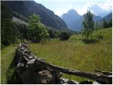 5
5 6
6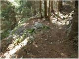 7
7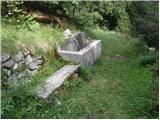 8
8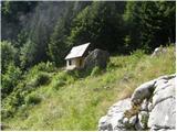 9
9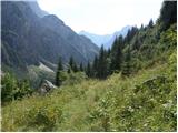 10
10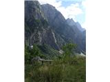 11
11 12
12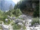 13
13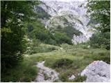 14
14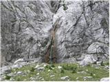 15
15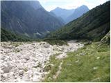 16
16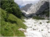 17
17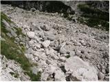 18
18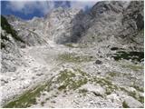 19
19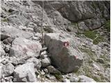 20
20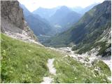 21
21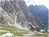 22
22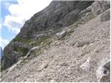 23
23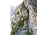 24
24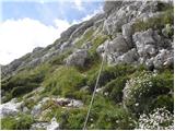 25
25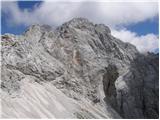 26
26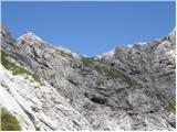 27
27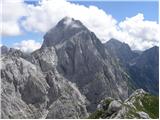 28
28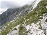 29
29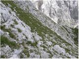 30
30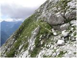 31
31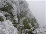 32
32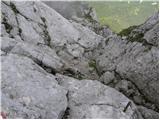 33
33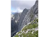 34
34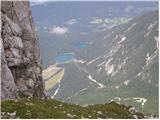 35
35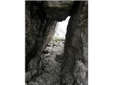 36
36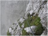 37
37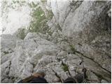 38
38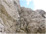 39
39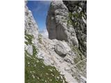 40
40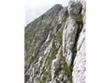 41
41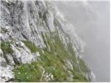 42
42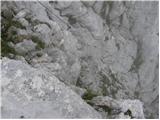 43
43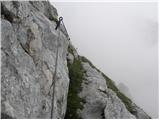 44
44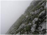 45
45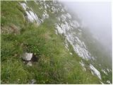 46
46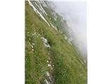 47
47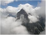 48
48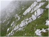 49
49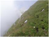 50
50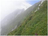 51
51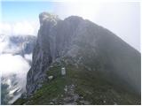 52
52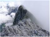 53
53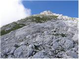 54
54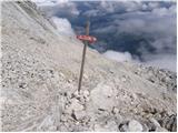 55
55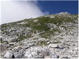 56
56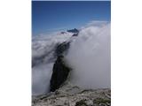 57
57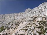 58
58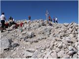 59
59
Discussion about the trip Loška Koritnica - Mangart
|
| panda25. 08. 2008 |
Path looks wild and adrenaline-fueled. Tempts me, but unsecured grassy traverse quite steep, untrodden. Anyone crossed this way this year?
|
|
|
|
| metod29. 08. 2011 |
The rocky slopes (passage through Huda škrbina and from the scree to the grassy slopes) are well secured, the steeper grassy areas are more tricky, especially above Huda škrbina. You have to be careful.
|
|
|
|
| BostjanL10. 09. 2012 |
From the fork onwards, where you go right towards the bivouac, left towards Mangart, you need to watch out to stay sufficiently to the left, as the markers are poor and you can quickly veer too far upwards towards the bivouac, past which this described route does NOT go!
If you go too straight up you reach a narrow passage, at the top of which is a short steep wall, over which a fixed cable is thrown, and next to it on the wall it says "Erikova pot". If you climb to the top of that cable a precipice awaits you on the other side, left a very difficult route to Mali Koritniški Mangart, right you can return to the bivouac along the exposed ridge. The route to Mali Koritniški Mangart is very steep and poorly protected, plus the terrain is crumbly, so I don't recommend it.
|
|
|
|
| superoxide8. 04. 2013 |
Here's a short video from the trail to Mangart from Loška Koritnica: http://www.youtube.com/watch?v=NQdikAKdSkY
We set off uphill in June 2012. We had to cross two snowfields, one at the end of the torrent gully, the other just below the summit. One way took us 6 to 7 hours, as described. We started a bit late, so darkness caught us halfway back through the torrent gully. Where there are fixed protection points, they are in good condition, but on some sections the path is quite exposed without protection.
|
|
|
|
| mado8. 07. 2024 19:31:48 |
Has anyone gone on this trail in recent years? It seems very interesting and attractive to me. Is it as difficult as Čez Plemenice to Triglav?
|
|
|
|
| julya9. 07. 2024 13:09:20 |
In August 2022 the path was clearly visible (and probably still is), the marks were somewhat faded, as many as there were. But it is really steep! This applies to the section from Koritnica to Huda škrbina or MKM, how it is further towards Mangart, I can't say because I haven't been there for a long time. If you've climbed Plemenice, this will probably be manageable too. You can always turn back 
Good luck!
|
|
|
|
| jax9. 07. 2024 13:53:48 |
There are no such nasty grasses on Plemenice as those in the pictures from 45 onwards, of course.
|
|
|
|
| matic410. 07. 2024 10:38:38 |
For me this is the most beautiful approach to Mangart. You walk less on this path, so it's less trodden. It's easier than via Plemenice, very demanding only around Huda škrbina, where it goes over steep grass it's well secured with cables. Go for it boldly, you surely won't regret it.
|
|
|
|
| jax10. 07. 2024 14:40:49 |
But no need to spread untruths. The steep grasses are mostly secured.
|
|
|
|
| Hammond11. 07. 2024 07:42:21 |
This last certainly holds true. "Well secured" only compared to pathless terrain. 
|
|
|
|
| darinka426. 08. 2025 07:34:04 |
Yesterday's impressions from this trail. We went more on a sightseeing tour. Reached the top of Hude škrbina 2401 m. The trail to there is long. I think it accumulates almost 1700 m of elevation gain. You don't meet anyone anyway. We're a chicken couple. A bit lower down, probably a viper of light color somewhere at 2300 m altitude. It was basking on the trail. Since it couldn't retreat to its hole in time, it coiled up to strike. On descent, we spotted another viper in the grass on the trail. This one quickly retreated. The trail is beautifully laid out. The difficulty is more below, where there's a rockslide. The trail is poorly visible there. But the path to Kotovo sedlo and the bivouac on the Italian side are nicely visible. On descent, pleasant chat with locals, where you always learn something new. As for the grass, you go carefully. We had dry grass and no problems on descent. The views from Hude škrbina are incredible.
|
|
|
To post a comment you must log in:
If you do not yet have a username, you must first
register.