Starting point: Lokvica (310 m)
| Latitude/Longitude: | 45,8695°N 13,6155°E |
| |
Walking time: 4 h
Difficulty: easy marked way
Elevation gain: 333 m
Elevation difference along the route: 725 m
Map: Goriška 1:50.000
Recommended equipment (summer):
Recommended equipment (winter):
Views: 10.632
 | 1 person like this post |
Access to starting point:
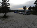
On the highway through the Vipava Valley we drive to the border crossing Vrtojba, then in the larger roundabout, which is located on the Italian side of the border, we continue towards the village Miren (to the village Miren we can also come if we drive on the regional road from Šempeter pri Gorici towards Dornberk. In this case in Volčja Draga we continue right or left, if we came from Dornberk. From the village Miren we continue driving towards the village Opatje Selo. After a few hairpin turns signs for Cerje point us to the left on a macadam road which we then follow to the parking lot, that is located only a few minutes below the monument Veliko Cerje.
Route description:
From the parking lot, we continue on the macadam road closed to traffic, on which in 5 minutes of walking we ascend to the monument Veliko Cerje.
From the monument we continue right on at first a wide path in the direction of Fajti hrib. The path ahead at first slightly descends, then gently ascends over gentle and at first also quite scenic slopes. The path then passes into a mostly pine forest, where we continue with some shorter ascents and descents. After a time we cross a forest road, then we continue the ascent on a narrower and in several parts surrounded by thorns mountain path. Higher the forest thins out and a moderately steep path brings us to Fajti hrib, on which there is a smaller information board in memory of the First World War.
From Fajti hrib we descend through young pine forest (here we still have nice views) to a saddle between the already mentioned peak and Veliki vrh. On the saddle we cross a wide cart track, then we start ascending to the 463 m high Veliki vrh, which we reach after approximately 20 minutes of ascent through the forest and bushes.
From Veliki vrh follows approximately 100 elevation meters long descent, which ends on the next cart track. We continue on a marked path, which past a decaying bench leads into a dense forest, where it starts moderately ascending. After approximately 15 minutes of ascent we step on Renški vrh 449 m.
Next follows a relatively gentle descent on the path which quickly brings us to an asphalt road which we only cross. We continue the ascent in the direction of "Trstelj po vrhovih" on a quite overgrown mountain path, which after approximately 20 minutes of ascent brings us to the forested peak of Vrtovka.
From Vrtovka we continue on a path that gently descends towards the east. Already after a few minutes of descent the path brings us to a macadam road which we follow a few minutes, then blazes direct us to the right on a footpath which gradually starts to ascend more steeply. Higher the path levels out and past caverns brings us to Lešenjak.
From the top we continue in the direction of Trstelj on the path which starts descending towards the east. After a few minutes we cross a power line, then we join a poor macadam road. We follow the road a few minutes, then blazes direct us to the left on a relatively steep footpath, on which in a few minutes we ascend to Stolovec.
From Stolovec the path in a few minutes of descent brings us to a poor forest road, on which we continue approximately 15 minutes, then signs for Trstelj direct us on an ascending footpath. A moderately steep path then quickly brings us to the forepeak of Stol, which we recognize by a larger cairn, and we continue on the marked path, which for a short time descends, then in a gentle ascent brings us to the top of Stol.
From Stol we descend to a smaller saddle, where there are a bench and small cross, then on a moderately steep path in a few minutes we ascend to panoramic Trstelj.

Photos:
 1
1 2
2 3
3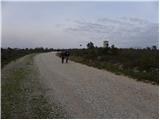 4
4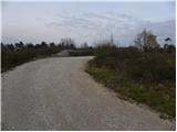 5
5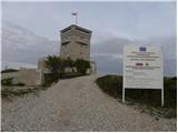 6
6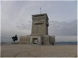 7
7 8
8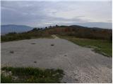 9
9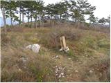 10
10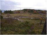 11
11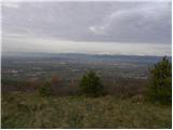 12
12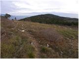 13
13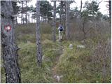 14
14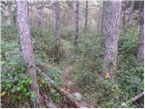 15
15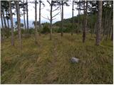 16
16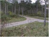 17
17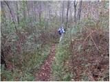 18
18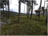 19
19 20
20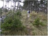 21
21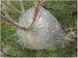 22
22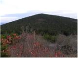 23
23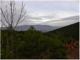 24
24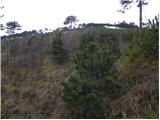 25
25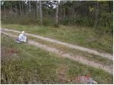 26
26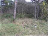 27
27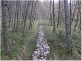 28
28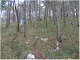 29
29 30
30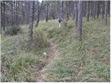 31
31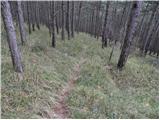 32
32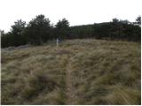 33
33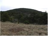 34
34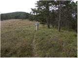 35
35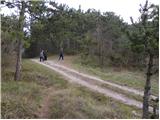 36
36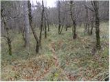 37
37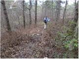 38
38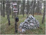 39
39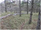 40
40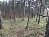 41
41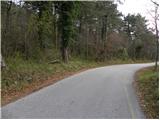 42
42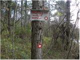 43
43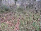 44
44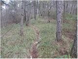 45
45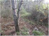 46
46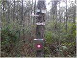 47
47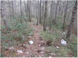 48
48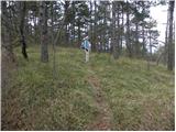 49
49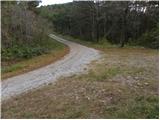 50
50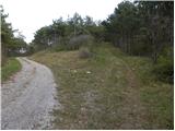 51
51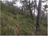 52
52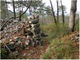 53
53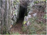 54
54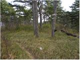 55
55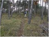 56
56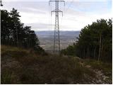 57
57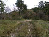 58
58 59
59 60
60 61
61 62
62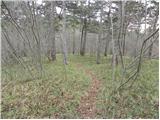 63
63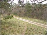 64
64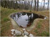 65
65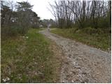 66
66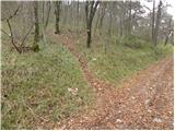 67
67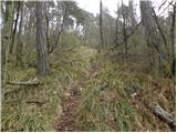 68
68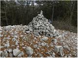 69
69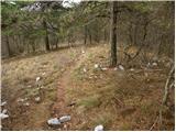 70
70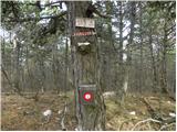 71
71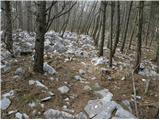 72
72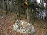 73
73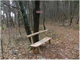 74
74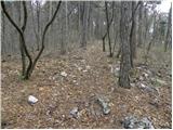 75
75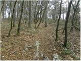 76
76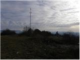 77
77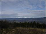 78
78
Discussion about the trip Lokvica - Trstelj
|
| Alpski Slovenc10. 02. 2012 |
It happened. The starting point of our hike on Culture Day was the parking lot under Cerje. From the monument we continued right towards Fajti hrib or we walked Bricevo planinsko pot, our starting point was Cerje or (Veliki hrib) 343 m – and continued along the following peaks in sequence, Fajti hrib 464 m - Veliki vrh 463 m - Renški vrh 449 m - Vrtovka or (Trešnik) 502 m - Lešenjak 565 m - Stolovec 563 m - Stol 629 m – and our goal was Trstelj 643 m. At Renški vrh I want to warn those who maintain this path to replace the logbook as it is already in ruins and a bear's tooth has processed it well. From Vrtovka we continued on the path descending eastwards. After a few minutes of descent the path brought us to a gravel road, which we followed, then there is NO MARKING but nevertheless we turned right on the gravel path that steeply ascends and after a few minutes of walking we spotted a mark (not even a signpost for which hill) on the left side of the gravel road that has been newly arranged or widened. (so-called fire trail). When we turn left uphill it takes us past caverns to the hill Lešenjak. At the top of the hill there is no logbook or box, the one that was once nailed to the pine was plastic, but torn off and thrown on the ground. After a few minutes of walking we cross a power line, then the path joins a worse gravel road. We follow the road for a few minutes, then the marks direct us left onto a steep footpath, up which we climb to Stolovec. After descent the path brings us to a forest road along which we continue for about 15 minutes, then the signs for Trstelj bring us to a moderately steep path and soon we reach a larger cairn, and continue along the marked path to the top of Stol. From Stol we descend to a smaller saddle where there is a bench and a small cross, then along a moderately steep path in a few minutes we climb to Trstelj. Wind accompanied us all the time, only on the southern side there was calm. On the top of Trstelj it was blowing quite strongly so after a few minutes we left it and started returning to the starting point. For the entire hike there and back we used 6 hours 30 minutes.
|
|
|
|
| SunnyDay20. 11. 2012 |
On the path from Vrtovke on descent to the gravel road we immediately noticed marks right uphill to a widened forest path (like a logging trail), but no branches after, so we actually went around Lešenjak on that forest logging trail instead of over the top. Similar happened to us with Stolovec. In short, from gravel/forest path we didn't notice any marks or footpath  . Only then from Stolovec to Stol we caught the footpath again. . Only then from Stolovec to Stol we caught the footpath again.
The whole path is cleared, nowhere overgrown.
We met only two pairs of hikers, otherwise some cyclists (on gravel), and on the very narrow and steep trail also a group of five enduro motorbikers   Luckily they descended slowly at least ... Luckily they descended slowly at least ...
Pleasant mountain hike!
|
|
|
|
| SunnyDay20. 11. 2012 |
One more thing: if you leave the car in Lokvica at the end of the village, at the last house on the right (parking sign), you can also view a 200-year-old štirna (cistern) along the path, which was recently renovated. At the parking lot there is also an information board on surrounding paths and sights as well as the former livestock watering place. From here to Cerje (on footpath) is approx. 20-30 minutes walk on flat or gentle terrain.
|
|
|
|
| Ana Fila14. 04. 2019 |
The path could also be Cerje - Trstelj.
We walked it in 3 hours. It's true that the path described above is not the most consistent in some places. But it still serves to find all the markers, which is the most important. We found all the markers and walked all the peaks to Trstelj. No orientation problems. But it is true that in some sections it's not entirely clear, when you join the macadam road, which direction to turn.
|
|
|
|
| Ana Fila14. 04. 2019 |
One more thing - there are huge numbers of ticks at this time.
|
|
|
To post a comment you must log in:
If you do not yet have a username, you must first
register.