Lokva Dernečište - Maglić
Starting point: Lokva Dernečište (1640 m)
Walking time: 2 h 45 min
Difficulty: partly demanding marked way
Elevation gain: 746 m
Elevation difference along the route: 746 m
Map: Montenegro NP Durmitor, Piva BiH NP Sutjeska, 1:50.000
Recommended equipment (summer):
Recommended equipment (winter): ice axe, crampons
Views: 12.561
 | 2 people like this post |
Access to starting point:
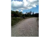
From Sarajevo, we drive towards Foča and just before it we turn towards Gacko and Tjentište (right road). At the beginning of Tjentište, we turn sharply left at the abandoned „Energopetrol“ gas station. Along a poor asphalt road, we soon reach a barrier where we have to pay the entrance fee for Sutjeska National Park. We continue along the gravel road without paying attention to smaller branches left and right. After 7 km, it becomes asphalt for a short time, this is Dragoš sedlo with monuments to fallen partisan heroes and a path to the viewpoint of Skakavac waterfall (5 min). After another 5 km, we reach a clearing with a signpost where we park.
Route description:
From the parking lot, we head across the road we came on to the forest path. The direction is also indicated by a signpost. At the beginning of the path there are several different markings, follow the red with white dot (classic). After about 50 m, follow the markings right into the forest. The path may be poorly visible at first, but it is well marked. After about 30 minutes, we emerge from the forest onto a clearing. Past the pine bushes, the path goes south. After approximately 1:30 to 2:00 hours of walking from the starting point, the path turns right and begins to ascend. The path is steep, steel cables are available. At the top of the ridge, follow the gentle path to the right, the summit of Maglić is already visible. Just before the summit, there is a short ascent, then we are at the top.
Photos:
 1
1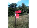 2
2 3
3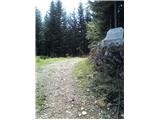 4
4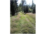 5
5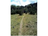 6
6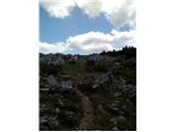 7
7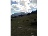 8
8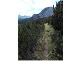 9
9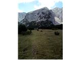 10
10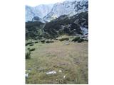 11
11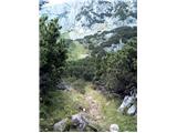 12
12 13
13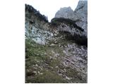 14
14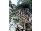 15
15 16
16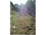 17
17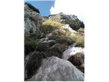 18
18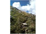 19
19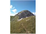 20
20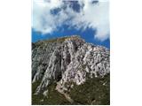 21
21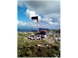 22
22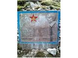 23
23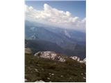 24
24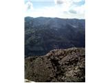 25
25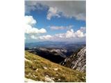 26
26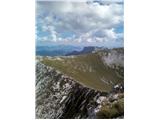 27
27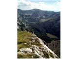 28
28
Discussion about the trip Lokva Dernečište - Maglić
|
| Lunca23. 08. 2021 11:59:11 |
Hello, has anyone been on this path recently?
|
|
|
|
| felix3. 08. 2022 15:23:46 |
I'm wondering if the road to the starting point is passable with a van. Thank you and best regards.
|
|
|
|
| felix31. 08. 2022 19:41:02 |
This weekend visited this path to Maglič. The road to the starting point is very bad. The time in this description is unrealistic for an average hiker. There is also a new sign at the starting point - estimated walking time 4 hours. The path is also not that easy, I would classify it as a difficult path. The views from the top are unique.
|
|
|
|
| Gorazd117. 08. 2024 11:43:40 |
Visited Maglić yesterday. The road is still in poor condition, so I recommend renting a car in Tjentište (App. Kosuta). Marked 4 hours, I reached the summit in 2 hours. Fixed cables are where needed, recommend helmet due to stones dislodged by other hikers. No views this time, as Maglić lived up to its name. Return to Prijevor via Trnovacko jezero.
|
|
|
To post a comment you must log in:
If you do not yet have a username, you must first
register.