Lokavec - Kucelj (on Čaven)
Starting point: Lokavec (170 m)
| Latitude/Longitude: | 45,902°N 13,8813°E |
| |
Walking time: 3 h 15 min
Difficulty: easy marked way
Elevation gain: 1067 m
Elevation difference along the route: 1170 m
Map: Goriška - izletniška karta 1:50.000
Recommended equipment (summer):
Recommended equipment (winter): ice axe, crampons
Views: 11.221
 | 2 people like this post |
Access to starting point:
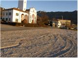
We drive on the highway from Razdrto towards Nova Gorica or vice versa and go to the exit Ajdovščina. Then at the crossroad, we turn left in the direction of Nova Gorica and drive to the village Cesta, where a sign for Lokavec points us to the right. We follow this road to a larger parking lot at the church in the village Lokavec, where there are also signposts for Čaven.
Route description:
From the parking lot, we continue on the road in the direction of Čavna. The road, which gently ascends among houses, soon brings us to a smaller crossroad near a small stream. Here we continue on the left road and left side of the stream, which at the end of the village brings us to a cart track on which we then ascend. Further we follow the cart track, which slowly turns into a footpath. The path eventually crosses a poor forest road and soon after that brings us to a junction, where we continue straight in the direction of Čavna. The path then brings us to a spring and after that steeply ascends for a few dozen steps. The path ahead brings us to unvegetated slopes, from which a nice view opens up on Nanos, Vipava Valley and surrounding hills. A little further, the path again crosses a poor forest road and ascends parallel to it for a short time. Only a little further, we come to a wider road, which we follow to the right, but only a few steps, then the blazes direct us left upwards. The path ahead starts to ascend more steeply and a little higher crosses a marked path that starts at the "tunnels".
Here we continue straight upwards on the path, which is becoming very steep. A little further, the path, which most of the time ran through the forest, again crosses some panoramic slopes. A little further, the path brings us to a ridge, where we have two options for continuing. The left path runs a little below the ridge and is less panoramic than the one that runs along the ridge, but it is more sheltered in case of strong bora. After 10 minutes both paths join and bring us to unvegetated grassy slopes east of Mala gora.
Here the steepness eases and the path ahead continues across nice meadows, where in spring and summer we notice a lot of mountain flowers. A little further, the path from Stomaž joins us from the left. Here we continue straight on the path, which brings us to the Koča na Čavnu in a few minutes.
Behind the hut, the signs for Kucelj direct us slightly left onto a footpath that starts descending across. The path ahead crosses a short stretch of forest, then turns right, where it continues descending gently. The path then gradually enters the forest and from the left the path from the village Kamnje joins us (there are two turn-offs for Kamnje).
We continue in the direction of Kuclja on the path, which gradually moves to the right side of the "Čavna" ridge. The path continues across a larger clearing, from which a view opens up on the surrounding hills, then returns to the forest. A little further, we leave a gently sloping cart track and continue the ascent to the left, ascending further through dense forest. The steepness soon eases and the path brings us from the forest to increasingly panoramic grassy slopes. A few minutes of easy walking follow, then the path brings us below the summit of Kuclja, where it steeply ascends again. We follow this path, which offers increasingly beautiful views, all the way to the summit of Kuclja, which we reach after a few minutes of further walking.

Photos:
 1
1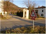 2
2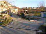 3
3 4
4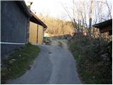 5
5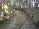 6
6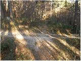 7
7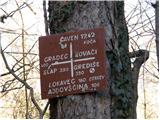 8
8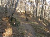 9
9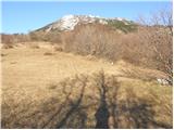 10
10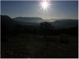 11
11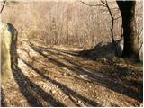 12
12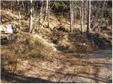 13
13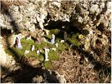 14
14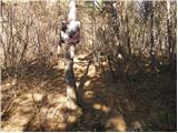 15
15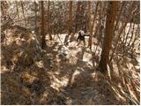 16
16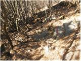 17
17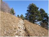 18
18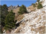 19
19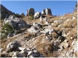 20
20 21
21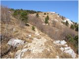 22
22 23
23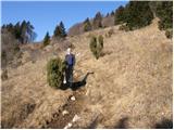 24
24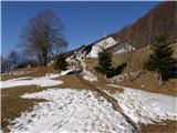 25
25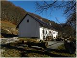 26
26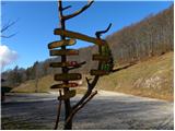 27
27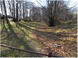 28
28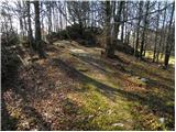 29
29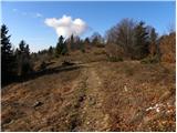 30
30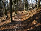 31
31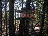 32
32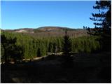 33
33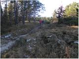 34
34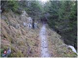 35
35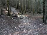 36
36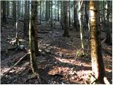 37
37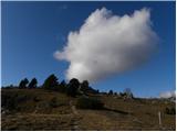 38
38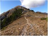 39
39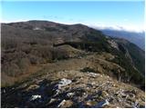 40
40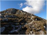 41
41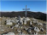 42
42 43
43
Discussion about the trip Lokavec - Kucelj (on Čaven)
|
| BT8822. 12. 2010 |
Kucelj is not on Čavnu  in my opinion Kucelj is an independent peak on the edge of Trnovska planota . . . or not in my opinion Kucelj is an independent peak on the edge of Trnovska planota . . . or not
|
|
|
|
| atoamac22. 12. 2010 |
Of course Kucelj is an independent peak, but it is also on Čavnu. It's a double naming: Čaven is one of the peaks, and also the whole "mountain range". On the map (see geopedija) Čaven is also the area beyond Kucelj, roughly right of peak Čaven 1186, via Veliki rob 1265, our Kucelj, and to the other side to Veliki and Mali Modrasovec 1306, which in the valley is called Čaven. And from the valley it's clearly visible that Kucelj and Čaven (Modrasovec) are two independent peaks that can only be confused in case of heavy fog, snowfall or darkness.
|
|
|
|
| BT8823. 12. 2010 |
OK just correct the title e.g. Čez Čaven to the scenic peak Kucelj
|
|
|
|
| BT8823. 12. 2010 |
Well let it be your way. But from the village Vrtovin do you go to Kucelj or to Kucelj na Čavnu?
|
|
|
|
| atoamac23. 12. 2010 |
Nejc Zaplotnik wrote that more important than the goal is the path. So it's important to go.
|
|
|
|
| BT8823. 12. 2010 |
Yes he really wrote that whoever finds the path will always walk on it . . . which means not to search for the path but to find it
|
|
|
|
| atoamac23. 12. 2010 |
And how to find it without searching for it?
|
|
|
|
| BT8823. 12. 2010 |
Atomac not all paths in life are marked you know that this little Kuceljček we're talking about is kinda my fave little hill so I'm rooting for it Capito you know that this little Kuceljček we're talking about is kinda my fave little hill so I'm rooting for it Capito
|
|
|
|
| mirank23. 12. 2010 |
All signposts on all accesses (and there are plenty of them) accurately indicate where you're going and I think locals know best what the hill is called. Similar story as with some other peak where it says Prisojnik everywhere but you end up on Prisank or whatever the top should be called?...
|
|
|
|
| marjana25. 12. 2010 |
Bravo, I think you've solved the problem.
|
|
|
|
| BT8827. 12. 2010 |
Mirank, that's something else that's Kucelj.
|
|
|
|
| brinta13. 05. 2012 |
Does anyone know if the avriklji on Kucelj are already blooming?
|
|
|
|
| čeveljc13. 05. 2012 |
On 27.4.12 we went from Otlice to Otliški vrh then to Predmeja via "Poti po Robu", a bit up and down to Čavn. Avriklji were already on the mentioned Pot po Robu as well as svišči. Beautiful day, beautiful landscape, views and everything. The Col - Ajdovščina road was closed, but the Ajdovščina - Predmeja road looked quite new (or newly renovated). In short, another beautiful corner of our homeland.
|
|
|
|
| darinka410. 06. 2023 19:03:45 |
Despite the bad forecast, Maksij and I went today from Lokavec, from the church to the hut at Čavnu. Then to the summit of Kucelj. Descended to Mala gora and back to Lokavec via the ascent path. In the last part of the path, rain caught us. It was quite slippery and watery on the descent.
|
|
|
To post a comment you must log in:
If you do not yet have a username, you must first
register.